La République de Côte d'Ivoire ou Côte-d'Ivoire est un pays d'Afrique occidentale. La Côte d'Ivoire, ex-colonie française, obtient son indépendance en 1960. Le pays est actuellement divisé en deux parties qui se disputent sur le concept d'ivoirité.
The Republic of Côte d'Ivoire , or, translated into English, the Ivory Coast,[1] is a country in West Africa. It borders ► Liberia and ► Guinea to the west, ► Mali and ► Burkina Faso to the north, ► Ghana to the east, and the Gulf of Guinea to the south.
Short name
Côte d'Ivoire
Official name
Republic of Côte d'Ivoire
Status
Independent country since 1960
Location
West Africa
Capital
Yamoussoukro
Population
26,453,542 inhabitants
Area
332,460 square kilometres (128,360 sq mi)
Major languages
French (official), 60 indigenous languages, e.g. Dioula, the Gur languages, the Kru languages and the Kwa languages
This section holds a short summary of the history of the area of present-day Côte d'Ivoire, illustrated with maps, including historical maps of former countries and empires that included present-day Côte d'Ivoire.
In the area that is now Côte d'Ivoire (Ivory Coast) the Senufo form in the 11th century their own state. This map shows the area were presently Senufo is spoken. For long times the region is under influence of the Ashanti Kingdom. Although the coast is explored by Portugal in the 15th century, it is not yet colonized.
Before be colonized by France, the area that is now Côte d'Ivoire shows in north of the country, kingdoms of Bouna, Kabadougou, and Kong ; and in east, the Akan kingdoms. In the other parts of the territory, populations are not organized into empires or kingdoms but on the basis of lineage and age groups within tribal communities or villages.
In 1843 the first French settlements and a first French protectorate over some regions is founded. Between 1880 and 1898 France occupies the Mandingo state and the whole of Ivory Coast becomes a French protectorate in 1891. This is changed into a colony in 1893. In 1904 Ivory Coast becomes a constituent part of French West Africa. Inside French West Africa Ivory Coast becomes in 1946 a French overseas territory. After the dissolution of French West Africa in 1958, Ivory Coast gets autonomy as the Republic of Ivory Coast. Carte de l'Afrique Occidentale française
Ivory Coast becomes independent in 1960. In 1999 the army stages a coup and Ivory Coast becomes a military dictatorship under Robert Guei.
After the elections of 2000 Laurent Gbagbo of the Front Populaire Ivorien becomes president. Gbagbo forms in 2002 a de facto government of national unity including the RDR. This map shows the results of the 2002 elections. Élections en 2002
Shortly after that rebels start to attack. Since 2003 a peacekeeping force of the Economic Community of West African States (ECOWAS) and French troops are stationed in the country and that year a power-sharing national reconciliation government including the New Forces is formed. This map shows the areas under control of the rebels in 2005. Carte montrant les territores contrôlées par les rebels.
Other maps
Carte montrant les éthnies
Ethnic map
Satellite maps
Carte satellite
Satellite map
Notes and references
General remarks:
The WIKIMEDIA COMMONS Atlas of the World is an organized and commented collection of geographical, political and historical maps available at Wikimedia Commons. The main page is therefore the portal to maps and cartography on Wikimedia. That page contains links to entries by country, continent and by topic as well as general notes and references.
Every entry has an introduction section in English. If other languages are native and/or official in an entity, introductions in other languages are added in separate sections. The text of the introduction(s) is based on the content of the Wikipedia encyclopedia. For sources of the introduction see therefore the Wikipedia entries linked to. The same goes for the texts in the history sections.
Historical maps are included in the continent, country and dependency entries.
The status of various entities is disputed. See the content for the entities concerned.
The maps of former countries that are more or less continued by a present-day country or had a territory included in only one or two countries are included in the atlas of the present-day country. For example the Ottoman Empire can be found in the Atlas of Turkey.
↑In October 1985 the government requested that the country be known as Côte d'Ivoire in every language, without a hyphen between the two words (thereby contravening the standard rule in French that geographical names with several words must be written with hyphens).


 Vallée du Bandama
 Sud-Comoé
 Sud-Bandama
 Savanes
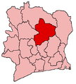
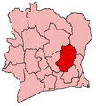 N'zi-Comoé
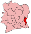 Moyen-Comoé
 Moyen-Cavally
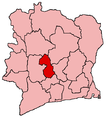 Marahoué
 Lagunes
 Région des Lacs
 Haut-Sassandra
 Fromager
 Dix-Huit Montagnes
 Denguélé
 Bas-Sassandra
 Bafing
 Agnéby
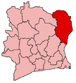 Zanzan
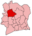 Worodougou


