File:1657 Jansson Map of the Empire of Charlemagne - Geographicus - CaroliMagni-jansson-1657.jpg
Jump to navigation
Jump to search

Size of this preview: 800 × 584 pixels. Other resolutions: 320 × 234 pixels | 640 × 467 pixels | 1,024 × 748 pixels | 1,280 × 934 pixels | 2,560 × 1,869 pixels | 4,000 × 2,920 pixels.
Original file (4,000 × 2,920 pixels, file size: 3.72 MB, MIME type: image/jpeg)
Captions
Captions
Add a one-line explanation of what this file represents
Summary[edit]
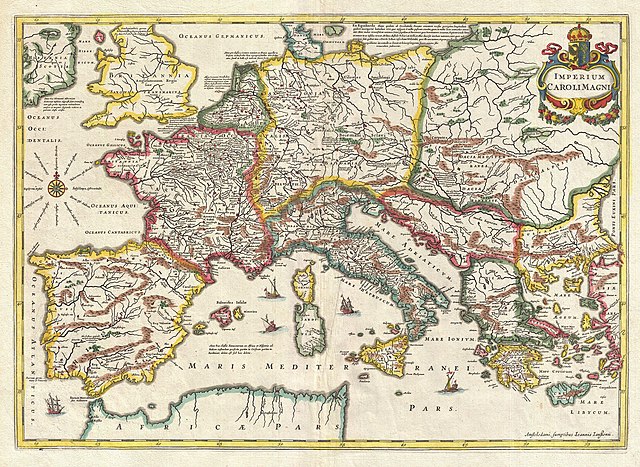
| Jan Janssonius: Imperium Caroli Magni.
( |
||||||||||||||||||||||||||
|---|---|---|---|---|---|---|---|---|---|---|---|---|---|---|---|---|---|---|---|---|---|---|---|---|---|---|
| Artist |
|
|||||||||||||||||||||||||
| Title |
Imperium Caroli Magni. |
|||||||||||||||||||||||||
| Description |
English: This is a remarkable example of Jan Jansson's 1657 mapping of the Empire of Charlemagne. Covers from Spain to the Black Sea and from Denmark and Ireland to North Africa. Filled with copious notations in Latin. Decorative sailing vessels ply the Mediterranean. A decorative title cartouche appears in the upper right quadrant. This remarkable map was published in volume six, the Orbis Antiquus , of Jan Jansson's Novus Atlas . |
|||||||||||||||||||||||||
| Date | 1657 (undated) | |||||||||||||||||||||||||
| Dimensions | height: 15 in (38.1 cm); width: 20.7 in (52.7 cm) | |||||||||||||||||||||||||
| Accession number |
Geographicus link: CaroliMagni-jansson-1657 |
|||||||||||||||||||||||||
| Source/Photographer |
Jansson, J., Novus Atlas, Sive Theatrum Orbis Terrarum: In quo Orbis Antiquus, Seu Geographia Vetus, Sacra & Profana exhibetur, Volume 6, 1657.
|
|||||||||||||||||||||||||
| Permission (Reusing this file) |
|
|||||||||||||||||||||||||
File history
Click on a date/time to view the file as it appeared at that time.
| Date/Time | Thumbnail | Dimensions | User | Comment | |
|---|---|---|---|---|---|
| current | 21:00, 23 March 2011 | | 4,000 × 2,920 (3.72 MB) | BotMultichillT (talk | contribs) | {{subst:User:Multichill/Geographicus |link=http://www.geographicus.com/P/AntiqueMap/CaroliMagni-jansson-1657 |product_name=1657 Jansson Map of the Empire of Charlemagne |map_title=Imperium Caroli Magni. |description=This is a remarkable example of Jan Jan |
You cannot overwrite this file.
File usage on Commons
The following page uses this file:
File usage on other wikis
The following other wikis use this file:
- Usage on el.wikipedia.org
- Usage on hr.wikipedia.org
- Usage on sh.wikipedia.org