File:A bridge of the KK line near Araku 02.jpg
Jump to navigation
Jump to search

Size of this preview: 800 × 530 pixels. Other resolutions: 320 × 212 pixels | 640 × 424 pixels | 1,024 × 678 pixels | 1,280 × 848 pixels | 2,560 × 1,696 pixels | 4,928 × 3,264 pixels.
Original file (4,928 × 3,264 pixels, file size: 12.53 MB, MIME type: image/jpeg)
Captions
Captions
Add a one-line explanation of what this file represents
Summary[edit]
| Description |
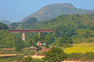
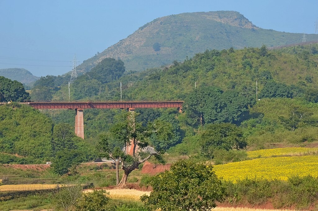
English: A beautiful bridge at Karakavalasa with mustard fields in the foreground |
| Date | |
| Source | Own work |
| Author | Drashokk |
| Camera location | | View this and other nearby images on: OpenStreetMap |
|---|
Licensing[edit]
I, the copyright holder of this work, hereby publish it under the following license:
This file is licensed under the Creative Commons Attribution-Share Alike 4.0 International license.
- You are free:
- to share – to copy, distribute and transmit the work
- to remix – to adapt the work
- Under the following conditions:
- attribution – You must give appropriate credit, provide a link to the license, and indicate if changes were made. You may do so in any reasonable manner, but not in any way that suggests the licensor endorses you or your use.
- share alike – If you remix, transform, or build upon the material, you must distribute your contributions under the same or compatible license as the original.
| This image was uploaded as part of Wiki Loves Vizag 2024. |

|
This image has been assessed under the valued image criteria and is considered the most valued image on Commons within the scope: Karakavalasa railway bridge on Kothavalasa–Kirandul line. You can see its nomination here. |
File history
Click on a date/time to view the file as it appeared at that time.
| Date/Time | Thumbnail | Dimensions | User | Comment | |
|---|---|---|---|---|---|
| current | 03:53, 28 April 2024 | | 4,928 × 3,264 (12.53 MB) | IM3847 (talk | contribs) | Denoised |
| 08:08, 10 February 2024 |  | 4,928 × 3,264 (2.35 MB) | Drashokk (talk | contribs) | Uploaded own work with UploadWizard |
You cannot overwrite this file.
File usage on Commons
The following 5 pages use this file:
File usage on other wikis
The following other wikis use this file:
- Usage on en.wikipedia.org