File:A map of Kamtschatka engraved from the russian map by Tho Jefferys.jpg

Original file (2,499 × 2,123 pixels, file size: 969 KB, MIME type: image/jpeg)
Captions
Captions
Summary[edit]
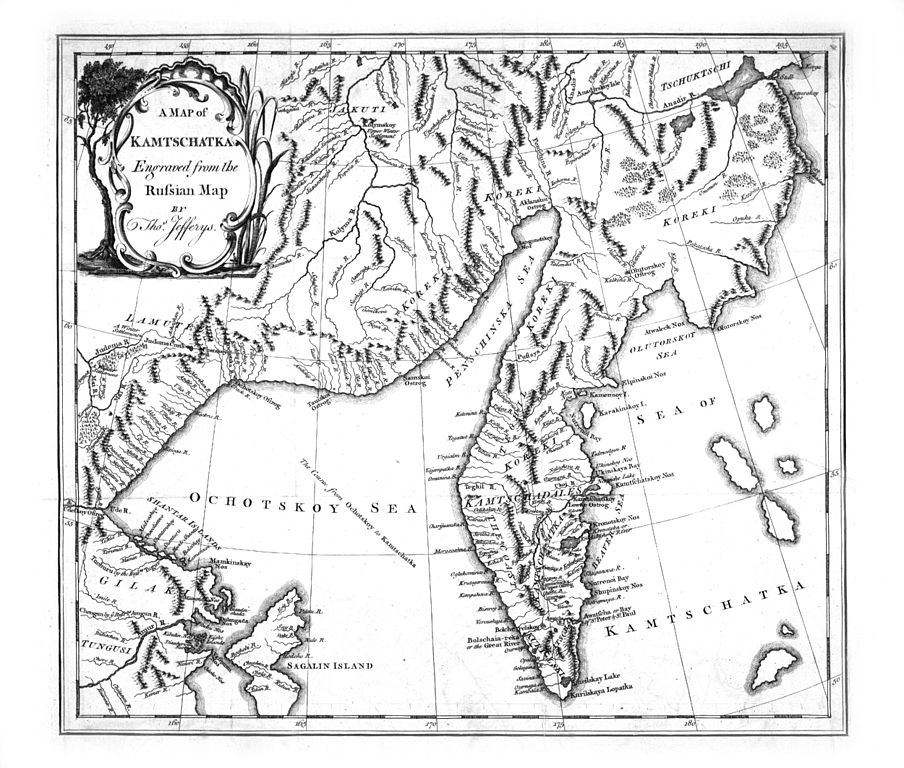
A map of Kamtschatka engraved from the russian map by Tho. Jefferys, aus: Stepan Petrovic Kraseninnikov: The history of Kamtschatka and the Kurilski Islands with the countries adjacent; Illustrated with maps and cuts. Published at Petersbourg in the Russian language by order of her Imperial Majesty (Übersetzung von James Grieve), London 1764
- Quelle: Göttinger Digitalisierungszentrum
- Persistant URL des Gesamtwerkes: http://www-gdz.sub.uni-goettingen.de/cgi-bin/digbib.cgi?PPN330822152
Licensing[edit]
|
This is a faithful photographic reproduction of a two-dimensional, public domain work of art. The work of art itself is in the public domain for the following reason:
The official position taken by the Wikimedia Foundation is that "faithful reproductions of two-dimensional public domain works of art are public domain". This photographic reproduction is therefore also considered to be in the public domain in the United States. In other jurisdictions, re-use of this content may be restricted; see Reuse of PD-Art photographs for details. {{PD-Art}} template without license parameter: please specify why the underlying work is public domain in both the source country and the United States
(Usage: {{PD-Art|1=|deathyear=''year of author's death''|country=''source country''}}, where parameter 1= can be PD-old-auto, PD-old-auto-expired, PD-old-auto-1996, PD-old-100 or similar. See Commons:Multi-license copyright tags for more information.) | ||||
File history
Click on a date/time to view the file as it appeared at that time.
| Date/Time | Thumbnail | Dimensions | User | Comment | |
|---|---|---|---|---|---|
| current | 10:13, 11 October 2006 | | 2,499 × 2,123 (969 KB) | Frank Schulenburg (talk | contribs) | ''A map of Kamtschatka engraved from the russian map by Tho. Jefferys'', in: Stepan Petrovic Kraseninnikov: The history of Kamtschatka and the Kurilski Islands with the countries adjacent; Illustrated with maps and cuts. Published at Petersbourg in the Ru |
You cannot overwrite this file.
File usage on Commons
The following page uses this file:
File usage on other wikis
The following other wikis use this file:
- Usage on en.wikipedia.org
- Usage on en.wikiversity.org
- Usage on es.wikipedia.org
- Usage on nl.wikipedia.org