File:Aerial view of UMass Boston campus, September 1993.jpg
Jump to navigation
Jump to search

Size of this preview: 800 × 497 pixels. Other resolutions: 320 × 199 pixels | 640 × 398 pixels | 1,024 × 637 pixels | 1,280 × 796 pixels | 2,560 × 1,592 pixels | 4,426 × 2,752 pixels.
Original file (4,426 × 2,752 pixels, file size: 1.18 MB, MIME type: image/jpeg)
Captions
Captions
Add a one-line explanation of what this file represents
Summary
[edit]
| Description |
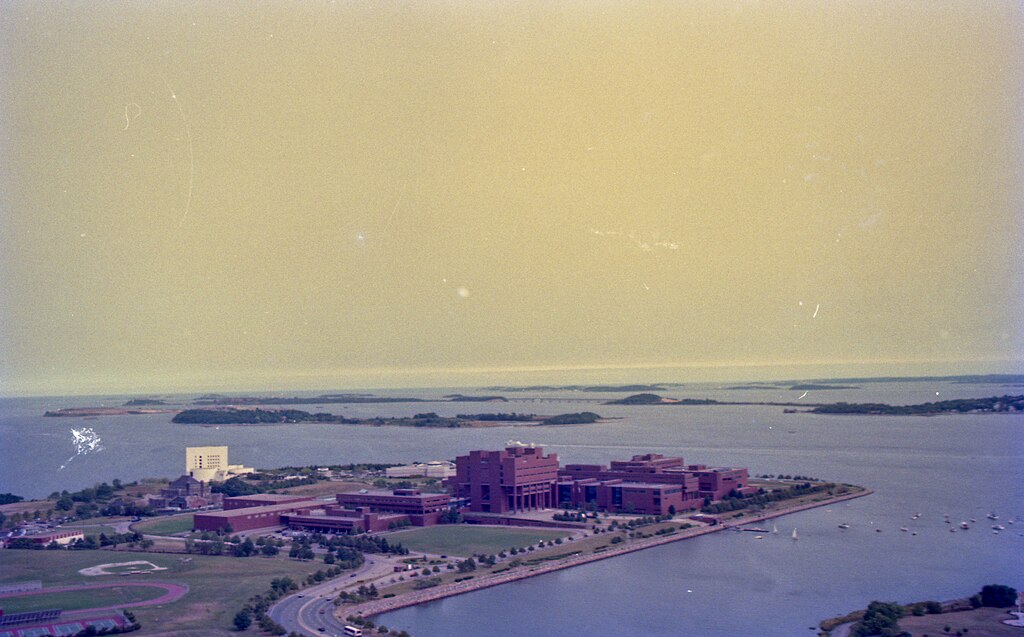
English: Aerial view of the UMass Boston Campus (center) with the Kennedy Library (white building, left-center) from the west in September 1993 |
| Date | Taken on 7 September 1993 |
| Source | 1993-09-07 - misc aerials - 003 |
| Author | Massachusetts Dept. of Environmental Protection |
| Camera location | | View this and other nearby images on: OpenStreetMap |
|---|
Licensing
[edit]
This file is licensed under the Creative Commons Attribution 2.0 Generic license.
- You are free:
- to share – to copy, distribute and transmit the work
- to remix – to adapt the work
- Under the following conditions:
- attribution – You must give appropriate credit, provide a link to the license, and indicate if changes were made. You may do so in any reasonable manner, but not in any way that suggests the licensor endorses you or your use.
| This image was originally posted to Flickr by Massachusetts Dept. of Environmental Protection at https://flickr.com/photos/42921580@N06/52522384096. It was reviewed on 27 November 2022 by FlickreviewR 2 and was confirmed to be licensed under the terms of the cc-by-2.0. |
File history
Click on a date/time to view the file as it appeared at that time.
| Date/Time | Thumbnail | Dimensions | User | Comment | |
|---|---|---|---|---|---|
| current | 04:02, 27 November 2022 | | 4,426 × 2,752 (1.18 MB) | Pi.1415926535 (talk | contribs) | Transferred from Flickr via #flickr2commons |
You cannot overwrite this file.
File usage on Commons
The following page uses this file:
- File:1993-09-07 - misc aerials - 003 (52522384096).jpg (file redirect)
.jpg&redirect=no)
File usage on other wikis
The following other wikis use this file:
- Usage on en.wikipedia.org