File:Autobahn 1-99.png
Jump to navigation
Jump to search

Size of this preview: 485 × 600 pixels. Other resolutions: 194 × 240 pixels | 388 × 480 pixels | 621 × 768 pixels | 828 × 1,024 pixels | 2,451 × 3,030 pixels.
Original file (2,451 × 3,030 pixels, file size: 905 KB, MIME type: image/png)
Captions
Captions
Add a one-line explanation of what this file represents
| Description |
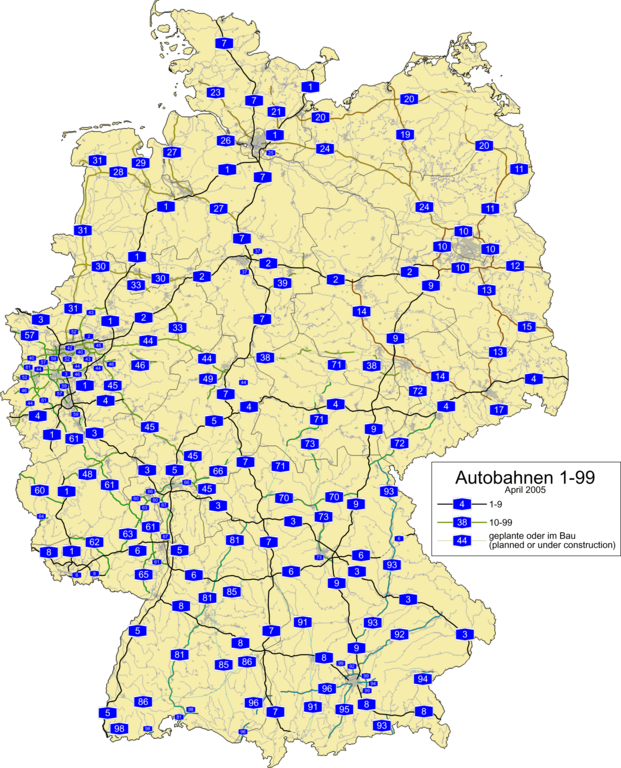
English: German Autobahnen 1-99. Base map is from OpenGeoDb, which allows any use. [Translation of part of [1] from German: "May I use the data also for commercial projects? Of course! Because the goal of this project was and is the structure of comprehensive a geo data base as possible, which can be used free of charge."]
Planned and under construction routes may need widening. They're looking rather gimpy. This map is deprecated in favor of Image:Autobahn 1-999.png. |
| Date | 23 April 2005 (upload date) |
| Source | Own work |
| Author | SPUI~commonswiki |
| This work has been released into the public domain by its author, SPUI. This applies worldwide. In some countries this may not be legally possible; if so: |
File history
Click on a date/time to view the file as it appeared at that time.
| Date/Time | Thumbnail | Dimensions | User | Comment | |
|---|---|---|---|---|---|
| current | 11:46, 23 April 2005 | | 2,451 × 3,030 (905 KB) | SPUI~commonswiki (talk | contribs) | {{spuimap}} German Autobahnen 1-99, on a public domain base map (same as Image:Autobahn 1-9.png). category:autobahncategory:road maps |
You cannot overwrite this file.
File usage on Commons
The following page uses this file: