File:Gowanus Canal Map.jpg
Jump to navigation
Jump to search
Size of this preview: 640 × 600 pixels. Other resolutions: 256 × 240 pixels | 819 × 768 pixels | 1,093 × 1,024 pixels | 1,340 × 1,256 pixels.
Original file (1,340 × 1,256 pixels, file size: 538 KB, MIME type: image/jpeg)
Captions
Captions
Add a one-line explanation of what this file represents
| This work has been released into the public domain by its author, SPUI. This applies worldwide. In some countries this may not be legally possible; if so: |
This image is in the public domain in the United States because it only contains materials that originally came from the United States Geological Survey, an agency of the United States Department of the Interior. For more information, see the official USGS copyright policy.
|
| Description |
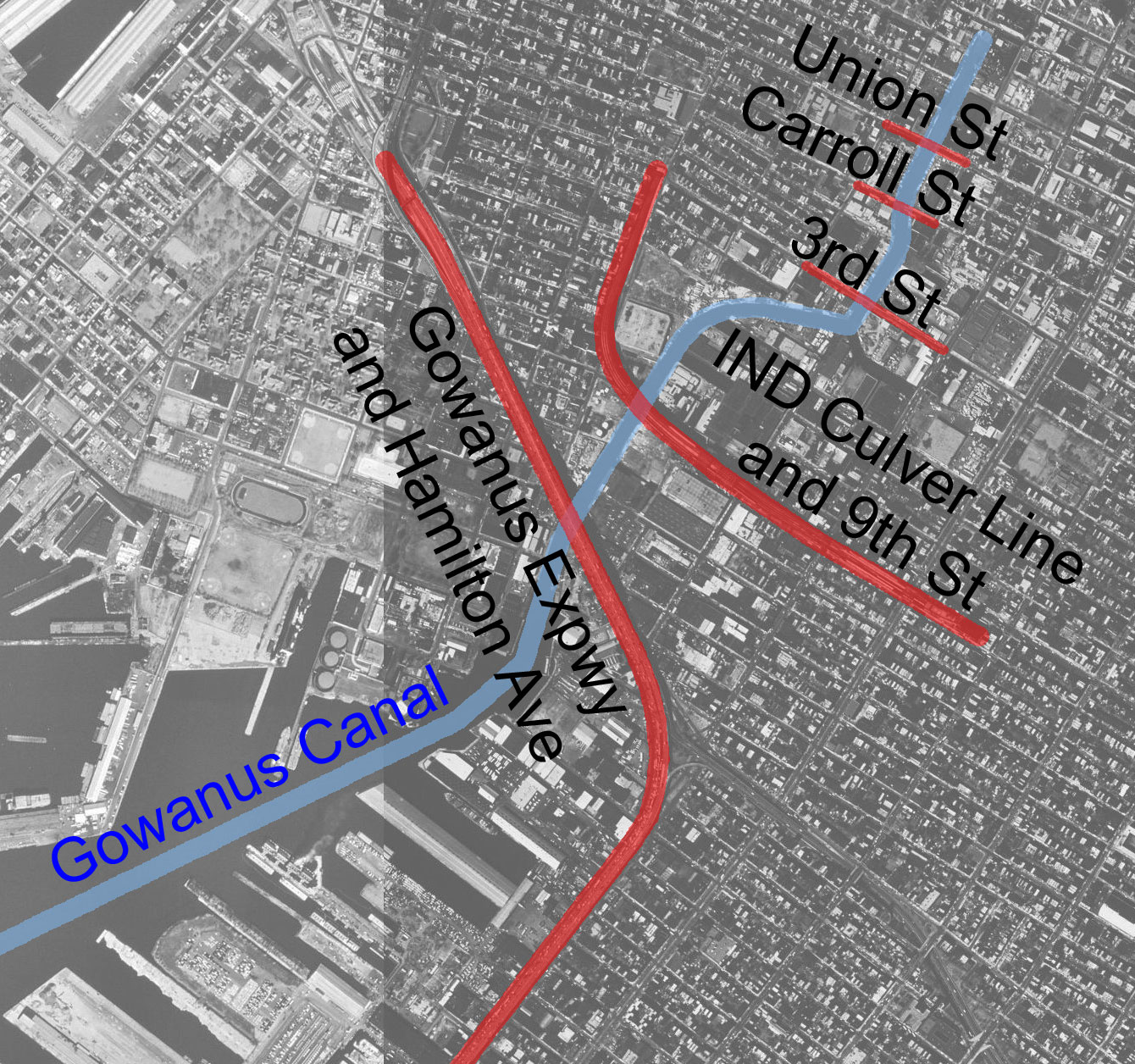
Gowanus Canal map. |
|||||||||
| Creator | ||||||||||
| Geotemporal data | ||||||||||
| Bounding box |
|
|||||||||
| Georeferencing | ||||||||||
File history
Click on a date/time to view the file as it appeared at that time.
| Date/Time | Thumbnail | Dimensions | User | Comment | |
|---|---|---|---|---|---|
| current | 22:53, 8 April 2005 | | 1,340 × 1,256 (538 KB) | SPUI~commonswiki (talk | contribs) | {{spuimap}}{{PD-USGov-USGS}} Gowanus Canal map. category:New York, New Yorkcategory:canals |
You cannot overwrite this file.
File usage on Commons
The following page uses this file:
- File:Gowanus Canal.jpg (file redirect)
File usage on other wikis
The following other wikis use this file:
- Usage on en.wikipedia.org
- Usage on hu.wikipedia.org
- Usage on it.wikipedia.org