File:Manchester UK local election 2014 map.svg
Jump to navigation
Jump to search

Size of this PNG preview of this SVG file: 330 × 599 pixels. Other resolutions: 132 × 240 pixels | 264 × 480 pixels | 423 × 768 pixels | 564 × 1,024 pixels | 1,129 × 2,048 pixels | 720 × 1,306 pixels.
Original file (SVG file, nominally 720 × 1,306 pixels, file size: 363 KB)
Captions
Captions
Add a one-line explanation of what this file represents
Summary[edit]
| Description |
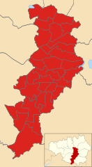
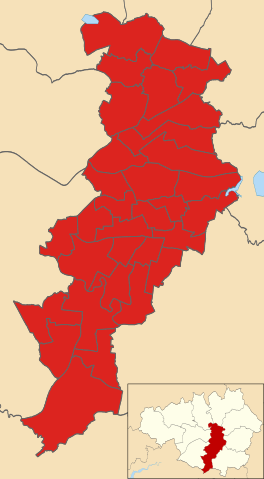
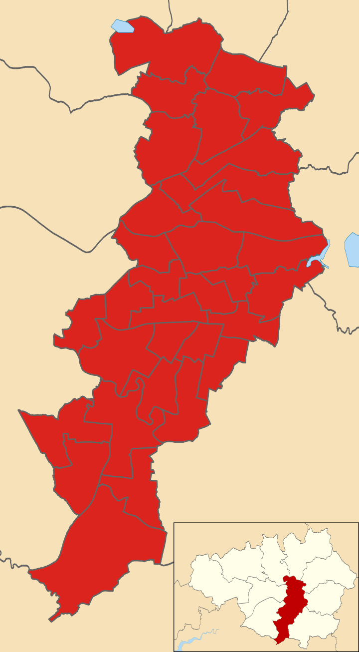
English: Results of the 2014 council election in Manchester. Coloured in red for Labour. |
| Date | |
| Source |
Derived from Manchester UK ward map 2010 (blank) by Nilfanion which in turn was derived from Ordnance Survey OpenData.
|
| Author | Derivative work by Videodude13 from Nilfanion from Ordnance Survey OpenData |
.svg)
Licensing[edit]
This file is licensed under the Creative Commons Attribution-Share Alike 3.0 Unported license.
- You are free:
- to share – to copy, distribute and transmit the work
- to remix – to adapt the work
- Under the following conditions:
- attribution – You must give appropriate credit, provide a link to the license, and indicate if changes were made. You may do so in any reasonable manner, but not in any way that suggests the licensor endorses you or your use.
- share alike – If you remix, transform, or build upon the material, you must distribute your contributions under the same or compatible license as the original.
File history
Click on a date/time to view the file as it appeared at that time.
| Date/Time | Thumbnail | Dimensions | User | Comment | |
|---|---|---|---|---|---|
| current | 17:10, 25 June 2016 | | 720 × 1,306 (363 KB) | Videodude13 (talk | contribs) | User created page with UploadWizard |
You cannot overwrite this file.
File usage on Commons
The following page uses this file:
File usage on other wikis
The following other wikis use this file:
- Usage on en.wikipedia.org
- Usage on www.wikidata.org