File:Sri Lanka’s Cultural triangle.svg
Jump to navigation
Jump to search

Size of this PNG preview of this SVG file: 372 × 599 pixels. Other resolutions: 149 × 240 pixels | 298 × 480 pixels | 477 × 768 pixels | 636 × 1,024 pixels | 1,271 × 2,048 pixels | 588 × 947 pixels.
Original file (SVG file, nominally 588 × 947 pixels, file size: 70 KB)
Captions
Captions
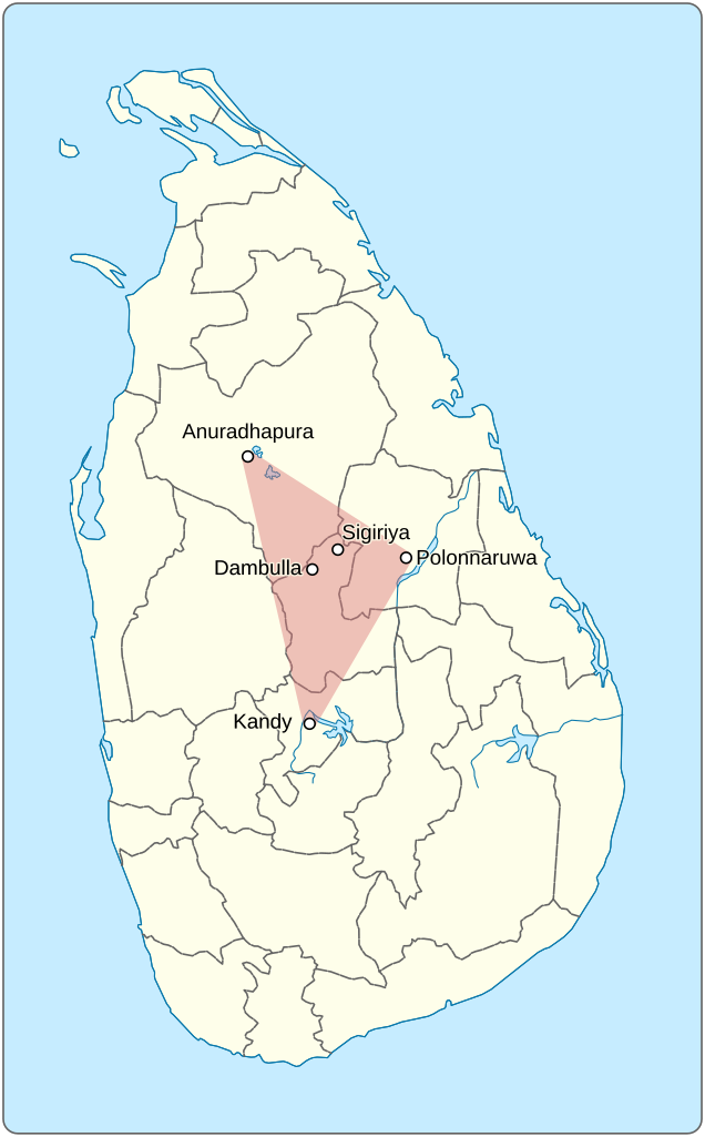
Sri Lanka’s Cultural triangle.
Summary
[edit]
| Description |
English: Situated in the centre of the island, covering an area which includes the World Heritage cultural sites of the Sacred City of Anuradhapura, the Ancient City of Polonnaruwa, the Ancient City of Sigiriya, the Ancient City of Dambulla and the Sacred City of Kandy. |
|||
| Date | ||||
| Source |
Own work Information from: |
|||
| Author | Goran tek-en, following request by Syced | |||
| Permission (Reusing this file) |
This file is licensed under the Creative Commons Attribution-Share Alike 4.0 International license. Attribution: Goran tek-en
|
|||
| SVG development |
| Object location | | View this and other nearby images on: OpenStreetMap |
|---|
File history
Click on a date/time to view the file as it appeared at that time.
| Date/Time | Thumbnail | Dimensions | User | Comment | |
|---|---|---|---|---|---|
| current | 12:37, 1 May 2019 | | 588 × 947 (70 KB) | Goran tek-en (talk | contribs) | {{Information |description ={{en|1=Situated in the centre of the island, covering an area which includes the World Heritage cultural sites of the Sacred City of Anuradhapura, the Ancient City of Polonnaruwa, the Ancient City of Sigiriya, the Ancient City of Dambulla and the Sacred City of Kandy.}} |date =20190501 |source ={{Own}}<br> {{Derived from|Sri Lanka location map.svg|xx}} Derived from; * [https://www.openstreetmap.org/#map=10/7.2126/80.6678 OSM] Information fro... |
You cannot overwrite this file.
File usage on Commons
The following page uses this file:
File usage on other wikis
The following other wikis use this file:
- Usage on en.wikipedia.org
- Usage on www.wikidata.org