File:Tiers Breibach (10).jpg
Jump to navigation
Jump to search
Size of this preview: 800 × 600 pixels. Other resolutions: 320 × 240 pixels | 640 × 480 pixels | 1,024 × 768 pixels | 1,280 × 960 pixels | 2,560 × 1,920 pixels | 3,648 × 2,736 pixels.
Original file (3,648 × 2,736 pixels, file size: 4.31 MB, MIME type: image/jpeg)
Captions
Captions
Add a one-line explanation of what this file represents
Summary
[edit].jpg&action=edit§ion=1)
| Description |
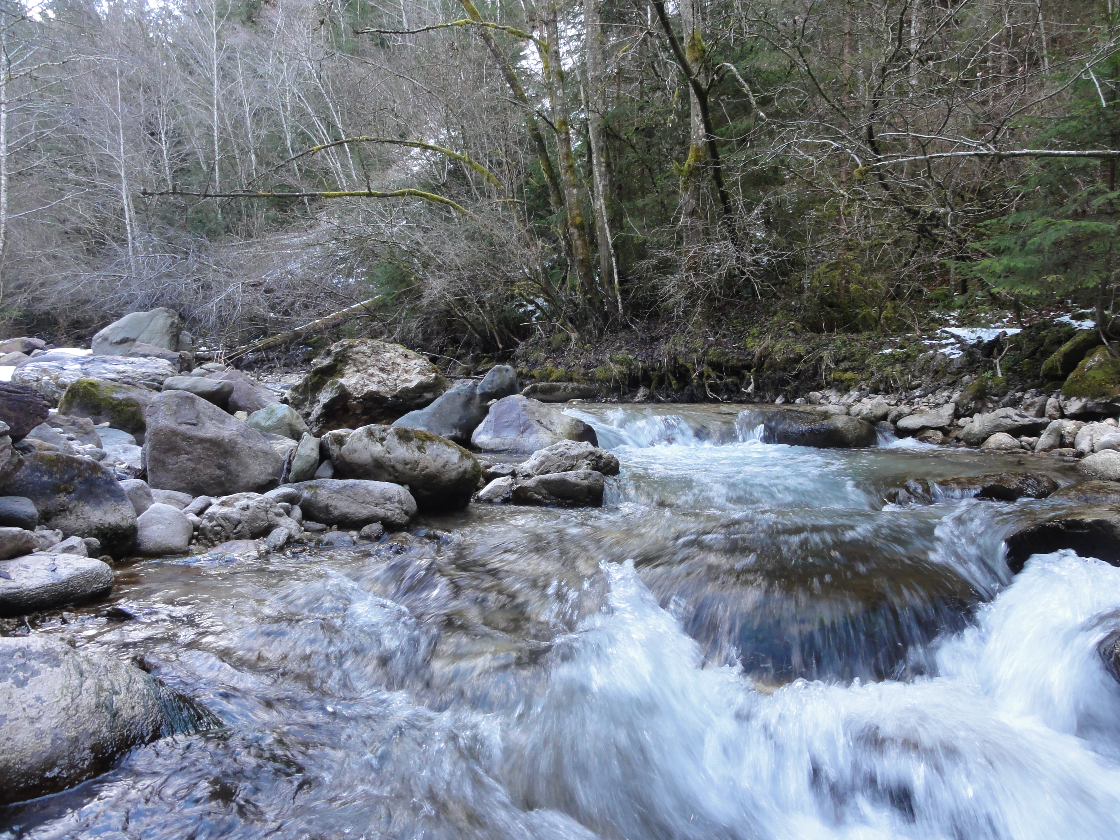
Deutsch: Hydrologisches Naturdenkmal. Der untere Teil des Baches als sehr natürlicher Bachlauf mit intaktem Bachökosystem erhalten. Der Bach weist teilweise schluchtartigen Charakter auf und dort, wo das Tal dem Bach etwas mehr Platz einräumt, ist das Bachbett breiter und verzweigt sich in mehrere Seitenarme. Die Strukturvielfalt dieses Gewässers erhöht die Vielfalt an Lebensräumen für verschiedenste Tier- und Pflanzengemeinschaften.
English: Hydrological Natural Monument. The lower part the brook is obtained as a very natural creek with intact stream ecosystem. The creek has partially gorge-like character and where the valley gives the stream a little more space, its bed is wider and branched into several side arms. The structural diversity of this water body increases the variety of habitats for a variety of animal and plant communities.
|
| Date | |
| Source | Own work |
| Author | Tommes |
| Permission (Reusing this file) |
English: You are free to use the picture obeying the law, but feel encouraged to mention the authors name.
Deutsch: Freie Verwendung für jeden Zweck im gesetzlichen Rahmen; Die Nennung des Namens des Autors wird mit Freude gesehen. |
| Camera location | | View this and other nearby images on: OpenStreetMap |
|---|
.jpg¶ms=046.465055_N_0011.516145_E_globe:Earth_type:camera_alt:1805.6_source:exif_heading:113.50&language=en)
| Object location | | View this and other nearby images on: OpenStreetMap |
|---|
.jpg¶ms=046.465055_N_0011.516145_E_globe:Earth_class:object_type:object__&language=en)
Licensing
[edit].jpg&action=edit§ion=2)
I, the copyright holder of this work, hereby publish it under the following license:
| This file is made available under the Creative Commons CC0 1.0 Universal Public Domain Dedication. | |
| The person who associated a work with this deed has dedicated the work to the public domain by waiving all of their rights to the work worldwide under copyright law, including all related and neighboring rights, to the extent allowed by law. You can copy, modify, distribute and perform the work, even for commercial purposes, all without asking permission.
|
File history
Click on a date/time to view the file as it appeared at that time.
| Date/Time | Thumbnail | Dimensions | User | Comment | |
|---|---|---|---|---|---|
| current | 19:36, 19 February 2016 | | 3,648 × 2,736 (4.31 MB) | Tommes (talk | contribs) | =={{int:filedesc}}== {{Information |description={{de|1=Hydrologisches Naturdenkmal. Der untere Teil des Baches als sehr natürlicher Bachlauf mit intaktem Bachökosystem erhalten. Der Bach weist teilweise schluchtartigen Charakter auf und dort, wo das... |
You cannot overwrite this file.
File usage on Commons
The following 3 pages use this file:
File usage on other wikis
The following other wikis use this file:
- Usage on da.wikipedia.org
- Usage on de.wikipedia.org
- Usage on en.wikipedia.org
- Usage on it.wikipedia.org
- Usage on www.wikidata.org
- Usage on zh.wikipedia.org
.jpg&oldid=547084138)