File:Fer - Le Canada, ou Nouvelle France, la Floride, la Virginie, Pensilvanie, Caroline.png
Jump to navigation
Jump to search

Size of this preview: 800 × 546 pixels. Other resolutions: 320 × 219 pixels | 640 × 437 pixels | 1,024 × 699 pixels | 1,280 × 874 pixels | 2,050 × 1,400 pixels.
Original file (2,050 × 1,400 pixels, file size: 5.34 MB, MIME type: image/png)
Captions
Captions
Add a one-line explanation of what this file represents
Summary
[edit]
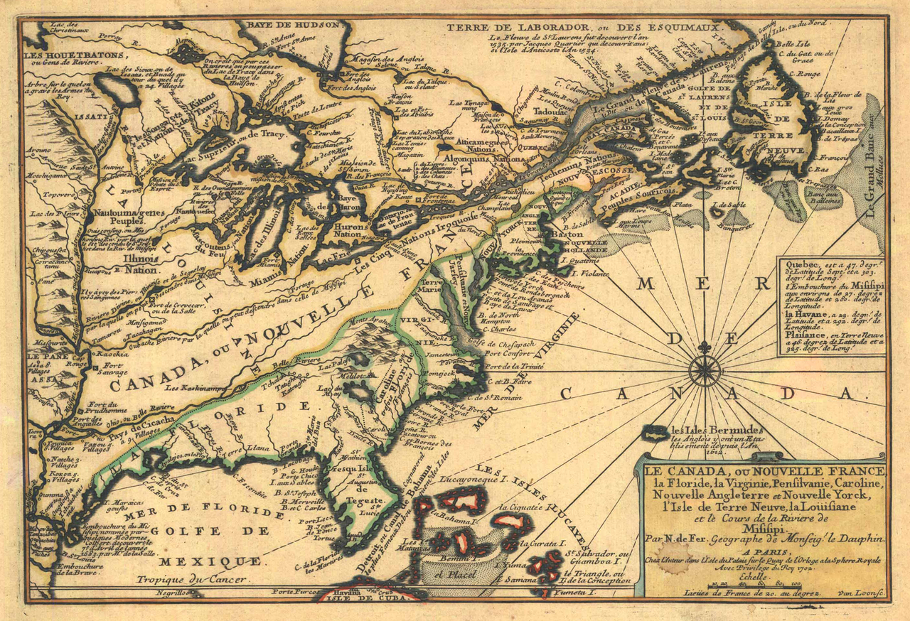
Nicolas de Fer: Le Canada, ou Nouvelle France, la Floride, la Virginie, Pensilvanie, Caroline ..., Paris 1702
From: L'Atlas curieux, ou la Monde..., quatrième partie, 1703
| Nicolas de Fer
(–1720) |
|||
|---|---|---|---|
 |
|||
| Description | French engraver and cartographer | ||
| Date of birth/death |
1646 / 1647 |
25 October 1720 | |
| Location of birth/death | Paris | Paris | |
| Work location | |||
| Authority file | |||
Licensing
[edit]
|
This work is in the public domain in its country of origin and other countries and areas where the copyright term is the author's life plus 100 years or fewer. | |
| This file has been identified as being free of known restrictions under copyright law, including all related and neighboring rights. | |
File history
Click on a date/time to view the file as it appeared at that time.
| Date/Time | Thumbnail | Dimensions | User | Comment | |
|---|---|---|---|---|---|
| current | 00:30, 27 September 2005 | | 2,050 × 1,400 (5.34 MB) | Frank Schulenburg (talk | contribs) | Nicolas de Fer: ''Le Canada, ou Nouvelle France, la Floride, la Virginie, Pensilvanie, Caroline ...'', Paris 1702 From: ''L'Atlas curieux, ou la Monde..., quatrième partie'', 1703 {{Creator:Nicolas de Fer}} Category:18th century maps |
You cannot overwrite this file.
File usage on Commons
The following 3 pages use this file:
File usage on other wikis
The following other wikis use this file:
- Usage on arz.wikipedia.org
- Usage on azb.wikipedia.org
- Usage on ca.wikipedia.org
- Usage on en.wikipedia.org
- Usage on es.wikipedia.org
- Usage on fr.wikipedia.org
- Usage on ga.wikipedia.org
- Usage on gl.wikipedia.org
- Usage on hu.wikipedia.org
- Usage on oc.wikipedia.org
- Usage on pam.wikipedia.org
- Usage on pt.wikipedia.org
- Usage on uk.wikipedia.org
- Usage on yi.wikipedia.org