File:Fitchburg on US map.png
Jump to navigation
Jump to search
Size of this preview: 800 × 542 pixels. Other resolutions: 320 × 217 pixels | 640 × 433 pixels | 1,024 × 693 pixels | 1,280 × 867 pixels | 2,560 × 1,733 pixels | 5,912 × 4,003 pixels.
Original file (5,912 × 4,003 pixels, file size: 1.85 MB, MIME type: image/png)
Captions
Captions
Add a one-line explanation of what this file represents
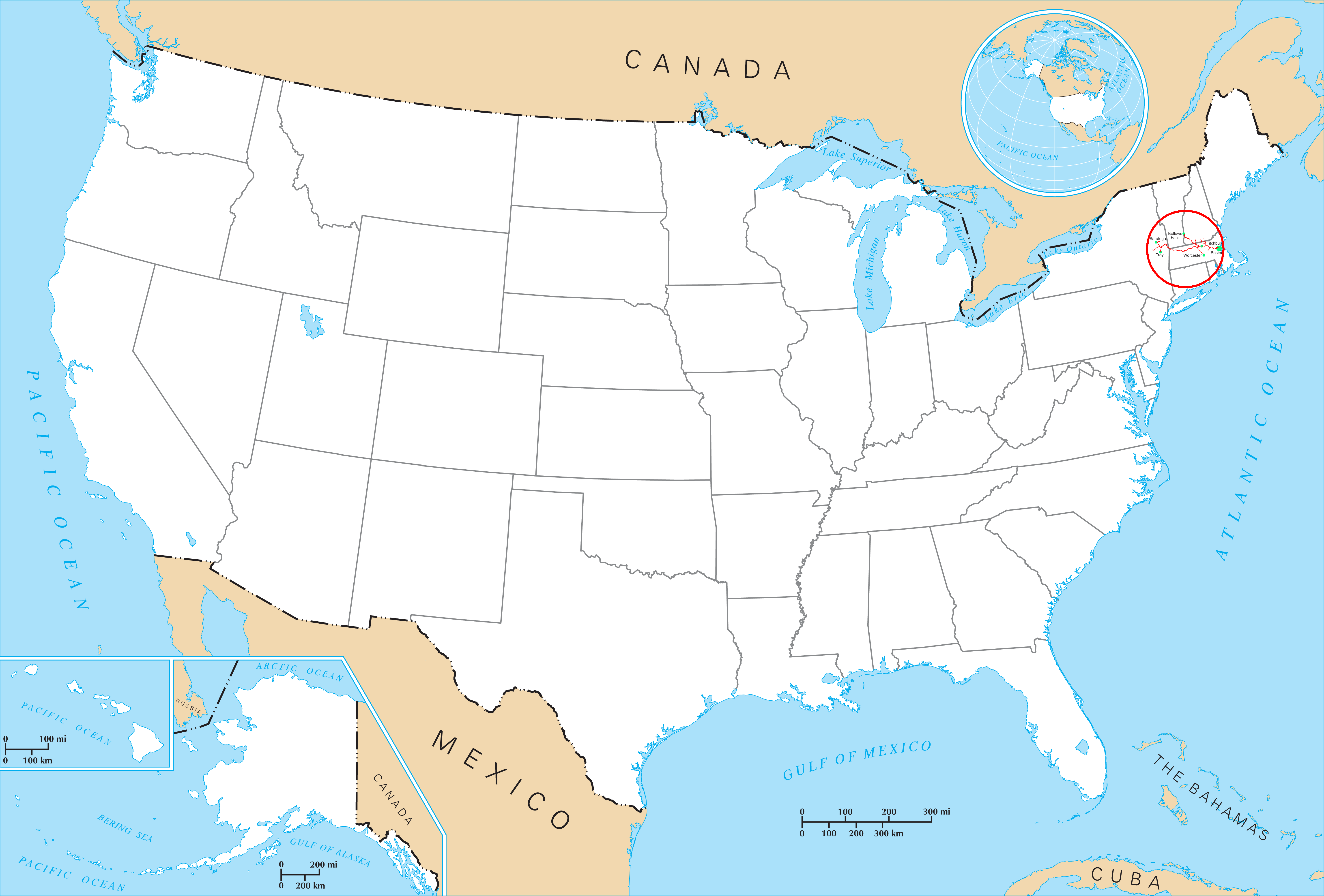
| Description | Map of the Fitchburg Railroad at its largest extent |
| Date | |
| Source | Own work on File:US state outline map.png |
| Author | User:SPUI |
| Other versions |

| This work has been released into the public domain by its author, SPUI. This applies worldwide. In some countries this may not be legally possible; if so: |
File history
Click on a date/time to view the file as it appeared at that time.
| Date/Time | Thumbnail | Dimensions | User | Comment | |
|---|---|---|---|---|---|
| current | 05:50, 28 July 2005 | | 5,912 × 4,003 (1.85 MB) | SPUI~commonswiki (talk | contribs) | {{spuimap}} Fitchburg Railroad on Image:US state outline map.png. See Image:Fitchburg on US map cropped.png for a cropped one. category:Boston and Maine Railroad category:railroad maps |
You cannot overwrite this file.
File usage on Commons
The following page uses this file: