Category:1860s maps of Chicago
Jump to navigation
Jump to search
Media in category "1860s maps of Chicago"
The following 18 files are in this category, out of 18 total.
-

-
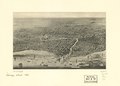
 (Chicago. LOC 75693205.jpg 2,840 × 2,040; 817 KB
-
 (Chicago. LOC 75693205.tif 2,840 × 2,040; 16.58 MB
-
 1861 Mitchell's Map of Illinois w- Chicago Inset - Geographicus - IL-m-60.jpg 2,774 × 3,500; 2.72 MB
-
 1861 Van Vechten's map of Cook County.jpg 18,754 × 21,222; 76.26 MB
-
 1862 Business portion of Chicago.jpg 7,522 × 5,357; 8.81 MB
-
 1862 Van Vechten's map of Cook County.jpg 18,854 × 21,144; 72.56 MB
-
 1863 Chicago map by Van Vechten.jpg 14,746 × 24,269; 65.46 MB
-
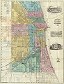
 1864 Blanchard's Guide Map of Chicago.jpg 2,224 × 3,000; 1.69 MB
-
 Plan of Camp Douglas, 1864-65.png 1,279 × 1,071; 190 KB
-
 1868 Guide Map of Chicago by Blanchard.jpg 5,340 × 6,800; 9.79 MB
-
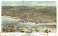 1868 Chicago.jpg 11,200 × 6,960; 29.55 MB
-
 1868 Shober's Guide map of Chicago.jpg 4,792 × 7,792; 18.26 MB
-

-
 1869 Blanchard's Guide Map of Chicago.jpg 4,902 × 6,376; 8.85 MB
-
 1869 Blanchard's map of Chicago and Environs.jpg 5,120 × 6,279; 6.41 MB
-
 Chicago in 1868 from Schiller Street north side to 12th Street south side. LOC 73693350.jpg 11,200 × 6,960; 17.43 MB
-
 County map of the State of Illinois; Plan of Chicago (inset). NYPL1510816.tiff 5,248 × 6,299; 95.24 MB
.jpg)


.jpg)


