Category:2020 presidential election maps of Georgia (U.S. state)
Jump to navigation
Jump to search
States of the United States: Alabama · Alaska · Arizona · Arkansas · California · Colorado · Connecticut · Delaware · Florida · Georgia · Hawaii · Idaho · Illinois · Indiana · Iowa · Kansas · Kentucky · Louisiana · Maine · Maryland · Massachusetts · Michigan · Minnesota · Mississippi · Missouri · Montana · Nebraska · Nevada · New Hampshire · New Jersey · New York · North Carolina · Ohio · Pennsylvania · Texas
Media in category "2020 presidential election maps of Georgia (U.S. state)"
The following 8 files are in this category, out of 8 total.
-
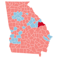
 2020 Presidential Election in Georgia's 6th Congressional District.png 3,840 × 2,528; 756 KB
-
 2020 US presidential in Georgia precinct results.svg 744 × 804; 24.68 MB
-
 GA President 2020.svg 810 × 810; 22.03 MB
-
 GA-20-pres-districts.svg 810 × 810; 127 KB
-
 Georgia County Flips 2020.svg 744 × 744; 690 KB
-
 Georgia County Swing 2020.svg 744 × 744; 693 KB
-
 Georgia County Trend 2020.svg 744 × 744; 693 KB
-


