Category:A3 road (England)
Jump to navigation
Jump to search

major road connecting London and Portsmouth in England    | |||||
| Upload media | |||||
| Instance of | |||||
|---|---|---|---|---|---|
| Location | |||||
| Transport network |
| ||||
| Connects with | |||||
| Has part(s) |
| ||||
| Length |
| ||||
| Terminus | |||||
| Different from | |||||
 | |||||
Subcategories
This category has the following 13 subcategories, out of 13 total.
A
- Anglesea Road, Portsmouth (8 F)
B
C
- Canadian Memorial Underpass (6 F)
H
- Hindhead Tunnel (65 F)
L
- London Road, Waterlooville (11 F)
N
R
W
- Waterlooville Baptist Church (5 F)
Media in category "A3 road (England)"
The following 145 files are in this category, out of 145 total.
-
-
 A really hideous roundabout - geograph.org.uk - 1702200.jpg 640 × 480; 46 KB
-
 A wet and windy London Road - geograph.org.uk - 1582831.jpg 640 × 480; 51 KB
-
 A3 - 1-2 mile to Burpham interchange - geograph.org.uk - 2686972.jpg 640 × 428; 80 KB
-
-
 A3 - panoramio.jpg 1,024 × 768; 215 KB
-
 A3 and B3006 Roundabout - geograph.org.uk - 3792.jpg 640 × 421; 24 KB
-
 A3 at Hook looking east. - geograph.org.uk - 39477.jpg 640 × 480; 106 KB
-
 A3 at the Hook underpass - geograph.org.uk - 39474.jpg 640 × 480; 87 KB
-
 A3 at Waterlooville boundary - geograph.org.uk - 3113476.jpg 640 × 480; 65 KB
-
 A3 at Wisley, Surrey - geograph.org.uk - 3352458.jpg 4,000 × 2,364; 5.87 MB
-
 A3 eastbound, Esher - geograph.org.uk - 1743114.jpg 1,600 × 1,200; 552 KB
-
 A3 flyover - geograph.org.uk - 1659077.jpg 640 × 480; 111 KB
-
 A3 from Bell Hill, Petersfield - geograph.org.uk - 95352.jpg 640 × 480; 69 KB
-
 A3 near Hook - geograph.org.uk - 42280.jpg 640 × 480; 190 KB
-
 A3 near Liphook.jpg 640 × 428; 45 KB
-
-
 A3 North - approaching the Wisley Interchange.jpg 640 × 427; 22 KB
-
 A3 Petersfield bypass and farmland. - geograph.org.uk - 10876.jpg 640 × 426; 70 KB
-
 A3 Portsdown Hill Junction 5.jpg 2,816 × 2,112; 1.47 MB
-
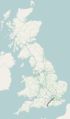 A3 road map.png 250 × 425; 48 KB
-
 A3 southbound near Horndean - geograph.org.uk - 1098960.jpg 640 × 480; 52 KB
-
 A3(T) from bridge near Hook - geograph.org.uk - 48802.jpg 640 × 480; 94 KB
-
-
 A3, Approaching junction 2 - geograph.org.uk - 2794364.jpg 640 × 399; 40 KB
-
 A3, Bramshott - geograph.org.uk - 21557.jpg 640 × 480; 99 KB
-
 A3, Devil's Punch Bowl - geograph.org.uk - 3751.jpg 640 × 480; 53 KB
-
 A3, Thursley junction - geograph.org.uk - 2790.jpg 640 × 435; 41 KB
-
 A31 road bridge over the A3 - geograph.org.uk - 705606.jpg 640 × 480; 117 KB
-
 A3M.PNG 171 × 116; 3 KB
-
 Abutment of former Portsmouth & Horndean Light Railway bridge 3 - 53024209089.jpg 4,608 × 3,456; 6.31 MB
-
 Abutment of former Portsmouth & Horndean Light Railway bridge 4.jpg 4,000 × 3,000; 5.19 MB
-
 Ace cars in London Road - geograph.org.uk - 1308018.jpg 640 × 480; 55 KB
-
 Area Around Former Sainsburys, Commercial Road.jpg 4,000 × 3,000; 5.33 MB
-

-
 Bend in the road at Plant Farm - geograph.org.uk - 732552.jpg 640 × 480; 60 KB
-
 Bike and bus lane on London Road - geograph.org.uk - 732624.jpg 640 × 480; 62 KB
-

-
 Bus stops by Christchurch Gardens - geograph.org.uk - 732036.jpg 640 × 480; 72 KB
-
 Bus stops in London Road - geograph.org.uk - 1584071.jpg 640 × 480; 67 KB
-
 Butser Hill and Hilhampton Bottom - geograph.org.uk - 206626.jpg 640 × 480; 68 KB
-
 Butser Hill and Hillhampton Bottom - geograph.org.uk - 8088.jpg 640 × 480; 110 KB
-
 Car in London Road - geograph.org.uk - 1308040.jpg 640 × 480; 65 KB
-
 Chalet bungalows in London Road - geograph.org.uk - 1584058.jpg 640 × 480; 51 KB
-
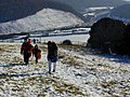 Climbing Butser Hill winter - geograph.org.uk - 417762.jpg 640 × 480; 207 KB
-

-
 Crossing on the A3 - geograph.org.uk - 1802271.jpg 800 × 428; 67 KB
-
 Devil's Punch Bowl A3 Portsmouth Road 2.JPG 3,328 × 1,872; 992 KB
-
 Devil's Punch Bowl A3 Portsmouth Road 3.JPG 3,328 × 1,744; 1.07 MB
-
 Devil's Punch Bowl A3 Portsmouth Road 4.JPG 3,328 × 1,872; 1.09 MB
-
 Devil's Punch Bowl A3 Portsmouth Road 5.JPG 3,328 × 1,730; 1,010 KB
-
 Devil's Punch Bowl A3 Portsmouth Road 6.JPG 3,328 × 1,734; 997 KB
-
 Devil's Punch Bowl A3 Portsmouth Road roadworks 2.JPG 3,328 × 1,872; 718 KB
-
 Devil's Punch Bowl A3 Portsmouth Road roadworks 3.JPG 3,328 × 1,872; 736 KB
-
 Devil's Punch Bowl A3 Portsmouth Road roadworks 4.JPG 3,328 × 1,780; 517 KB
-
 Devil's Punch Bowl A3 Portsmouth Road roadworks.JPG 3,328 × 1,809; 530 KB
-
 Devil's Punch Bowl A3 Portsmouth Road.JPG 3,328 × 1,821; 1.27 MB
-
 Devil's Punch Bowl from A3 Portsmouth Road.JPG 3,328 × 1,872; 1.15 MB
-
 Devil's Punch Bowl, old A3 closed to traffic 1.jpg 2,816 × 2,112; 1.47 MB
-
 Devil's Punch Bowl, old A3 closed to traffic 2.jpg 2,816 × 2,112; 3.53 MB
-
 Devil's Punch Bowl, old A3 closed to traffic 3.jpg 2,816 × 2,112; 1.45 MB
-
 Devil's Punch Bowl, old A3 closed to traffic 4.jpg 2,816 × 2,112; 1.46 MB
-
 Devil's Punch Bowl, old A3 closed to traffic 5.jpg 2,816 × 2,112; 3.27 MB
-
 Dockyard Building, Albert Road - geograph.org.uk - 2930147.jpg 1,600 × 1,200; 443 KB
-
 Footbridge Between FirstSolent Bus Depot and Southdown View.jpg 4,000 × 3,000; 5.07 MB
-
 Former A3 north of Hindhead - geograph.org.uk - 818744.jpg 640 × 480; 74 KB
-
 Former Evangelical Mission Hall, London Road, Cowplain (May 2019).JPG 1,800 × 1,400; 905 KB
-
 Gymnasium, Eastney, Jervis.jpg 4,000 × 2,250; 8.01 MB
-
 Gymnasium, HMS Nelson.jpg 4,608 × 2,592; 8.38 MB
-
 Hindhead A3 London Road.JPG 3,328 × 1,872; 979 KB
-
 Hindhead A3 Portsmouth Road contraflow 2.JPG 3,328 × 1,803; 511 KB
-
 Hindhead A3 Portsmouth Road contraflow 3.JPG 3,328 × 1,736; 692 KB
-
 Hindhead A3 Portsmouth Road contraflow and roadworks 2.JPG 3,328 × 1,845; 664 KB
-
 Hindhead A3 Portsmouth Road contraflow and roadworks.JPG 3,328 × 1,797; 610 KB
-
 Hindhead A3 Portsmouth Road contraflow.JPG 3,328 × 1,766; 465 KB
-
 Hindhead A3 Portsmouth Road roadworks 2.JPG 3,328 × 1,872; 657 KB
-
 Hindhead A3 Portsmouth Road roadworks 3.JPG 3,328 × 1,872; 657 KB
-
 Hindhead A3 Portsmouth Road roadworks 4.JPG 3,328 × 1,872; 759 KB
-
 Hindhead A3 Portsmouth Road roadworks.JPG 3,328 × 1,872; 590 KB
-
 Hindhead A3 Portsmouth Road.JPG 3,328 × 1,823; 1.03 MB
-
 Hindhead Traffic Lights A3 Portsmouth Road 2.JPG 3,328 × 1,872; 660 KB
-
 Hindhead Traffic Lights A3 Portsmouth Road.JPG 3,328 × 1,824; 694 KB
-
 Hindhead Tunnel Vision - geograph.org.uk - 2407997.jpg 1,024 × 768; 98 KB
-
 Hindhead Tunnel Vision - geograph.org.uk - 2408082.jpg 1,024 × 768; 70 KB
-
 Hindhead Tunnel Vision Day - geograph.org.uk - 2407995.jpg 1,024 × 768; 103 KB
-
 Junction of Park Road with the A3 - geograph.org.uk - 757197.jpg 640 × 480; 68 KB
-

-
 Just Stop Oil, Portsmouth, 9th Sept 2023 2.jpg 4,000 × 3,000; 5.3 MB
-
 Just Stop Oil, Portsmouth, 9th Sept 2023.jpg 4,608 × 3,456; 6.27 MB
-
 Lampposts in London Road - geograph.org.uk - 1583982.jpg 640 × 480; 54 KB
-

-
 London Road, Purbrook - geograph.org.uk - 732072.jpg 640 × 480; 93 KB
-

-
-

-

-
 Looking north-east up London Road - geograph.org.uk - 1308078.jpg 640 × 480; 70 KB
-
 Looking south-west down London Road - geograph.org.uk - 1286257.jpg 480 × 640; 61 KB
-

-
 Mid section of London Road - geograph.org.uk - 1583971.jpg 640 × 480; 61 KB
-
 Mile End Roundabout Junction.jpg 4,000 × 3,000; 5.45 MB
-
 Milestone beside A3, Bramshott Common, Hampshire 05.jpg 4,128 × 3,096; 5.34 MB
-
 Milestone beside A3, Bramshott Common, Hampshire 07.jpg 4,128 × 3,096; 6.08 MB
-
 Milestone beside A3, Bramshott Common, Hampshire 08.jpg 3,096 × 4,128; 5.8 MB
-
 Milestone beside A3, Bramshott Common, Hampshire 09.jpg 3,096 × 4,128; 5.95 MB
-
 Milestone beside A3, Bramshott Common, Hampshire 10.jpg 4,128 × 3,096; 4.58 MB
-
 Milestone beside A3, Bramshott Common, Hampshire 11.jpg 4,000 × 3,000; 5.64 MB
-
 Number 21 at Cathedral Junction - geograph.org.uk - 698686.jpg 640 × 480; 56 KB
-
 Old A3 Hindhead.JPG 1,944 × 2,592; 1.71 MB
-
 Petersfield bypass - geograph.org.uk - 357284.jpg 640 × 477; 78 KB
-
 Petrol station at Lower Eashing on A3 - geograph.org.uk - 1263450.jpg 640 × 480; 109 KB
-
 Portsbridge Roundabout from the South.jpg 4,000 × 3,000; 6.02 MB
-
 Portsdown Hill Road Bridge opening commemoration stone (20221022 092955 687).jpg 4,160 × 3,120; 4.32 MB
-
-
 Postbox in London Road - geograph.org.uk - 732598.jpg 480 × 640; 70 KB
-
 Queen Elizabeth Country Park - panoramio - Alistair Cunningham (1).jpg 1,024 × 768; 298 KB
-
 Ripley By-Pass - geograph.org.uk - 1001379.jpg 640 × 480; 89 KB
-
 Shops in London Road - geograph.org.uk - 1308024.jpg 640 × 480; 62 KB
-
 Shops in London Road, Widley - geograph.org.uk - 732060.jpg 640 × 480; 64 KB
-
 Snowplough on the A3 - geograph.org.uk - 1144219.jpg 640 × 480; 86 KB
-
 Stagecoach Hants & Surrey 32628 P628 PGP.JPG 3,328 × 1,776; 696 KB
-
 Subway under the A3 at Black Hanger, Thursley 01.jpg 4,000 × 3,000; 3.16 MB
-
 Subway under the A3 at Black Hanger, Thursley 02.jpg 4,000 × 3,000; 3.16 MB
-
 Subway under the A3 at Black Hanger, Thursley 03.jpg 4,000 × 3,000; 2.47 MB
-
 Subway under the A3 at Black Hanger, Thursley 04.jpg 4,000 × 3,000; 2.75 MB
-
 Subway under the A3 at Black Hanger, Thursley 05.jpg 4,000 × 3,000; 5.55 MB
-
 The A3 - geograph.org.uk - 1253844.jpg 640 × 477; 98 KB
-
 The A3 approaching Hindhead - geograph.org.uk - 818748.jpg 640 × 480; 68 KB
-
 The A3 at Warren Park - geograph.org.uk - 1802209.jpg 800 × 430; 80 KB
-
 The A3 from half way up Butser Hill - geograph.org.uk - 808798.jpg 640 × 480; 81 KB
-
 The A3 out of Portsmouth - geograph.org.uk - 3621935.jpg 640 × 480; 256 KB
-
 The A3 trunk road - geograph.org.uk - 3588692.jpg 2,048 × 1,536; 1.25 MB
-
 The A3, looking north - geograph.org.uk - 251669.jpg 640 × 478; 50 KB
-
 The old A3 at Hindhead (aerial).jpg 3,008 × 1,960; 5.31 MB
-
 The Spaniard, Bramshott Chase - geograph.org.uk - 17161.jpg 640 × 426; 50 KB
-
 These are not just lampposts.... - geograph.org.uk - 732545.jpg 640 × 480; 92 KB
-
 Tower block on the A3 - geograph.org.uk - 757213.jpg 640 × 480; 74 KB
-
 Twyford Avenue - geograph.org.uk - 1294465.jpg 640 × 480; 101 KB
-
 Twyford Avenue, Stamshaw - geograph.org.uk - 723095.jpg 640 × 480; 69 KB
-
 UK road A3.svg 286 × 191; 4 KB
-
 A3 From Clay Lane - geograph.org.uk - 1144273.jpg 640 × 480; 76 KB
-
 A3 London Road north of Burpham - geograph.org.uk - 696508.jpg 640 × 480; 108 KB
-
 A3 London-bound - geograph.org.uk - 1001887.jpg 640 × 480; 82 KB
-
 A3 near Thursley - geograph.org.uk - 1802306.jpg 800 × 600; 115 KB
-
 A3, Looking East From Clay Lane - geograph.org.uk - 1144286.jpg 640 × 480; 83 KB


_from_bridge_near_Hook_-_geograph.org.uk_-_48802.jpg)
_from_the_bridleway_bridge_near_Barwell_Farm_-_geograph.org.uk_-_45394.jpg)


.JPG)


.jpg)


.jpg)


.jpg)


