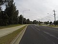
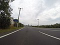
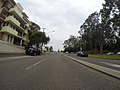
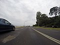
Category:Batemans Bay
Jump to navigation
Jump to search
Deutsch: Batemans Bay ist eine Stadt und eine Bucht an der Südostküste Australiens im Eurobodalla Shire des Bundesstaates New South Wales. Der Ort befindet sich am Princes Highway (Highway 1) etwa 280 km südlich von Sydney, 760 km nordöstlich von Melbourne und liegt 160 km östlich von Canberra (über den Kings Highway). (→Batemans Bay)
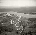
English: Batemans Bay is a town and a bay in the South Coast region of the state of New South Wales, Australia. Batemans Bay is administered by the Eurobodalla Shire council. The town is located on the Princes Highway (Highway 1) about from Canberra via the Kings Highway. At the 2006 census it had a population of 10,845. The Clyde River empties here into the Tasman Sea. (→Batemans Bay)
Français : Batemans Bay ( habitants) est une ville sur la côte Sud de la Nouvelle-Galles-du-Sud en Australie à l'embouchure de la Clyde. (→Batemans Bay (Australie))
Polski: Batemans Bay - nadmorska miejscowość i zatoka w stanie Nowa Południowa Walia w Australii. Położona w odległości 280 km od Sydney i 151 km od Canberry. Głównym źródłem dochodu miasta jest turystyka, przemysł drzewny i połowy ostryg. W Batemans Bay krzyżują się dwie znane drogi; Kings Highway i Princes Highway. (→Batemans Bay)
town in New South Wales, Australia  | |||||
| Upload media | |||||
| Instance of | |||||
|---|---|---|---|---|---|
| Location |
| ||||
| Population |
| ||||
| Elevation above sea level |
| ||||
 | |||||
Subcategories
This category has the following 13 subcategories, out of 13 total.
B
- Batehaven, New South Wales (56 F)
- Batemans Bay Bridge (13 F)
- Birdland Animal Park (3 F)
- Burrewarra Point Lighthouse (2 F)
C
- Catalina, New South Wales (20 F)
D
- Denhams Beach, New South Wales (19 F)
E
F
L
- Long Beach, New South Wales (4 F)
M
N
- North Batemans Bay (155 F)
S
- Surfside, New South Wales (2 F)
Pages in category "Batemans Bay"
This category contains only the following page.
Media in category "Batemans Bay"
The following 200 files are in this category, out of 271 total.
(previous page) (next page)-
 074 Nr Bateman's Bay, Jan 1979 (52091671339).jpg 2,560 × 1,920; 1.65 MB
-
 A beach in Batemans Bay, NSW.jpg 1,600 × 1,011; 362 KB
-
 A street in Batemans Bay in front of ALDI (101).jpg 3,000 × 2,250; 1.22 MB
-

-
 Admiralty Chart No 2176 Jervis and Bateman Bays, Published 1853.jpg 7,873 × 5,852; 19.71 MB
-
 Bateman's Bay (4903858794).jpg 1,024 × 770; 129 KB
-
 Batemans Bay (3527203628).jpg 487 × 434; 56 KB
-
 Batemans Bay - 17 Nov 1937 (29240997114).jpg 5,844 × 5,760; 9.54 MB
-
 Batemans Bay - 17 Nov 1937 (29868035875).jpg 5,703 × 5,784; 11.15 MB
-
 Batemans Bay - Circuit Beach.jpg 500 × 375; 179 KB
-
 Batemans Bay 2.jpg 500 × 375; 175 KB
-
 Batemans Bay Aerial.JPG 2,288 × 1,712; 1.14 MB
-
 Batemans Bay at Batemans Bay, New South Wales, 2020.jpg 4,032 × 3,024; 4.55 MB
-
 Batemans Bay Banner.jpg 4,928 × 705; 1.52 MB
-
 Batemans Bay Bridge Post Construction Northern Foreshore July 2022.jpg 900 × 675; 229 KB
-
 Batemans Bay Bridge.jpg 4,259 × 2,063; 4.98 MB
-
 Batemans Bay Courthouse.jpg 1,000 × 651; 230 KB
-
 Batemans Bay NSW 2536, Australia - panoramio (102).jpg 3,000 × 2,250; 1.14 MB
-
 Batemans Bay NSW 2536, Australia - panoramio (103).jpg 3,000 × 2,250; 1.29 MB
-
 Batemans Bay NSW 2536, Australia - panoramio (104).jpg 3,000 × 2,250; 1.41 MB
-
 Batemans Bay NSW 2536, Australia - panoramio (105).jpg 3,000 × 2,250; 1.42 MB
-
 Batemans Bay NSW 2536, Australia - panoramio (106).jpg 3,000 × 2,250; 1.17 MB
-
 Batemans Bay NSW 2536, Australia - panoramio (107).jpg 3,000 × 2,250; 1.31 MB
-
 Batemans Bay NSW 2536, Australia - panoramio (108).jpg 3,000 × 2,250; 1.19 MB
-
 Batemans Bay NSW 2536, Australia - panoramio (109).jpg 3,000 × 2,250; 1.1 MB
-
 Batemans Bay NSW 2536, Australia - panoramio (11).jpg 5,184 × 3,456; 6.54 MB
-
 Batemans Bay NSW 2536, Australia - panoramio (110).jpg 3,000 × 2,250; 1.13 MB
-
 Batemans Bay NSW 2536, Australia - panoramio (111).jpg 3,000 × 2,250; 1.06 MB
-
 Batemans Bay NSW 2536, Australia - panoramio (112).jpg 3,000 × 2,250; 1.06 MB
-
 Batemans Bay NSW 2536, Australia - panoramio (116).jpg 3,000 × 2,250; 1.33 MB
-
 Batemans Bay NSW 2536, Australia - panoramio (119).jpg 3,000 × 2,250; 1,018 KB
-
 Batemans Bay NSW 2536, Australia - panoramio (12).jpg 5,184 × 3,456; 6.25 MB
-
 Batemans Bay NSW 2536, Australia - panoramio (120).jpg 3,000 × 2,250; 1.19 MB
-
 Batemans Bay NSW 2536, Australia - panoramio (121).jpg 3,000 × 2,250; 1.28 MB
-
 Batemans Bay NSW 2536, Australia - panoramio (122).jpg 3,000 × 2,250; 1.07 MB
-
 Batemans Bay NSW 2536, Australia - panoramio (123).jpg 3,000 × 2,250; 1.03 MB
-
 Batemans Bay NSW 2536, Australia - panoramio (124).jpg 3,000 × 2,250; 1.33 MB
-
 Batemans Bay NSW 2536, Australia - panoramio (125).jpg 3,000 × 2,250; 1.09 MB
-
 Batemans Bay NSW 2536, Australia - panoramio (126).jpg 3,000 × 2,250; 1.13 MB
-
 Batemans Bay NSW 2536, Australia - panoramio (127).jpg 3,000 × 2,250; 1.28 MB
-
 Batemans Bay NSW 2536, Australia - panoramio (128).jpg 3,000 × 2,250; 1.24 MB
-
 Batemans Bay NSW 2536, Australia - panoramio (129).jpg 3,000 × 2,250; 1.36 MB
-
 Batemans Bay NSW 2536, Australia - panoramio (13).jpg 5,184 × 2,585; 5.28 MB
-
 Batemans Bay NSW 2536, Australia - panoramio (130).jpg 3,000 × 2,250; 1.45 MB
-
 Batemans Bay NSW 2536, Australia - panoramio (131).jpg 3,000 × 2,250; 1.26 MB
-
 Batemans Bay NSW 2536, Australia - panoramio (132).jpg 3,000 × 2,250; 1.35 MB
-
 Batemans Bay NSW 2536, Australia - panoramio (133).jpg 3,000 × 2,250; 1.6 MB
-
 Batemans Bay NSW 2536, Australia - panoramio (134).jpg 3,000 × 2,250; 1.42 MB
-
 Batemans Bay NSW 2536, Australia - panoramio (135).jpg 3,000 × 2,250; 1.37 MB
-
 Batemans Bay NSW 2536, Australia - panoramio (136).jpg 3,000 × 2,250; 1.43 MB
-
 Batemans Bay NSW 2536, Australia - panoramio (137).jpg 3,000 × 2,250; 1.32 MB
-
 Batemans Bay NSW 2536, Australia - panoramio (138).jpg 3,000 × 2,250; 1.42 MB
-
 Batemans Bay NSW 2536, Australia - panoramio (139).jpg 3,000 × 2,250; 1.3 MB
-
 Batemans Bay NSW 2536, Australia - panoramio (14).jpg 5,183 × 2,009; 4.14 MB
-
 Batemans Bay NSW 2536, Australia - panoramio (140).jpg 3,000 × 2,250; 1.48 MB
-
 Batemans Bay NSW 2536, Australia - panoramio (141).jpg 3,000 × 2,250; 1.3 MB
-
 Batemans Bay NSW 2536, Australia - panoramio (142).jpg 3,000 × 2,250; 1.62 MB
-
 Batemans Bay NSW 2536, Australia - panoramio (143).jpg 3,000 × 2,250; 1.38 MB
-
 Batemans Bay NSW 2536, Australia - panoramio (144).jpg 3,000 × 2,250; 1.49 MB
-
 Batemans Bay NSW 2536, Australia - panoramio (145).jpg 3,000 × 2,250; 1.31 MB
-
 Batemans Bay NSW 2536, Australia - panoramio (146).jpg 3,000 × 2,250; 1.4 MB
-
 Batemans Bay NSW 2536, Australia - panoramio (147).jpg 3,000 × 2,250; 1.56 MB
-
 Batemans Bay NSW 2536, Australia - panoramio (148).jpg 3,000 × 2,250; 1.49 MB
-
 Batemans Bay NSW 2536, Australia - panoramio (151).jpg 2,560 × 1,920; 1.77 MB
-
 Batemans Bay NSW 2536, Australia - panoramio (152).jpg 2,560 × 1,920; 1.49 MB
-
 Batemans Bay NSW 2536, Australia - panoramio (154).jpg 2,560 × 1,920; 1.81 MB
-
 Batemans Bay NSW 2536, Australia - panoramio (155).jpg 2,560 × 1,920; 2.15 MB
-
 Batemans Bay NSW 2536, Australia - panoramio (156).jpg 2,560 × 1,920; 1.98 MB
-
 Batemans Bay NSW 2536, Australia - panoramio (157).jpg 2,560 × 1,920; 1.54 MB
-
 Batemans Bay NSW 2536, Australia - panoramio (158).jpg 2,560 × 1,920; 1.61 MB
-
 Batemans Bay NSW 2536, Australia - panoramio (159).jpg 2,560 × 1,920; 2 MB
-
 Batemans Bay NSW 2536, Australia - panoramio (16).jpg 5,184 × 3,456; 6.35 MB
-
 Batemans Bay NSW 2536, Australia - panoramio (160).jpg 2,560 × 1,920; 1.48 MB
-
 Batemans Bay NSW 2536, Australia - panoramio (161).jpg 2,560 × 1,920; 2.11 MB
-
 Batemans Bay NSW 2536, Australia - panoramio (162).jpg 2,560 × 1,920; 1.77 MB
-
 Batemans Bay NSW 2536, Australia - panoramio (163).jpg 2,560 × 1,920; 2.1 MB
-
 Batemans Bay NSW 2536, Australia - panoramio (164).jpg 2,560 × 1,920; 1.98 MB
-
 Batemans Bay NSW 2536, Australia - panoramio (165).jpg 2,560 × 1,920; 1.6 MB
-
 Batemans Bay NSW 2536, Australia - panoramio (166).jpg 2,560 × 1,920; 1.83 MB
-
 Batemans Bay NSW 2536, Australia - panoramio (167).jpg 2,560 × 1,920; 1.92 MB
-
 Batemans Bay NSW 2536, Australia - panoramio (168).jpg 2,560 × 1,920; 1.63 MB
-
 Batemans Bay NSW 2536, Australia - panoramio (169).jpg 2,560 × 1,920; 1.98 MB
-
 Batemans Bay NSW 2536, Australia - panoramio (17).jpg 5,184 × 3,456; 7.59 MB
-
 Batemans Bay NSW 2536, Australia - panoramio (170).jpg 2,560 × 1,920; 1.53 MB
-
 Batemans Bay NSW 2536, Australia - panoramio (171).jpg 2,560 × 1,920; 1.62 MB
-
 Batemans Bay NSW 2536, Australia - panoramio (172).jpg 2,560 × 1,920; 1.79 MB
-
 Batemans Bay NSW 2536, Australia - panoramio (173).jpg 2,560 × 1,920; 2.13 MB
-
 Batemans Bay NSW 2536, Australia - panoramio (174).jpg 2,560 × 1,920; 1.82 MB
-
 Batemans Bay NSW 2536, Australia - panoramio (175).jpg 2,560 × 1,920; 1.49 MB
-
 Batemans Bay NSW 2536, Australia - panoramio (176).jpg 2,560 × 1,920; 1.7 MB
-
 Batemans Bay NSW 2536, Australia - panoramio (177).jpg 2,560 × 1,920; 2.11 MB
-
 Batemans Bay NSW 2536, Australia - panoramio (178).jpg 2,560 × 1,920; 1.61 MB
-
 Batemans Bay NSW 2536, Australia - panoramio (179).jpg 2,560 × 1,920; 1.77 MB
-
 Batemans Bay NSW 2536, Australia - panoramio (18).jpg 5,184 × 3,456; 6.15 MB
-
 Batemans Bay NSW 2536, Australia - panoramio (180).jpg 2,560 × 1,920; 1.94 MB
-
 Batemans Bay NSW 2536, Australia - panoramio (181).jpg 2,560 × 1,920; 1.81 MB
-
 Batemans Bay NSW 2536, Australia - panoramio (182).jpg 2,560 × 1,920; 1.64 MB
-
 Batemans Bay NSW 2536, Australia - panoramio (183).jpg 2,560 × 1,920; 1.66 MB
-
 Batemans Bay NSW 2536, Australia - panoramio (184).jpg 2,560 × 1,920; 1.98 MB
-
 Batemans Bay NSW 2536, Australia - panoramio (185).jpg 2,560 × 1,920; 1.73 MB
-
 Batemans Bay NSW 2536, Australia - panoramio (186).jpg 2,560 × 1,920; 1.94 MB
-
 Batemans Bay NSW 2536, Australia - panoramio (187).jpg 2,560 × 1,920; 1.77 MB
-
 Batemans Bay NSW 2536, Australia - panoramio (188).jpg 2,560 × 1,920; 1.77 MB
-
 Batemans Bay NSW 2536, Australia - panoramio (189).jpg 2,560 × 1,920; 1.83 MB
-
 Batemans Bay NSW 2536, Australia - panoramio (19).jpg 5,184 × 2,821; 4.61 MB
-
 Batemans Bay NSW 2536, Australia - panoramio (190).jpg 2,560 × 1,920; 1.65 MB
-
 Batemans Bay NSW 2536, Australia - panoramio (191).jpg 2,560 × 1,920; 1.82 MB
-
 Batemans Bay NSW 2536, Australia - panoramio (192).jpg 2,560 × 1,920; 1.96 MB
-
 Batemans Bay NSW 2536, Australia - panoramio (193).jpg 2,560 × 1,920; 1.91 MB
-
 Batemans Bay NSW 2536, Australia - panoramio (194).jpg 2,560 × 1,920; 1.75 MB
-
 Batemans Bay NSW 2536, Australia - panoramio (195).jpg 2,560 × 1,920; 1.88 MB
-
 Batemans Bay NSW 2536, Australia - panoramio (196).jpg 2,560 × 1,920; 2.11 MB
-
 Batemans Bay NSW 2536, Australia - panoramio (197).jpg 2,560 × 1,920; 2.12 MB
-
 Batemans Bay NSW 2536, Australia - panoramio (198).jpg 2,560 × 1,920; 1.75 MB
-
 Batemans Bay NSW 2536, Australia - panoramio (199).jpg 2,560 × 1,920; 1.86 MB
-
 Batemans Bay NSW 2536, Australia - panoramio (2).jpg 5,184 × 2,959; 4.78 MB
-
 Batemans Bay NSW 2536, Australia - panoramio (20).jpg 5,184 × 3,456; 7.29 MB
-
 Batemans Bay NSW 2536, Australia - panoramio (200).jpg 2,560 × 1,920; 1.75 MB
-
 Batemans Bay NSW 2536, Australia - panoramio (201).jpg 2,560 × 1,920; 1.53 MB
-
 Batemans Bay NSW 2536, Australia - panoramio (202).jpg 2,560 × 1,920; 1.56 MB
-
 Batemans Bay NSW 2536, Australia - panoramio (203).jpg 2,560 × 1,920; 2.07 MB
-
 Batemans Bay NSW 2536, Australia - panoramio (204).jpg 2,560 × 1,920; 1.57 MB
-
 Batemans Bay NSW 2536, Australia - panoramio (205).jpg 2,560 × 1,920; 1.88 MB
-
 Batemans Bay NSW 2536, Australia - panoramio (206).jpg 2,560 × 1,920; 1.77 MB
-
 Batemans Bay NSW 2536, Australia - panoramio (207).jpg 2,560 × 1,920; 1.57 MB
-
 Batemans Bay NSW 2536, Australia - panoramio (208).jpg 2,560 × 1,920; 1.64 MB
-
 Batemans Bay NSW 2536, Australia - panoramio (209).jpg 2,560 × 1,920; 1.69 MB
-
 Batemans Bay NSW 2536, Australia - panoramio (21).jpg 5,184 × 3,456; 6.44 MB
-
 Batemans Bay NSW 2536, Australia - panoramio (210).jpg 2,560 × 1,920; 1.61 MB
-
 Batemans Bay NSW 2536, Australia - panoramio (211).jpg 2,560 × 1,920; 1.66 MB
-
 Batemans Bay NSW 2536, Australia - panoramio (212).jpg 2,560 × 1,920; 1.58 MB
-
 Batemans Bay NSW 2536, Australia - panoramio (213).jpg 2,560 × 1,920; 1.69 MB
-
 Batemans Bay NSW 2536, Australia - panoramio (214).jpg 2,560 × 1,920; 1.56 MB
-
 Batemans Bay NSW 2536, Australia - panoramio (215).jpg 2,560 × 1,920; 1.66 MB
-
 Batemans Bay NSW 2536, Australia - panoramio (216).jpg 2,560 × 1,920; 1.57 MB
-
 Batemans Bay NSW 2536, Australia - panoramio (217).jpg 2,560 × 1,920; 1.62 MB
-
 Batemans Bay NSW 2536, Australia - panoramio (218).jpg 2,560 × 1,920; 1.59 MB
-
 Batemans Bay NSW 2536, Australia - panoramio (219).jpg 2,560 × 1,920; 1.63 MB
-
 Batemans Bay NSW 2536, Australia - panoramio (22).jpg 5,039 × 3,359; 6.14 MB
-
 Batemans Bay NSW 2536, Australia - panoramio (220).jpg 2,560 × 1,920; 1.71 MB
-
 Batemans Bay NSW 2536, Australia - panoramio (221).jpg 2,560 × 1,920; 1.83 MB
-
 Batemans Bay NSW 2536, Australia - panoramio (222).jpg 2,560 × 1,920; 1.68 MB
-
 Batemans Bay NSW 2536, Australia - panoramio (223).jpg 2,560 × 1,920; 1.81 MB
-
 Batemans Bay NSW 2536, Australia - panoramio (224).jpg 2,560 × 1,920; 1.92 MB
-
 Batemans Bay NSW 2536, Australia - panoramio (225).jpg 2,560 × 1,920; 1.87 MB
-
 Batemans Bay NSW 2536, Australia - panoramio (226).jpg 2,560 × 1,920; 1.7 MB
-
 Batemans Bay NSW 2536, Australia - panoramio (227).jpg 2,560 × 1,920; 1.7 MB
-
 Batemans Bay NSW 2536, Australia - panoramio (228).jpg 2,560 × 1,920; 1.87 MB
-
 Batemans Bay NSW 2536, Australia - panoramio (229).jpg 2,560 × 1,920; 1.78 MB
-
 Batemans Bay NSW 2536, Australia - panoramio (23).jpg 5,035 × 2,752; 4.04 MB
-
 Batemans Bay NSW 2536, Australia - panoramio (230).jpg 2,560 × 1,920; 1.74 MB
-
 Batemans Bay NSW 2536, Australia - panoramio (231).jpg 2,560 × 1,920; 1.82 MB
-
 Batemans Bay NSW 2536, Australia - panoramio (232).jpg 2,560 × 1,920; 1.84 MB
-
 Batemans Bay NSW 2536, Australia - panoramio (233).jpg 2,560 × 1,920; 1.93 MB
-
 Batemans Bay NSW 2536, Australia - panoramio (234).jpg 2,560 × 1,920; 1.96 MB
-
 Batemans Bay NSW 2536, Australia - panoramio (235).jpg 2,560 × 1,920; 1.73 MB
-
 Batemans Bay NSW 2536, Australia - panoramio (24).jpg 4,918 × 3,279; 5.32 MB
-
 Batemans Bay NSW 2536, Australia - panoramio (25).jpg 3,000 × 2,250; 1.34 MB
-
 Batemans Bay NSW 2536, Australia - panoramio (26).jpg 3,000 × 2,250; 1.27 MB
-
 Batemans Bay NSW 2536, Australia - panoramio (27).jpg 3,000 × 2,250; 1.16 MB
-
 Batemans Bay NSW 2536, Australia - panoramio (28).jpg 3,000 × 2,250; 1.37 MB
-
 Batemans Bay NSW 2536, Australia - panoramio (29).jpg 3,000 × 2,250; 1.67 MB
-
 Batemans Bay NSW 2536, Australia - panoramio (3).jpg 5,184 × 3,456; 5.87 MB
-
 Batemans Bay NSW 2536, Australia - panoramio (30).jpg 3,000 × 2,250; 1.55 MB
-
 Batemans Bay NSW 2536, Australia - panoramio (31).jpg 3,000 × 2,250; 1.41 MB
-
 Batemans Bay NSW 2536, Australia - panoramio (32).jpg 3,000 × 2,250; 1.37 MB
-
 Batemans Bay NSW 2536, Australia - panoramio (33).jpg 3,000 × 2,250; 1.68 MB
-
 Batemans Bay NSW 2536, Australia - panoramio (34).jpg 3,000 × 2,250; 1.27 MB
-
 Batemans Bay NSW 2536, Australia - panoramio (35).jpg 3,000 × 2,250; 1.27 MB
-
 Batemans Bay NSW 2536, Australia - panoramio (36).jpg 3,000 × 2,250; 1.27 MB
-
 Batemans Bay NSW 2536, Australia - panoramio (37).jpg 3,000 × 2,250; 1.27 MB
-
 Batemans Bay NSW 2536, Australia - panoramio (38).jpg 3,000 × 2,250; 1.27 MB
-
 Batemans Bay NSW 2536, Australia - panoramio (39).jpg 3,000 × 2,250; 1.24 MB
-
 Batemans Bay NSW 2536, Australia - panoramio (4).jpg 5,184 × 3,456; 5.66 MB
-
 Batemans Bay NSW 2536, Australia - panoramio (40).jpg 3,000 × 2,250; 1.27 MB
-
 Batemans Bay NSW 2536, Australia - panoramio (41).jpg 3,000 × 2,250; 1.44 MB
-
 Batemans Bay NSW 2536, Australia - panoramio (42).jpg 3,000 × 2,250; 1.22 MB
-
 Batemans Bay NSW 2536, Australia - panoramio (43).jpg 3,000 × 2,250; 1.22 MB
-
 Batemans Bay NSW 2536, Australia - panoramio (44).jpg 3,000 × 2,250; 1.56 MB
-
 Batemans Bay NSW 2536, Australia - panoramio (45).jpg 3,000 × 2,250; 1.25 MB
-
 Batemans Bay NSW 2536, Australia - panoramio (46).jpg 3,000 × 2,250; 1.39 MB
-
 Batemans Bay NSW 2536, Australia - panoramio (47).jpg 3,000 × 2,250; 1.39 MB
-
 Batemans Bay NSW 2536, Australia - panoramio (48).jpg 3,000 × 2,250; 1.4 MB
-
 Batemans Bay NSW 2536, Australia - panoramio (49).jpg 3,000 × 2,250; 1.44 MB
-
 Batemans Bay NSW 2536, Australia - panoramio (5).jpg 5,184 × 3,456; 5.3 MB
-
 Batemans Bay NSW 2536, Australia - panoramio (50).jpg 3,000 × 2,250; 1.31 MB
-
 Batemans Bay NSW 2536, Australia - panoramio (51).jpg 3,000 × 2,250; 1.37 MB
-
 Batemans Bay NSW 2536, Australia - panoramio (52).jpg 3,000 × 2,250; 1.77 MB
-
 Batemans Bay NSW 2536, Australia - panoramio (53).jpg 3,000 × 2,250; 1.74 MB
-
 Batemans Bay NSW 2536, Australia - panoramio (54).jpg 3,000 × 2,250; 1.61 MB
-
 Batemans Bay NSW 2536, Australia - panoramio (55).jpg 3,000 × 2,250; 1.67 MB
-
 Batemans Bay NSW 2536, Australia - panoramio (56).jpg 3,000 × 2,250; 1.41 MB
-
 Batemans Bay NSW 2536, Australia - panoramio (57).jpg 3,000 × 2,250; 1.65 MB
-
 Batemans Bay NSW 2536, Australia - panoramio (58).jpg 3,000 × 2,250; 1.49 MB
-
 Batemans Bay NSW 2536, Australia - panoramio (59).jpg 3,000 × 2,250; 1.55 MB
-
 Batemans Bay NSW 2536, Australia - panoramio (6).jpg 5,184 × 3,188; 5.94 MB
-
 Batemans Bay NSW 2536, Australia - panoramio (60).jpg 3,000 × 2,250; 1.58 MB
-
 Batemans Bay NSW 2536, Australia - panoramio (61).jpg 3,000 × 2,250; 1.5 MB
-
 Batemans Bay NSW 2536, Australia - panoramio (62).jpg 3,000 × 2,250; 1.72 MB
-
 Batemans Bay NSW 2536, Australia - panoramio (63).jpg 3,000 × 2,250; 1.63 MB
.jpg)

.jpg)


.jpg)
.jpg)
.jpg)
.jpg)


.jpg)
.jpg)
.jpg)
.jpg)
.jpg)
.jpg)
.jpg)
.jpg)
.jpg)
.jpg)
.jpg)
.jpg)
.jpg)
.jpg)
.jpg)
.jpg)
.jpg)
.jpg)
.jpg)
.jpg)
.jpg)
.jpg)
.jpg)
.jpg)
.jpg)
.jpg)
.jpg)
.jpg)
.jpg)
.jpg)
.jpg)
.jpg)
.jpg)
.jpg)
.jpg)
.jpg)
.jpg)
.jpg)
.jpg)
.jpg)
.jpg)
.jpg)
.jpg)
.jpg)
.jpg)
.jpg)
.jpg)
.jpg)
.jpg)
.jpg)
.jpg)
.jpg)
.jpg)
.jpg)
.jpg)
.jpg)
.jpg)
.jpg)
.jpg)
.jpg)
.jpg)
.jpg)
.jpg)
.jpg)
.jpg)
.jpg)
.jpg)
.jpg)
.jpg)
.jpg)
.jpg)
.jpg)
.jpg)
.jpg)
.jpg)
.jpg)
.jpg)
.jpg)
.jpg)
.jpg)
.jpg)
.jpg)
.jpg)
.jpg)
.jpg)
.jpg)
.jpg)
.jpg)
.jpg)
.jpg)
.jpg)
.jpg)
.jpg)
.jpg)
.jpg)
.jpg)
.jpg)
.jpg)
.jpg)
.jpg)
.jpg)
.jpg)
.jpg)
.jpg)
.jpg)
.jpg)
.jpg)
.jpg)
.jpg)
.jpg)
.jpg)
.jpg)
.jpg)
.jpg)
.jpg)
.jpg)
.jpg)
.jpg)
.jpg)
.jpg)
.jpg)
.jpg)
.jpg)
.jpg)
.jpg)
.jpg)
.jpg)
.jpg)
.jpg)
.jpg)
.jpg)
.jpg)
.jpg)
.jpg)
.jpg)
.jpg)
.jpg)
.jpg)
.jpg)
.jpg)
.jpg)
.jpg)
.jpg)
.jpg)
.jpg)
.jpg)
.jpg)
.jpg)
.jpg)
.jpg)
.jpg)
.jpg)
.jpg)
.jpg)
.jpg)
.jpg)
.jpg)
.jpg)
.jpg)
.jpg)
.jpg)
.jpg)
.jpg)
.jpg)
.jpg)
.jpg)
.jpg)
.jpg)
.jpg)
.jpg)
.jpg)
.jpg)
.jpg)
.jpg)
.jpg)
.jpg)
.jpg)
.jpg)
.jpg)
.jpg)
.jpg)
.jpg)
.jpg)