Category:Cadastral maps of the United States
Jump to navigation
Jump to search
Subcategories
This category has the following 9 subcategories, out of 9 total.
P
- Plats of the 1600s (2 F)
- Plats of the 1700s (316 F)
- Plats of the 1800s (922 F)
Media in category "Cadastral maps of the United States"
The following 88 files are in this category, out of 88 total.
-

-

-
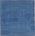
 1805 Survey - Twelve Mile Square Reserve.png 1,854 × 1,854; 1.16 MB
-
 1834-mouth of black river-lorain.jpg 1,024 × 717; 472 KB
-
 1868 Plat map of Helena, Montana.png 1,684 × 2,447; 1.18 MB
-
 1875 Survey T34 R5.JPG 3,862 × 4,177; 987 KB
-

-
 1951 Middletown Survey of Spring Lake in Berlin, New York (lower half).jpg 3,102 × 2,274; 3.72 MB
-
 1951 Middletown Survey of Spring Lake in Berlin, New York (upper half).jpg 2,940 × 2,319; 3.43 MB
-
 1951 Middletown survey of Spring Lake in Berlin, New York.jpg 2,172 × 2,844; 2.74 MB
-
-
-

-
-

-

-

-

-

-
-

-

-
-
-
-
 A Map of Washington's Farms at Mt. Vernon (1830 engraving).jpg 4,408 × 2,489; 10.93 MB
-
 A Plat of Broad Ripple Town.jpg 2,690 × 3,177; 647 KB
-
 Americus, Indiana 1878.png 1,600 × 1,700; 580 KB
-

-
 Ballard's Addition to Gilman Park, Seattle, March 11, 1890 (MOHAI 14540).jpg 807 × 1,000; 138 KB
-

-
 Bell's 5th Addition to the City of Seattle, March 30, 1882 (MOHAI 13331).jpg 1,200 × 480; 58 KB
-
 Belmont-plat-1904.jpg 5,792 × 5,680; 4.03 MB
-

-
 Cadastral map of part of Brightwood, Washington D.C.. LOC 87694385.jpg 5,474 × 6,558; 3.3 MB
-

-
 Denver, Col. - DPLA - 2cafca4c366cec9f47bb798d8666e914.jpg 9,000 × 6,549; 5.93 MB
-
 First Salt Lake City Plat Map, Great Salt Lake City Plot A, 1857.jpg 1,936 × 3,219; 786 KB
-
 Foster, Washington, plat map, circa 1905 (MOHAI 13447).jpg 1,200 × 690; 90 KB
-
 Hampstead Plat.pdf 1,231 × 1,733; 7.44 MB
-
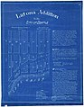 Latona Addition to the City of Seattle, October 28, 1889 (MOHAI 14548).jpg 779 × 1,000; 156 KB
-
 Map of Independence, Jackson County, Missouri.jpg 1,234 × 1,526; 1.43 MB
-
 Map of the town of Michigan 1847.jpg 11,430 × 6,540; 48.27 MB
-

-
 Map showing the plat of Blabon, Steele County, North Dakota.jpg 1,200 × 1,455; 295 KB
-
 Map showing the plat of Sherbrooke, Steele County, North Dakota.jpg 1,200 × 1,224; 305 KB
-
 March 1798 John Goddard N6 page 332 Huger Street.jpg 1,629 × 2,198; 1.02 MB
-
 Meridians-baselines.png 4,746 × 3,181; 4.23 MB
-
 N6 pagr 69 Sep 1797 - 112 Queen.jpg 2,532 × 3,079; 1.72 MB
-
 Ohio Lands.svg 323 × 364; 242 KB
-
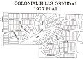 ORIGINAL 1927 PLAT.JPG 800 × 572; 293 KB
-
 Plan of Port Perry 1849.png 3,052 × 4,339; 129 KB
-
 Plat Map.jpg 3,600 × 4,244; 2.38 MB
-
 Plat of Barnum - DPLA - 8a432735b6fa9dcbfe14c8c55c75e2ce.jpg 8,695 × 9,000; 12.16 MB
-
 Plat of Larimer City - DPLA - ac8076ec69b8df2b439aa9f99653a3c6.jpg 6,924 × 5,419; 7.31 MB
-
 Plat of Lone Jack, Missouri.jpg 443 × 976; 319 KB
-
 Plat of the Second Addition, City of Seattle, December 1876 (MOHAI 14545).jpg 1,000 × 624; 142 KB
-
 Providencialandwaterdevelopment.jpg 800 × 675; 286 KB
-
 Purcell plat of Blake Tenements.png 1,746 × 581; 1.71 MB
-
 Q6 314 May 9 1797.jpg 1,450 × 1,789; 636 KB
-
 Q6 463 SW corner Charlotte and Alexander Oct. 13,1796 Joseph Purcell.jpg 2,498 × 2,308; 1.65 MB
-
 Racial deed restriction.gif 1,139 × 1,100; 318 KB
-

-
 S6 368 1797 Calhoun and Bull and Coming and Pitt.jpg 3,473 × 2,015; 1.65 MB
-

-
 The story of some French refugees and their "Azilum," 1793-1800 (1903) (14775732781).jpg 2,886 × 1,880; 584 KB
-
 Township No 24 North Range No 4 East, 1864 (MOHAI 14539).jpg 846 × 1,000; 101 KB
-

-
 Transitville, Indiana 1878.png 1,600 × 1,440; 434 KB
-
 USBLM meridian map 5th PM north.jpg 592 × 420; 101 KB
-
 USBLM meridian map 5th PM south.jpg 592 × 420; 101 KB
-
 USBLM meridian map 6th PM.jpg 592 × 420; 86 KB
-
 USBLM meridian map Alaska.jpg 461 × 344; 162 KB
-
 USBLM meridian map Arizona.jpg 592 × 420; 99 KB
-
 USBLM meridian map California and Nevada.jpg 419 × 583; 97 KB
-
 USBLM meridian map Florida.jpg 592 × 420; 98 KB
-
 USBLM meridian map Idaho.jpg 592 × 420; 87 KB
-
 USBLM meridian map Louisiana Mississippi Alabama.jpg 592 × 420; 95 KB
-
 USBLM meridian map Montana.jpg 592 × 420; 83 KB
-
 USBLM meridian map New Mexico.jpg 592 × 417; 78 KB
-
 USBLM meridian map Oklahoma.jpg 592 × 420; 84 KB
-
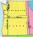
 USBLM meridian map Oregon-Washington.jpg 592 × 420; 65 KB
-
 USBLM meridian map point of beginning.jpg 592 × 420; 103 KB
-
 USBLM meridian map Utah.jpg 592 × 420; 95 KB
-
 USBLM meridian map Wisconsin Michigan.jpg 592 × 420; 85 KB
-
 Willamette meridians.png 261 × 291; 138 KB
-
 Y6 page 128 Aug 2 1799 East Bay Joseph Purcell.jpg 2,848 × 1,844; 1.46 MB
-
 Y6 page 266 Dec 1799 Joseph Purcell.jpg 2,821 × 1,694; 1.31 MB
_LOC_88693169.jpg)


.jpg)
.jpg)
.jpg)

.jpg)
.jpg)
.jpg)
.jpg)
.jpg)
.jpg)
.jpg)
.jpg)
.jpg)
.jpg)
.jpg)
.jpg)
.jpg)
.jpg)
.jpg)
.jpg)


.jpg)
.jpg)
.jpg)

.jpg)

.jpg)


.jpg)
.jpg)


.jpg)


.jpg)


.jpg)
_(14775732781).jpg)
.jpg)
.jpg)


.jpg)