Category:Colorado State Highway 69
Jump to navigation
Jump to search
 | number: | (sixty-nine) |
|---|---|---|
| State highways in Colorado: | 52 · 53 · 55 · 56 · 57 · 58 · 59 · 60 · 61 · 62 · 63 · 64 · 65 · 66 · 67 · 69 · 71 · 72 · 74 · 75 · 78 · 79 · 82 · 83 · 86 · 88 · 89 |
highway in Colorado   | |||||
| Upload media | |||||
| Instance of | |||||
|---|---|---|---|---|---|
| Location | Colorado | ||||
| Transport network | |||||
| Owned by | |||||
| Maintained by | |||||
| Length |
| ||||
| |||||
English: Media related to Colorado State Highway 69, a 82.664-mile (133.035 km) state highway in Huerfano, Custer, and Fremont counties in Colorado, United States, that connects U.S. Route 50 in Texas Creek with Interstate 25 Business Loop in Farista (north of Walsenburg).
Subcategories
This category has the following 2 subcategories, out of 2 total.
0
- Maitland Arroyo Bridge (2 F)
Media in category "Colorado State Highway 69"
The following 10 files are in this category, out of 10 total.
-
 Calumet, Colorado.JPG 5,931 × 2,916; 8.29 MB
-
 Colorado 69.svg 601 × 601; 7 KB
-
 Colorado State Highway 69 Map.svg 1,028 × 609; 857 KB
-
 Delcarbon, Colorado.JPG 5,822 × 3,620; 15.42 MB
-
 Distance road sign in Westcliffe, Colorado.JPG 4,291 × 3,092; 10 MB
-
 Fremont County, Colorado.JPG 4,334 × 3,355; 12.55 MB
-
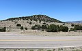
 Gardner Butte.JPG 8,564 × 3,386; 20.55 MB
-
 Gardner, Colorado.JPG 5,184 × 3,456; 10.11 MB
-
 Hillside, Colorado.JPG 5,077 × 3,504; 12.03 MB
-
 Promontory Divide.JPG 4,991 × 3,516; 8.74 MB


