Category:English-language maps of New York (state)
Jump to navigation
Jump to search
States of the United States: Alabama · Alaska · Arkansas · California · Florida · Maryland · Massachusetts · New Jersey · New Mexico · New York · North Carolina · Ohio · Oklahoma · Pennsylvania · Texas · Utah – Washington, D.C.
Subcategories
This category has the following 4 subcategories, out of 4 total.
Media in category "English-language maps of New York (state)"
The following 40 files are in this category, out of 40 total.
-
 1807 Bridges Map of New York City (1871 reissue) - Geographicus - NewYork-bridges-1871.jpg 3,000 × 2,934; 2.72 MB
-

-

-
 1879 Lower Manhattan map.jpg 1,954 × 2,913; 1.45 MB
-

-
 Colton's new township railroad map of New York with parts of adjoining states & Canada. LOC 98688526.jpg 12,477 × 10,815; 27.52 MB
-
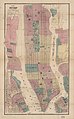
 Colton's New York City - Brooklyn, Jersey City, Hoboken, etc. LOC 00557441.jpg 5,186 × 7,519; 6.98 MB
-
 Cram's township and rail road map of New York. LOC 98688528.jpg 7,056 × 5,312; 9.8 MB
-
-
 Forest Types of Ulster County, New York.pdf 2,400 × 3,000; 609 KB
-
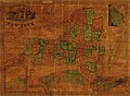
 Garden-city-map.gif 575 × 425; 85 KB
-

-
 Hammond's new guide map of Manhattan and the Bronx. LOC 79695063.jpg 10,597 × 11,271; 24.18 MB
-
 Hydrologic unit map-1974, state of New York LOC 98680448.jpg 17,050 × 13,450; 25.36 MB
-
 Important farmland of New York LOC 81693111.jpg 11,927 × 8,959; 13.25 MB
-
 Lower manhattan map.png 1,317 × 1,276; 1.08 MB
-
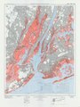
 Map of New York and vicinity. LOC 2015591056.jpg 7,068 × 11,369; 11.67 MB
-
 Map of New York City, 1707.jpg 2,003 × 1,517; 868 KB
-
 Map of the city of New York. LOC 2011593667.jpg 3,262 × 4,709; 2.93 MB
-
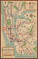 Map of the New York city subway system LOC 82690521.jpg 3,562 × 5,479; 2.89 MB
-
 Map of the state of New York LOC 00554823.jpg 6,617 × 5,195; 5.43 MB
-
 Map of the state of New York LOC 2008620307.jpg 4,937 × 3,945; 2.92 MB
-

-
 Mappa metropolitana New York stazioni fantasma.png 1,419 × 1,728; 3.58 MB
-
 New York City District Map 2.svg 2,652 × 2,582; 116 KB
-
 New York in 1674.jpg 900 × 721; 307 KB
-
 New York LOC 83692134.jpg 16,400 × 12,556; 20.17 MB
-
 New York Manhattan printable tourist attractions map.jpg 1,488 × 2,105; 1.55 MB
-
 New York state geographic map-en.svg 2,811 × 2,000; 18.34 MB
-
 New York-1980. LOC 00557178.jpg 9,581 × 7,369; 9.88 MB
-
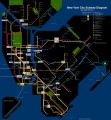 NYC subway late night map June2010.svg 2,500 × 2,700; 2.97 MB
-

-
 Prime farmland of New York LOC 81693112.jpg 11,926 × 8,881; 13.37 MB
-
 State of New York, base map with highways and contours. LOC 76697546.jpg 16,399 × 12,787; 27.54 MB
-
 State of New York, base map. LOC 76697547.jpg 16,456 × 12,881; 20.76 MB
-
 State of New York, base map. LOC 76697561.jpg 8,323 × 6,457; 6.2 MB
-
 Status of New York soil surveys - October 1, 1980 LOC 81690084.jpg 3,278 × 2,515; 983 KB
-

-
-
 Transportation map of New York. LOC 77694844.jpg 6,555 × 5,042; 3.96 MB
_-_Geographicus_-_NewYork-bridges-1871.jpg)


._6000_feet_-_btv1b531212883.jpg)


.jpg)