Category:Geography of Belfast
Jump to navigation
Jump to search
Wikimedia category | |||||
| Upload media | |||||
| Instance of | |||||
|---|---|---|---|---|---|
| Category combines topics | |||||
| geography | |||||
science that studies the terrestrial surface, the societies that inhabit it and the territories, landscapes, places or regions that form it when interacting with each other     | |||||
| Pronunciation audio | |||||
| Instance of |
| ||||
| Different from | |||||
| Partially coincident with | |||||
| |||||
Subcategories
This category has the following 22 subcategories, out of 22 total.
A
B
C
- Cave Hill, Belfast (60 F)
- Clarawood (10 F)
D
- Divis Mountain (64 F)
F
K
- Knocknagoney (5 F)
L
M
R
S
T
U
- Upper Malone, Belfast (4 F)
W
- Windsor, Belfast (59 F)
- Woodvale, Belfast (3 F)
Media in category "Geography of Belfast"
The following 18 files are in this category, out of 18 total.
-
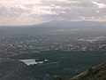 A view from The Cave Hill. - geograph.org.uk - 70606.jpg 640 × 480; 89 KB
-
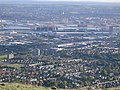 A View over Belfast. - geograph.org.uk - 70591.jpg 640 × 480; 146 KB
-
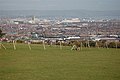 A view over East Belfast - geograph.org.uk - 722335.jpg 640 × 426; 52 KB
-
 Ballysillanview.png 600 × 267; 243 KB
-
 Belfast (2).jpg 1,600 × 1,200; 602 KB
-
 Belfast (3).jpg 1,600 × 1,200; 623 KB
-
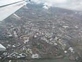
 Belfast Aerial (cropped).jpg 1,885 × 1,376; 1.19 MB
-
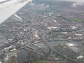
 Belfast Aerial.jpg 1,944 × 2,592; 1.68 MB
-

-
 Belfast from Black Mountain - geograph.org.uk - 1254125.jpg 640 × 490; 315 KB
-
 Cavehill, Belfast.jpg 1,024 × 768; 484 KB
-
 Cliff small.JPG 269 × 359; 24 KB
-
 Conn's Water, Belfast - geograph.org.uk - 855128.jpg 640 × 480; 267 KB
-
 Donegall Place, Belfast (13733091263).jpg 2,071 × 1,395; 950 KB
-
 New Lodge clouds.jpg 3,008 × 2,000; 436 KB
-
 New Lodge rainbow.jpg 3,008 × 2,000; 698 KB
-
 River Connswater, Belfast - geograph.org.uk - 43934.jpg 480 × 640; 340 KB
-
 Sailortown, Belfast (1) - geograph.org.uk - 736218.jpg 640 × 419; 63 KB


.jpg)
.jpg)
.jpg)


.jpg)


_-_geograph.org.uk_-_736218.jpg)