Category:Maps by User:Pi.1415926535
Jump to navigation
Jump to search
Media in category "Maps by User:Pi.1415926535"
The following 76 files are in this category, out of 76 total.
-
 25 Busiest Amtrak stations.png 2,000 × 1,237; 255 KB
-
 Abraham Lincoln (train) map.svg 800 × 1,225; 156 KB
-
 Amtrak network map 2016.png 4,800 × 3,200; 1.63 MB
-
 Amtrak network map 2016.svg 1,152 × 768; 1.45 MB
-
 Amtrak System Map.svg 1,042 × 652; 5.55 MB
-
 Amtrak top 25.svg 959 × 593; 275 KB
-
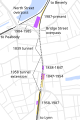
 Amtrak Vermonter.svg 1,200 × 1,285; 1.46 MB
-
 Ashmont Mattapan High Speed Line map.svg 961 × 724; 4.78 MB
-
 Atlantic Branch Map.PNG 808 × 569; 78 KB
-
 Atlantic Branch Map.svg 808 × 569; 181 KB
-
 Ayer railroads.svg 880 × 524; 13 KB
-
 Balboa Park station complex map, 2018.svg 2,100 × 3,200; 123 KB
-
 Baltimore Green Line.svg 1,440 × 1,080; 133 KB
-
 Baltimore Rail Plan.svg 3,600 × 3,200; 160 KB
-
 Baltimore rapid transit.svg 1,500 × 2,700; 80 KB
-
 Beacon Hill.svg 1,800 × 1,350; 86 KB
-
 CapeFLYER 2013 map.svg 1,080 × 1,080; 420 KB
-
 CapeFLYER 2014 map.svg 1,080 × 1,080; 431 KB
-
 CapeFLYER 2015 map.svg 1,080 × 1,080; 433 KB
-
 CapeFLYER 2019 map.svg 1,080 × 1,080; 437 KB
-
 Central Corridor Rail Line.svg 1,900 × 1,800; 141 KB
-
 Central New England Railway lines in the Upper Hudson Valley.svg 1,225 × 1,950; 124 KB
-
 Clamdigger 1971.svg 800 × 600; 61 KB
-
 Clamdigger 1978.svg 1,500 × 1,000; 76 KB
-
 CorridorVia.svg 1,250 × 750; 161 KB
-
 Crosstown bus map.svg 990 × 765; 940 KB
-
 Fairmount Line map.svg 600 × 1,000; 33 KB
-
 Fitchburg Cutoff modern status map.svg 1,850 × 1,150; 39 KB
-
 Fitchburg Cutoff rail map.svg 1,850 × 1,150; 45 KB
-
 Framingham stations map.svg 1,550 × 1,550; 24 KB
-
 GLX Phase 1.svg 1,080 × 700; 2.35 MB
-
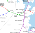
 Greater Bristol Metro proposed network map March 2012.svg 7,500 × 4,600; 47 KB
-
 Green Line A Branch map.svg 3,200 × 750; 147 KB
-
 Green Line Extension.svg 1,000 × 750; 4.76 MB
-
 Harvard stations simplified map.svg 921 × 1,063; 47 KB
-
 HBLR diagram.svg 646 × 1,123; 608 KB
-
 Hynes Convention Center station layout 2020.svg 840 × 420; 60 KB
-
 Ipswich Street line on 1921 map.svg 1,920 × 1,200; 3.18 MB
-
 K-104 (KS) map.svg 500 × 500; 61 KB
-
 LA Metro Measure R map.svg 1,500 × 1,000; 455 KB
-
 LARy numbered routes.svg 1,500 × 2,500; 215 KB
-
 Lechmere 1936 track layout.svg 700 × 385; 559 KB
-
 Lincoln MBTA station plan.svg 731 × 1,052; 46 KB
-
 Lincoln Service map.svg 810 × 1,220; 125 KB
-
 Littleton stations.svg 1,380 × 1,350; 18 KB
-
 Lynn stations map.svg 957 × 537; 46 KB
-
 MBTA bus districts.svg 765 × 990; 9.18 MB
-
 MBTA Bus geographic map.svg 765 × 990; 7.71 MB
-
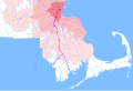
 MBTA Commuter Rail and funding district map.svg 904 × 553; 2.37 MB
-
 MBTA Green Line construction date map.pdf 1,800 × 900; 258 KB
-
 MBTA Green Line Extension map.pdf 1,200 × 900; 120 KB
-
 MBTA Green Line physical characteristics map.pdf 1,800 × 900; 373 KB
-
 MBTA Silver Line geographic map.svg 900 × 720; 633 KB
-
 MBTA Silver Line map.svg 1,500 × 1,500; 491 KB
-
 MBTA system line map II.svg 7,013 × 9,794; 248 KB
-
 MBTA system line map.svg 7,013 × 9,794; 248 KB
-
 MBTA Urban Ring map.svg 800 × 800; 304 KB
-
 Middleborough and Taunton railroads.svg 960 × 640; 10 KB
-
 Middleborough stations.svg 960 × 640; 18 KB
-
 Milpitas station layout.svg 800 × 880; 35 KB
-
 NJT railmap infobox.svg 2,720 × 4,960; 768 KB
-
 Pleasant Street Portal map.svg 1,000 × 1,800; 136 KB
-
 Radial-system.png 500 × 500; 18 KB
-
 Readville.svg 1,080 × 1,600; 24 KB
-
 Riverside.svg 1,800 × 1,960; 36 KB
-
 Salem downtown stations map.svg 1,200 × 1,800; 51 KB
-
 Salem stations and lines map.svg 800 × 750; 44 KB
-
 SEPTA Airport Line map.svg 750 × 920; 123 KB
-
 Silver Line Chelsea alternatives map.svg 583 × 763; 5.68 MB
-
 Silver Line Chelsea proposal map.svg 583 × 763; 5.68 MB
-
 Silver Line Phase III alternatives.svg 800 × 480; 948 KB
-
 South Coast Rail map.svg 4,700 × 3,200; 1.04 MB
-
 South Framingham railroads map.svg 750 × 450; 14 KB
-
 Sunrail map.svg 700 × 2,750; 239 KB
-
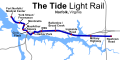 Tide light rail map.svg 800 × 400; 177 KB
-
 Woomera Test Range map.svg 1,535 × 1,783; 318 KB

_map.svg)


_map.svg)


