Category:Maps of 9th-century Iberian Peninsula
Jump to navigation
Jump to search
| Preceded by: Maps of 8th-century Iberian Peninsula |
Maps of 9th-century Iberian Peninsula 801 AD-900 AD |
Succeeded by: Maps of 10th-century Iberian Peninsula |
Media in category "Maps of 9th-century Iberian Peninsula"
The following 13 files are in this category, out of 13 total.
-
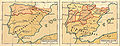 Pyreneiska halvön historisk.jpg 2,031 × 786; 670 KB
-
 Crisis del Emirato de Córdoba-hu.svg 694 × 539; 671 KB
-
 Crisis del Emirato de Córdoba-pt.svg 694 × 539; 524 KB
-
 Crisis del Emirato de Córdoba.svg 694 × 539; 1,001 KB
-
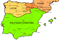
 Galicia891.png 624 × 335; 191 KB
-
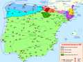
 Iberian Peninsula fr 1000 es.svg 827 × 574; 229 KB
-
 Kartenn Ledenez Iberia 1000-br.svg 827 × 574; 255 KB
-
 Mapa de la Península Ibérica nel añu 1000.svg 827 × 574; 236 KB
-
 Peninsula ibèrica 1000 ca.svg 827 × 574; 238 KB
-
 Péninsule ibérique en 814.png 2,000 × 1,500; 867 KB
-
 Péninsule ibérique en 850.png 2,000 × 1,500; 826 KB
-
 Péninsule ibérique en 875.png 2,000 × 1,500; 859 KB
-
 Péninsule ibérique en 900.png 2,000 × 1,500; 858 KB


