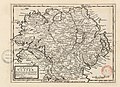
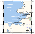
Category:Maps of County Donegal
Jump to navigation
Jump to search
Wikimedia category | |||||
| Upload media | |||||
| Instance of | |||||
|---|---|---|---|---|---|
| Category combines topics | |||||
| County Donegal | |||||
county in Ireland     | |||||
| Instance of | |||||
| Part of |
| ||||
| Location |
| ||||
| Capital | |||||
| Legislative body |
| ||||
| Executive body |
| ||||
| Population |
| ||||
| Area |
| ||||
| Elevation above sea level |
| ||||
| official website | |||||
 | |||||
Media in category "Maps of County Donegal"
The following 48 files are in this category, out of 48 total.
-
-

-

-
 268 of 'Ireland- its Scenery, Character, etc' (11018609305).jpg 2,736 × 1,878; 1.01 MB
-
 Admiralty Chart No 1245 Horn Head to Rathlin O'Birne, Published 1860.jpg 8,099 × 11,065; 25.78 MB
-
 Admiralty Chart No 2499 Lough Foyle, Published 1885.jpg 16,304 × 10,902; 68.63 MB
-
 Admiralty Chart No 2699 Sheep Haven, Published 1963.jpg 8,440 × 12,257; 31.91 MB
-
 Admiralty Chart No 2702 Donegal Bay, Published 1959.jpg 16,310 × 11,270; 26.79 MB
-
 Admiralty Chart No 2811 Lough Foyle to Lough Swilly, Published 1966.jpg 16,451 × 11,304; 53.19 MB
-
 Ancient Stone Monuments Donegal Map Somerville 1909 journalofroyalso39roya 0275.jpg 2,452 × 3,030; 532 KB
-
 Baronies of Donegal.jpg 3,142 × 2,227; 1.77 MB
-
 Black's guide to Ireland (1912) (14783676143).jpg 2,032 × 3,208; 1.43 MB
-
 CDRmap.png 4,167 × 2,375; 681 KB
-
 Donegal - British Isles.svg 1,250 × 1,835; 1,002 KB
-
 Donegal Ireland (BI Sect 7).svg 583 × 711; 1,004 KB
-
 Donegal North East (Dáil Éireann constituency).png 2,294 × 2,910; 69 KB
-
 Donegal South West (Dáil Éireann constituency).png 2,294 × 2,910; 69 KB
-
 Donegal Ulster.png 200 × 249; 28 KB
-
 Donegal-Bay.PNG 415 × 541; 12 KB
-
 Donegalbaycloseup.png 544 × 538; 14 KB
-
 DonegalEire.PNG 500 × 586; 17 KB
-
 Donegalmap.jpg 1,172 × 1,031; 792 KB
-
 Dunleweyloughmap.PNG 908 × 1,159; 117 KB
-
 Duquesta Santa Anna Drive - geograph.org.uk - 1161317.jpg 640 × 426; 238 KB
-
 Eske.PNG 499 × 608; 11 KB
-
 Fahan Inishowen Map.png 284 × 290; 12 KB
-
 Inishowen blank map.svg 784 × 745; 255 KB
-
 Inishowen peninsula.PNG 1,435 × 1,430; 252 KB
-
 Inishowen.png 908 × 1,159; 118 KB
-
 Inishowensatmap.jpg 945 × 1,044; 642 KB
-
 Ireland map County Donegal Magnified.png 188 × 244; 10 KB
-
 Ireland map County Donegal.png 188 × 128; 6 KB
-
 IrelandDonegal.png 200 × 249; 29 KB
-
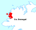
 Location map Ireland County Donegal.png 870 × 758; 499 KB
-
 Lough Eske.PNG 908 × 1,159; 104 KB
-
 Malin Head & Inishowen satmap.jpg 945 × 1,044; 433 KB
-
 Ordnance Survey Ireland Half-Inch Sheet 1 Londonderry, Published 1952.jpg 12,170 × 8,629; 9.76 MB
-
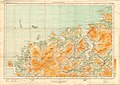
 Ordnance Survey Ireland Half-Inch Sheet 1 The North West, Published 1970.jpg 16,044 × 12,161; 59.99 MB
-
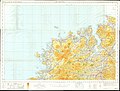
 Ordnance Survey Ireland Half-Inch Sheet 3 Donegal, Published 1951.jpg 12,113 × 8,651; 9.67 MB
-

-

-

-
 Rosses Donegal Map.svg 1,013 × 894; 1.7 MB
-
 Rosses Ireland Map.svg 1,458 × 1,815; 1.7 MB
-
-
 The Quarterly journal of the Geological Society of London (12895385934).jpg 1,465 × 1,294; 746 KB
-
 The Rosses map.svg 323 × 240; 1.22 MB
-
 Therossesmap.PNG 310 × 265; 15 KB


.jpg)
.jpg)


_(14783676143).jpg)


.svg)
.png)
.png)


_Company%27s_illustrated_guide_to_the_sporting_and_touring_grounds_of_the_north_of_Ireland_(1908)_(14777151501).jpg)
_Company%27s_illustrated_guide_to_the_sporting_and_touring_grounds_of_the_north_of_Ireland_(1908)_(14799890423).jpg)
.jpg)


_Castle_circa_1649.JPG)
.jpg)

