Category:Maps of Hooghly district
Jump to navigation
Jump to search
Districts of West Bengal: Alipurduar · Bankura · Birbhum · Cooch Behar · Dakshin Dinajpur · Darjeeling · Hooghly · Howrah · Jalpaiguri · Jhargram · Kalimpong · Kolkata · Malda · Murshidabad · Nadia · North 24 Parganas · Paschim Bardhaman · Paschim Medinipur · Purba Bardhaman · Purba Medinipur · Purulia · South 24 Parganas · Uttar Dinajpur
Subcategories
This category has the following 3 subcategories, out of 3 total.
M
- Maps of Chanditala I (21 F)
Media in category "Maps of Hooghly district"
The following 44 files are in this category, out of 44 total.
-

-

-
 ARAMBAG CD BLOCK MAP.svg 800 × 1,000; 137 KB
-
 Balagarh CD block map.svg 750 × 1,000; 91 KB
-
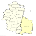
 CHANDITALA-I CD BLOCK MAP 1.svg 1,000 × 1,200; 112 KB
-
 CHANDITALA-II BLOCK MAP.png 1,000 × 1,200; 100 KB
-
 CHANDITALA-II CD BLOCK MAP.svg 1,000 × 1,000; 76 KB
-
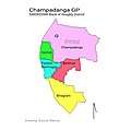 Chapadanga GP Map.jpg 800 × 800; 117 KB
-
 Chinsurah-Mogra CD Block.svg 1,200 × 1,300; 90 KB
-
 Dhaniakhali CD block map.svg 1,055 × 1,055; 119 KB
-
 GANGADHARPUR CHANDITALA-I HOOGHLY.svg 793 × 1,123; 24 KB
-
 Goghat-I CD block map.svg 700 × 1,000; 62 KB
-
 Goghat-II CD block map.svg 1,000 × 1,000; 85 KB
-
 HARIPAL CD BLOCK MAP.svg 1,000 × 700; 126 KB
-
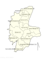
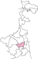
 Hooghly District .svg 1,500 × 900; 347 KB
-
 Hooghly district.png 287 × 441; 38 KB
-
 Hooghly in West Bengal (India).svg 1,039 × 1,585; 850 KB
-
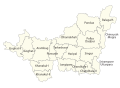
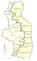
 Hooghly Subdivision Map (bn).svg 512 × 373; 182 KB
-
 Hooghly Subdivision Map (en).svg 512 × 373; 141 KB
-
 Hooghly Tehsil Map (bn).svg 512 × 373; 160 KB
-
 Hooghly Tehsil Map (en).svg 512 × 373; 127 KB
-
 JANGIPARA CD BLOCK MAP.svg 1,000 × 800; 83 KB
-
 Khanakul-I CD Block.svg 1,000 × 700; 80 KB
-
 Khanakul-II CD block map.svg 1,000 × 900; 71 KB
-
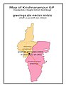 KRISHNARAMPUR GP.jpg 700 × 900; 140 KB
-
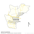 KULBATPUR MAP.svg 1,200 × 1,200; 66 KB
-
 Map of Antpur GP.jpg 2,806 × 1,984; 972 KB
-
 Map of arambag municipality .jpg 800 × 800; 142 KB
-
 Map Of Chandernagore Municipal Corporation.jpg 1,800 × 1,425; 469 KB
-
 Map of dankuni municipality.jpg 800 × 1,100; 254 KB
-
 Map of hooghly chinsurah municipality.jpg 1,332 × 2,130; 704 KB
-
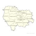
 Map of hooghly district .jpg 1,500 × 900; 429 KB
-
 Map of Pursurah CD block.svg 700 × 1,100; 55 KB
-
 Map of serampore subdivision.jpg 2,200 × 1,000; 766 KB
-
 Map of tarakeswar municipality.jpg 1,800 × 1,800; 563 KB
-
 Map of uttarpara kotrung municipality.jpg 1,413 × 1,370; 218 KB
-
 Pandua CD Block map.svg 1,000 × 1,000; 117 KB
-
 Polba-Dadpur CD block .svg 1,000 × 800; 92 KB
-
 Serampore Municipality.jpg 960 × 960; 141 KB
-
 SINGUR CD BLOCK MAP.svg 1,200 × 1,200; 147 KB
-
 Sreerampur Uttarpara CD Block Map.svg 800 × 1,300; 75 KB
-
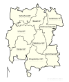
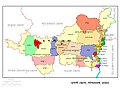
 Subdivision of Hooghly District.jpg 1,800 × 1,200; 511 KB
-
 Tarokeswr CD Block Map.svg 1,100 × 1,100; 83 KB
-
 হুগলী জেলা মানচিত্র.jpg 1,900 × 1,400; 677 KB
.jpg)
.jpg)


.svg)
.svg)
.svg)
.svg)
.svg)


