Category:Maps of cantonal tripoints of Switzerland
Jump to navigation
Jump to search
Media in category "Maps of cantonal tripoints of Switzerland"
The following 27 files are in this category, out of 27 total.
-
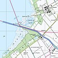
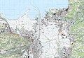 1076 St. Margrethen.jpg 14,000 × 9,600; 79.22 MB
-
 1093 Hörnli.jpg 14,000 × 9,600; 140.43 MB
-
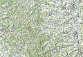
 1108 Murgenthal.jpg 14,000 × 9,600; 97.1 MB
-
 1112 Stäfa.jpg 14,000 × 9,600; 96.46 MB
-
 1115 Säntis.jpg 14,000 × 9,600; 117.64 MB
-
 1132 Einsiedeln.jpg 14,000 × 9,600; 115.65 MB
-
 1151 Rigi.jpg 14,000 × 9,600; 107.25 MB
-
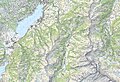
 1164 Neuchâtel.jpg 14,000 × 9,600; 70.87 MB
-
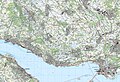
 1165 Murten.jpg 14,000 × 9,600; 74.94 MB
-
 1171 Beckenried.jpg 14,000 × 9,600; 108.87 MB
-
 1173 Linthal.jpg 14,000 × 9,600; 131.56 MB
-
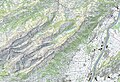
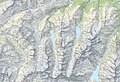
 1174 Elm.jpg 14,000 × 9,600; 134.49 MB
-
 1183 Grandson.jpg 14,000 × 9,600; 82.55 MB
-
 1189 Sörenberg.jpg 14,000 × 9,600; 124.34 MB
-
 1190 Melchtal.jpg 14,000 × 9,600; 127.12 MB
-
 1191 Engelberg.jpg 14,000 × 9,600; 132.92 MB
-
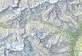
 1193 Tödi.jpg 14,000 × 9,600; 131.02 MB
-
 1211 Meiental.jpg 14,000 × 9,600; 142.47 MB
-
 1231 Urseren.jpg 14,000 × 9,600; 136.39 MB
-
 1232 Oberalppass.jpg 14,000 × 9,600; 135.96 MB
-
 1245 Château-d'Œx.jpg 14,000 × 9,600; 124.57 MB
-
 1251 Val Bedretto.jpg 14,000 × 9,600; 134.9 MB
-
 1285 Les Diablerets.jpg 14,000 × 9,600; 128.79 MB
-
-

-

-


,_Neuenburg_(NW),_Waadt_(SW)_und_Fribourg_(SE)_-_(von_Swisstopo_Landeskarte_1165,_Raster_25).jpg)
_und_Seehof_(SW)_im_Kanton_Bern_mit_Jura_(WSW),_Solothurn_(SE)_-_(von_Swisstopo_Landeskarte_1107,_Raster_25).jpg)
,_Jura_(S),_Solothurn_(NE)_-_(von_Swisstopo_Landeskarte_1086,_Raster_25).jpg)
.png)