Category:Maps of the Burgenlandkreis
Jump to navigation
Jump to search
Subcategories
This category has the following 2 subcategories, out of 2 total.
M
Media in category "Maps of the Burgenlandkreis"
The following 13 files are in this category, out of 13 total.
-
 Schlacht bei auerstädt (14.10.1806).jpg 744 × 454; 146 KB
-
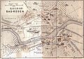 Bad Kösen Stadtplan 1914.jpg 2,436 × 1,716; 4.45 MB
-
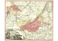
 Bad Kösen Umgebung 1914.JPG 3,500 × 2,288; 8.65 MB
-
 Burgenlandkreis in S-A.svg 500 × 657; 31 KB
-
 Chorographia Territorii Naumburgo-Citiensis.pdf 2,479 × 1,752; 16.23 MB
-
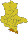
 Lage des Burgenlandkreises (2007) in Deutschland.png 197 × 235; 3 KB
-
 Lage des Burgenlandkreises in Deutschland.png 176 × 234; 5 KB
-
 Locator map BLK in Germany.svg 1,075 × 1,273; 570 KB
-
 Locator map BLK in Saxony-Anhalt.svg 1,957 × 2,306; 786 KB
-
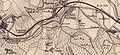 Saaleck Kösen Pforta 1914.JPG 1,754 × 803; 760 KB
-
 Saxony anhalt blk 2007.png 364 × 467; 5 KB
-
 Saxony anhalt blk.png 197 × 245; 11 KB
-
 Saxony anhalt wsf.png 197 × 245; 9 KB
.jpg)


_in_Deutschland.png)


