Category:New York State Route 80
Jump to navigation
Jump to search
 | number: | (eighty-) |
|---|---|---|
| State highways in New York (state): | 60 · 61 · 63 · 64 · 65 · 66 · 67 · 68 · 69 · 70 · 71 · 72 · 73 · 74 · 75 · 76 · 77 · 78 · 79 · 80 · 81 · 82 · 83 · 85 · 86 · 88 · 89 · 90 · 91 · 92 · 93 · 94 · 95 · 96 · 97 · 98 · 99 · 100 |
127.32-mile-long (204.90 km) west–east New York State Route located within Onondaga, Madison, Chenango, Otsego, Herkimer, and Montgomery counties in New Yor  | |||||
| Upload media | |||||
| Instance of | |||||
|---|---|---|---|---|---|
| Location | New York | ||||
| Transport network | |||||
| Owned by | |||||
| Maintained by | |||||
| Length |
| ||||
| |||||
English: Media related to New York State Route 80.
Media in category "New York State Route 80"
The following 21 files are in this category, out of 21 total.
-
 2019 temporary NY 80 Truck Detour.jpg 1,932 × 2,576; 975 KB
-
 Burlington, NY, USA - panoramio.jpg 2,648 × 2,647; 1.18 MB
-
 Eastendny28and80concur.jpg 1,932 × 1,627; 1.74 MB
-
 Junction 81-11-80-281 in Cortland County.jpg 1,024 × 768; 170 KB
-
 New York State Route 205 - 11918966624.jpg 3,072 × 2,304; 1.21 MB
-
 New York State Route 205 - 4323202201.jpg 1,600 × 1,200; 372 KB
-
 New York State Route 205 northern terminus.jpg 1,024 × 768; 198 KB
-
 New York State Route 28 80 (28484723332).jpg 4,608 × 3,456; 7.45 MB
-
 New York State Route 80 at Route 173 with old signage.jpg 1,024 × 768; 315 KB
-
 New York State Route 80 Map.svg 1,027 × 609; 1.59 MB
-
 NY 28-NY 80 old shields in Cooperstown.jpg 1,140 × 1,002; 369 KB
-
 NY 80 at NY 163.jpg 640 × 480; 45 KB
-
 NY 80 at NY 168 West.jpg 640 × 480; 42 KB
-
 NY 80 West at NY 205.jpg 640 × 480; 30 KB
-
 NY 80 West NY 91 South.jpg 640 × 480; 63 KB
-
 NY-80 (1960).svg 600 × 600; 7 KB
-
 NY-80.svg 600 × 600; 7 KB
-
 NY163atNY80.jpg 1,932 × 2,576; 1.76 MB
-
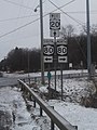 NY80atUS20Springfield.jpg 1,872 × 2,500; 2.13 MB
-
 Route 11A north at NY 80 east.jpg 640 × 480; 51 KB
-
 Victorious Life Church, Fort Plain, New York.jpg 4,208 × 4,688; 3.85 MB


.jpg)


.svg)


