Category:Sawtooth Wilderness
Jump to navigation
Jump to search
wilderness area in Idaho, United States  | |||||
| Upload media | |||||
| Instance of | |||||
|---|---|---|---|---|---|
| Location |
| ||||
| IUCN protected areas category | |||||
| Inception |
| ||||
 | |||||
English: Media related to the Sawtooth Wilderness, a wilderness area in Idaho, United States.
Subcategories
This category has the following 5 subcategories, out of 5 total.
H
- Hell Roaring Lake (6 F)
L
- Little Redfish Lake (15 F)
R
- Redfish Lake (1 P, 39 F)
S
- Sawtooth Lake (4 F)
Pages in category "Sawtooth Wilderness"
This category contains only the following page.
Media in category "Sawtooth Wilderness"
The following 86 files are in this category, out of 86 total.
-
 A-10A Idaho ANG over Sawtooth Range 2009.jpg 3,000 × 2,008; 1.2 MB
-
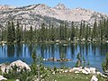
 Alice Lake.jpg 3,648 × 2,736; 4.61 MB
-
 Alpine Lake and Alpine Peak.jpg 2,816 × 2,112; 3.51 MB
-
 Alpine Lake in Iron Creek watershed.JPG 2,816 × 2,112; 4.61 MB
-
 Alpine Way Trial south of Marshall Lake.JPG 2,816 × 2,112; 3.29 MB
-
 Ascaphus montanus tadpole.JPG 1,476 × 974; 996 KB
-
 Asters SNRA.JPG 2,048 × 1,536; 2.95 MB
-
 Decker Peak.jpg 1,646 × 1,513; 1.25 MB
-
 Dusky grouse Sawtooth National Forest.JPG 1,600 × 1,200; 878 KB
-
 Falls Creek Valley.JPG 1,600 × 1,200; 374 KB
-
 Farley Lake Sawtooth NRA.jpg 1,187 × 800; 693 KB
-
 First Bench Lake 1.JPG 1,600 × 1,200; 380 KB
-
 First Bench Lake 2.JPG 1,600 × 1,200; 384 KB
-
 Goat Lake.jpg 3,648 × 2,736; 4.87 MB
-
 God Rays Galena Summit Idaho.jpg 1,500 × 1,004; 1.28 MB
-
 Grand Mogul 3.JPG 2,816 × 2,112; 1.93 MB
-
 Grand Mogul through the clouds.JPG 1,600 × 1,200; 330 KB
-
 Grand Mogul.JPG 2,816 × 2,112; 1.71 MB
-
 Grand Mogul2.JPG 3,296 × 2,472; 1.83 MB
-
 Hell Roaring Creek Sawtooth NRA.JPG 2,816 × 2,112; 5.39 MB
-
 Horstmann Peak.jpg 2,816 × 2,112; 3.24 MB
-
 Idaho Sawtooths.jpg 1,600 × 1,200; 684 KB
-
 Iron Creek Sawtooth NRA.JPG 3,648 × 2,736; 5.54 MB
-
 Marshall Lake.jpg 2,816 × 2,112; 3.04 MB
-
 McDonald Lake.jpg 2,816 × 2,112; 3.06 MB
-
 Mushroom SNRA.JPG 1,600 × 1,200; 411 KB
-
 Parks Peak.JPG 2,816 × 2,112; 2.14 MB
-
 Pettit Lake.jpg 3,648 × 2,736; 3.45 MB
-
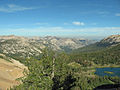
 Rendezvous Lake and South Fork Payette River.jpg 2,816 × 2,112; 3.93 MB
-
 S Fork Payette River.JPG 1,200 × 1,600; 308 KB
-
 Sawtooth From Alpine Way Trail.JPG 2,816 × 2,112; 3.56 MB
-
 Sawtooth from South 2.JPG 2,816 × 2,112; 1.71 MB
-
 Sawtooth from Stanley Lake Creek.JPG 2,816 × 2,112; 3.54 MB
-
 Sawtooth mtns.JPG 2,816 × 2,112; 3.3 MB
-
 Sawtooth National Forest Map with roads.jpg 1,241 × 1,521; 249 KB
-
 Sawtooth National Forest Map.jpg 1,079 × 1,307; 166 KB
-
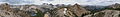 Sawtooth Panorama 1.JPG 11,889 × 1,683; 15.45 MB
-
 Sawtooth Panorama 2.jpg 9,973 × 1,974; 12.72 MB
-
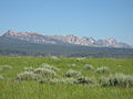
 Sawtooth Range ID1.jpg 3,872 × 1,976; 4.63 MB
-
 Sawtooth Valley ID1.jpg 3,778 × 2,241; 7.44 MB
-
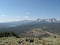 Sawtooth Valley.JPG 2,816 × 2,112; 1.37 MB
-
 Sawtooth Wilderness Baron Lakes 2008.JPG 3,072 × 2,304; 2.43 MB
-
 Sawtooth Wilderness Mushrooms.JPG 1,600 × 1,200; 417 KB
-
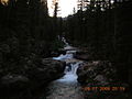
 Sawtooth Wilderness Stream 1.JPG 1,600 × 1,200; 404 KB
-
 Sawtooth Wilderness stream 1.JPG 1,600 × 1,200; 432 KB
-
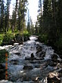
 Sawtooth Wilderness Stream 2.JPG 1,600 × 1,200; 394 KB
-
 Sawtooth Wilderness stream 2.JPG 1,200 × 1,600; 387 KB
-
 Sawtooth Wilderness Stream 3.JPG 1,600 × 1,200; 394 KB
-
 Sawtooth Wilderness stream 3.JPG 1,200 × 1,600; 376 KB
-
 Sawtooth Wilderness Stream 4.JPG 1,600 × 1,200; 421 KB
-
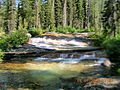 Sawtooth Wilderness Stream 6.JPG 1,600 × 1,200; 415 KB
-
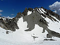
 Sawtooth Wilderness Summit Lake NorthRaker.JPG 3,072 × 2,304; 2.71 MB
-
 Sawtooth Wilderness.JPG 2,816 × 2,112; 3.07 MB
-
 Sawtooths and S Fork of Payette.JPG 2,816 × 2,112; 3.75 MB
-
 Sawtooths and Toxaway Lake.JPG 2,816 × 2,112; 3.53 MB
-
 Sawtooths from South 3.JPG 2,816 × 2,112; 1.21 MB
-
 Sawtooths from South 4.JPG 2,816 × 2,112; 1.27 MB
-
 Sawtooths from South.JPG 2,816 × 2,112; 1.8 MB
-
 Sawtooths from Stanley.jpg 1,024 × 768; 309 KB
-
 Sawtooths North 1.jpg 4,411 × 1,920; 6.11 MB
-
 Sawtooths South 3.jpg 5,009 × 1,880; 6.98 MB
-
 Sawtooths.JPG 2,816 × 2,112; 3.95 MB
-
 SF Payette Valley.JPG 1,600 × 1,200; 386 KB
-
 Small Lake Near Sawtooth Lake.JPG 2,112 × 2,816; 2.02 MB
-
 Smith Falls.JPG 1,200 × 1,600; 349 KB
-
 Southern Sawtooths.JPG 2,816 × 2,112; 1.56 MB
-
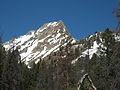
 Thompson and Williams Peaks.JPG 2,816 × 2,112; 1.29 MB
-
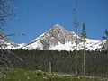
 Thompson Peak (1).jpg 2,816 × 2,112; 4.23 MB
-
 Thompson Peak ID1.jpg 3,872 × 1,844; 5.62 MB
-
 Thompson Peak Idaho.JPG 3,648 × 2,736; 5.23 MB
-
 Thompson Peak1.JPG 2,816 × 2,112; 1.19 MB
-
 Thompson Peak2.JPG 2,816 × 2,112; 1.96 MB
-
 Thompson Peak3.JPG 1,906 × 1,707; 1.85 MB
-
 Toxaway Lake.jpg 2,816 × 2,112; 3.82 MB
-
 Virginia Lake Idaho.JPG 2,816 × 2,112; 4.49 MB
-
 Western tanager SNRA.JPG 1,932 × 1,523; 2.43 MB
-
 Wildflowers in SNRA 1.JPG 2,816 × 2,112; 3.08 MB
-
 Wildflowers in SNRA 2.JPG 2,816 × 2,112; 3.9 MB
-
 Williams Peak 1.JPG 2,816 × 2,112; 960 KB
-
 Williams Peak 2.JPG 2,816 × 2,112; 1.51 MB
-
 Williams Peak 3.JPG 2,816 × 2,112; 4.51 MB
-
 Williams Peak 4.JPG 2,816 × 2,112; 1.88 MB
-
 Williams Peak Idaho.JPG 3,648 × 2,736; 5.09 MB
-
 Williams Peak.JPG 2,816 × 2,112; 3.3 MB
-
 Yellow Belly Lake Sawtooth NRA.JPG 1,547 × 1,097; 382 KB
-
 Yellow Belly Lake.JPG 2,816 × 2,112; 1.69 MB


.jpg)


