Category:Swisstopo 1:25'000 maps cropped
Jump to navigation
Jump to search
English: Swisstopo maps cropped from 1:25'000 map sheets.
Notes:
- For full sheets (tiles), use Category:Swisstopo 1:25'000 map sheets.
- Also add files to a subcategory of Category:Swisstopo maps by work.
Media in category "Swisstopo 1:25'000 maps cropped"
The following 27 files are in this category, out of 27 total.
-
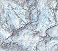
 1229 Grindelwald (Eiger).jpg 3,368 × 1,762; 1.34 MB
-
 1249 Finsteraarhorn (Jungfrau).jpg 3,089 × 2,807; 1.75 MB
-
 1277 Piz Bernina (cropped).jpg 5,058 × 4,435; 22.77 MB
-
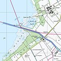
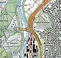
 Bahnhof Vallorbe - Karte 1934.jpg 2,108 × 1,010; 1.59 MB
-
 Bahnhof Zug 1990.png 2,880 × 3,990; 8.16 MB
-
 Bahnhof Zug 2018.png 2,880 × 3,990; 4.52 MB
-
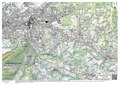 Carte de l'agglomération d'Annemasse, 25 000.pdf 2,481 × 1,754; 5.96 MB
-
-

-

-
 Oberhauserriet 2013.png 718 × 738; 1.13 MB
-
 Prison de la Croisée, 2023 (cropped).jpg 440 × 311; 84 KB
-
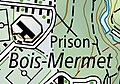 Prison du Bois-Mermet, 2023 (cropped).jpg 294 × 207; 81 KB
-
 Ruisseau du Geny, Carte 1.jpg 1,080 × 1,065; 584 KB
-
 Swisstopo 6.jpg 800 × 800; 586 KB
-
 Swisstopo Matterhorn.jpg 3,174 × 3,021; 9.49 MB
-
 Swisstopo Murmeltier.png 116 × 107; 29 KB
-
 Territorium Burgergemeinde Biel Stand 2020.jpg 1,500 × 908; 669 KB
-
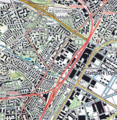
 Verzweigung Brüttisellen, location on 25000 map by Swisstopo, 2013.jpg 625 × 790; 113 KB
-
 Verzweigung Lattigen, location on 25000 map by Swisstopo, 2016.jpg 1,483 × 1,020; 273 KB
-
 Verzweigung Limmattal, location on 25000 map by Swisstopo, 2013.jpg 2,242 × 1,338; 549 KB
-
 Verzweigung Lopper, location on 25000 map by Swisstopo, 2013.jpg 1,266 × 1,188; 267 KB
-
 Verzweigung Rotsee, location on 25000 map by Swisstopo, 2013.jpg 1,280 × 1,160; 295 KB
-
 Verzweigung Zürich-Nord, location on 25000 map by Swisstopo, 2013.jpg 1,041 × 963; 232 KB
-
 Verzweigung Zürich-Ost, location on 25000 map by Swisstopo, 2013.jpg 1,793 × 1,464; 609 KB
-
 Verzweigung Zürich-Süd, location on 25000 map by Swisstopo, 2013.jpg 1,116 × 1,065; 254 KB
-
 Verzweigung Zürich-West, location on 25000 map by Swisstopo, 2013.jpg 1,643 × 1,602; 422 KB
.jpg)
.jpg)
.jpg)


,_Neuenburg_(NW),_Waadt_(SW)_und_Fribourg_(SE)_-_(von_Swisstopo_Landeskarte_1165,_Raster_25).jpg)
_und_Seehof_(SW)_im_Kanton_Bern_mit_Jura_(WSW),_Solothurn_(SE)_-_(von_Swisstopo_Landeskarte_1107,_Raster_25).jpg)
,_Jura_(S),_Solothurn_(NE)_-_(von_Swisstopo_Landeskarte_1086,_Raster_25).jpg)

.jpg)
.jpg)


