| Location
|
Upload
|
Photo
|
Object
|
Cat.
|
Coordinates
|
KGS-Nr
|
| Aedermannsdorf
|

|
yes
|


|
Kapelle St. Joseph mit Brunnen
|
B
|
47°18′20″N 7°36′34″E / 47.305617779°N 7.60957124°E / 47.305617779; 7.60957124
|
11121
|
| Aedermannsdorf
|
|

|
|
Gasthaus Schlüssel
|
B
|
47°18′18″N 7°36′34″E / 47.304889314°N 7.60951601°E / 47.304889314; 7.60951601
|
11080
|
| Aedermannsdorf
|
|
|
|
Ehemalige Hammerschmiede
|
B
|
47°17′47″N 7°36′48″E / 47.29634779°N 7.613388917°E / 47.29634779; 7.613388917
|
13464
|
| Aeschi
|
|
|
|
St.-Anna-Kirche
|
B
|
47°10′53″N 7°39′39″E / 47.181521477°N 7.660879288°E / 47.181521477; 7.660879288
|
4487
|
| Aeschi
|
|
|
|
Kapelle St. Maria
|
B
|
47°09′38″N 7°41′11″E / 47.160430692°N 7.686257002°E / 47.160430692; 7.686257002
|
11238
|
| Balm bei Günsberg
|
|
yes
|
|
Ruine Balm
|
A
|
47°15′20″N 7°33′18″E / 47.255555555°N 7.555°E / 47.255555555; 7.555
|
4492
|
| Balm bei Günsberg
|
|
|
|
Unter der Fluh, Abri-Siedlung
|
B
|
47°15′22″N 7°33′23″E / 47.256088471°N 7.556343242°E / 47.256088471; 7.556343242
|
4493
|
| Balsthal
|
|
yes
|
|
Ruine Neu-Falkenstein
|
A
|
47°19′22″N 7°42′37″E / 47.322887°N 7.710332°E / 47.322887; 7.710332
|
4497
|
| Balsthal
|
|
yes
|
|
Burg Alt-Falkenstein
|
B
|
47°18′25″N 7°41′26″E / 47.307°N 7.69064°E / 47.307; 7.69064
|
4498
|
| Balsthal
|
|
yes
|
|
Gasthof zum Kreuz 1621
|
B
|
47°18′57″N 7°41′43″E / 47.315703918°N 7.695295672°E / 47.315703918; 7.695295672
|
13471
|
| Balsthal
|
|
yes
|
|
Gasthof zum Löwen 1752
|
B
|
47°18′59″N 7°41′52″E / 47.31641824°N 7.69764014°E / 47.31641824; 7.69764014
|
13481
|
| Balsthal
|
|
yes
|
|
Gasthof Rössli 1751/1825
|
B
|
47°18′57″N 7°41′46″E / 47.315719814°N 7.696234786°E / 47.315719814; 7.696234786
|
13482
|
| Balsthal
|
|
yes
|
|
Altes Kornhaus 1790
|
B
|
47°18′56″N 7°41′45″E / 47.315559065°N 7.695718197°E / 47.315559065; 7.695718197
|
13486
|
| Balsthal
|
|
yes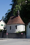
|
|
Kapelle St. Joseph 1760
|
B
|
47°18′24″N 7°41′26″E / 47.30671978°N 7.690584237°E / 47.30671978; 7.690584237
|
13488
|
| Balsthal
|
|
yes
|
|
Kapelle St. Wolfgang 1474/1519
|
B
|
47°19′19″N 7°42′32″E / 47.321861356°N 7.708843777°E / 47.321861356; 7.708843777
|
13490
|
| Balsthal
|
|
|
|
St. Antoniuskapelle (16. Jh.)
|
B
|
47°19′17″N 7°41′46″E / 47.321377579°N 7.696129961°E / 47.321377579; 7.696129961
|
4499
|
| Balsthal
|
|
|
|
Schmelzihof um 1920
|
B
|
47°18′17″N 7°41′39″E / 47.304625363°N 7.694078408°E / 47.304625363; 7.694078408
|
4501
|
| Balsthal
|
|
|
|
Kaplanenhaus, Sigristenhaus und alte Schlossscheune
|
B
|
47°19′19″N 7°42′31″E / 47.321807637°N 7.708737688°E / 47.321807637; 7.708737688
|
4503
|
| Balsthal
|
|
|
|
Heimatmuseum Alt Falkenstein
|
B
|
47°18′25″N 7°41′27″E / 47.306971335°N 7.690717669°E / 47.306971335; 7.690717669
|
10643
|
| Balsthal
|
|
|
|
Ehemaliges Bezirksgefängnis
|
B
|
47°18′58″N 7°41′39″E / 47.31610205°N 7.694226297°E / 47.31610205; 7.694226297
|
11124
|
| Balsthal
|
|
|
|
Altes Gemeindehaus
|
B
|
47°18′54″N 7°41′36″E / 47.314997813°N 7.693281949°E / 47.314997813; 7.693281949
|
11125
|
| Balsthal
|
|
|
|
Altes Amtshaus 1788/1804
|
B
|
47°18′57″N 7°41′40″E / 47.315939945°N 7.694318097°E / 47.315939945; 7.694318097
|
13469
|
| Balsthal
|
|
|
|
Ehemaliges Siechen- und Pfrundhaus um 1800
|
B
|
47°18′03″N 7°42′02″E / 47.300914281°N 7.700473369°E / 47.300914281; 7.700473369
|
13470
|
| Balsthal
|
|
|
|
Altes Pfarrhaus St. Wolfgang 1642
|
B
|
47°19′19″N 7°42′30″E / 47.321853591°N 7.708314652°E / 47.321853591; 7.708314652
|
13483
|
| Balsthal
|
|
|
|
Alte Post erste Hälfte 19. Jahrhundert
|
B
|
47°18′22″N 7°41′31″E / 47.306185864°N 7.692062731°E / 47.306185864; 7.692062731
|
13484
|
| Balsthal
|
|
|
|
Altes Bezirksschulhaus 1843/1848
|
B
|
47°18′59″N 7°41′54″E / 47.31626361°N 7.698406493°E / 47.31626361; 7.698406493
|
13485
|
| Balsthal
|
|
|
|
Bezirksgefängnis 1788
|
B
|
47°18′58″N 7°41′39″E / 47.31610205°N 7.694226297°E / 47.31610205; 7.694226297
|
13487
|
| Balsthal
|
|
|
|
Kapelle St. Ottilia 1662
|
B
|
47°18′57″N 7°41′50″E / 47.315960593°N 7.697161771°E / 47.315960593; 7.697161771
|
13489
|
| Balsthal
|
|
|
|
Alte Pfarrkirche Unserer Lieben Frau 1517/1761
|
B
|
47°19′16″N 7°41′45″E / 47.321117363°N 7.695850934°E / 47.321117363; 7.695850934
|
13933
|
| Balsthal
|
|
|
|
Altes Schulhaus 1742
|
B
|
47°18′25″N 7°41′23″E / 47.306901398°N 7.689791679°E / 47.306901398; 7.689791679
|
13934
|
| Balsthal
|
|
|
|
Ehemaliges Archiv zum Alten Amthaus 1788
|
B
|
47°18′58″N 7°41′40″E / 47.315993677°N 7.694424164°E / 47.315993677; 7.694424164
|
13935
|
| Balsthal
|
|
|
|
Ehemaliges Zollhaus (1. H 19. Jh.)
|
B
|
47°18′54″N 7°41′38″E / 47.314969632°N 7.693824066°E / 47.314969632; 7.693824066
|
13936
|
| Bärschwil
|
|
|
|
Pfarrhaus
|
B
|
47°22′57″N 7°28′24″E / 47.382380148°N 7.473312612°E / 47.382380148; 7.473312612
|
11126
|
| Bättwil
|
|
yes
|
|
Kapelle St. Martin
|
B
|
47°29′24″N 7°30′33″E / 47.490068905°N 7.509207938°E / 47.490068905; 7.509207938
|
4505
|
| Bättwil
|
|
yes
|
|
Wirtschaft zur Krone 1600
|
B
|
47°29′24″N 7°30′37″E / 47.489996383°N 7.51014997°E / 47.489996383; 7.51014997
|
13491
|
| Bättwil
|
|
yes
|
|
Ehemalige Mühle 17. Jahrhundert
|
B
|
47°29′23″N 7°30′27″E / 47.489782046°N 7.507615243°E / 47.489782046; 7.507615243
|
13492
|
| Beinwil
|
|
yes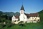
|
|
Kloster Beinwil
|
A
|
47°21′44″N 7°35′14″E / 47.362222222°N 7.587222222°E / 47.362222222; 7.587222222
|
4506
|
| Beinwil
|
|
|
|
St. Johanneskapelle 1695
|
B
|
47°21′47″N 7°35′16″E / 47.362942541°N 7.58772723°E / 47.362942541; 7.58772723
|
13576
|
| Beinwil
|
|
|
|
Weidenscheune beim Joggenhaus 18. Jh.
|
B
|
47°21′41″N 7°34′35″E / 47.361319557°N 7.576444497°E / 47.361319557; 7.576444497
|
13937
|
| Beinwil
|
|
|
|
Hammerschmiede
|
B
|
47°21′39″N 7°34′34″E / 47.360942153°N 7.576139066°E / 47.360942153; 7.576139066
|
13938
|
| Bellach
|
|
|
|
Ehemaliges Pulverhaus
|
B
|
47°12′28″N 7°30′00″E / 47.207749963°N 7.500034765°E / 47.207749963; 7.500034765
|
11127
|
| Bettlach
|
|
yes
|
|
Zehntenscheune mit Wegkreuz
|
B
|
47°12′06″N 7°25′21″E / 47.201783572°N 7.422491681°E / 47.201783572; 7.422491681
|
11128
|
| Bettlach
|
|
|
|
Burgruine Grenchen (11. Jh.)
|
B
|
47°13′09″N 7°24′13″E / 47.219129967°N 7.403647009°E / 47.219129967; 7.403647009
|
4507
|
| Biberist
|
|
yes
|
|
Ehemaliger Landsitz Hinter-Bleichenberg (18. Jh.) mit Park
|
B
|
47°11′49″N 7°33′48″E / 47.197013127°N 7.563419235°E / 47.197013127; 7.563419235
|
4509
|
| Biberist
|
|
yes
|
|
Schlösschen Vorder-Bleichenberg 1602-09
|
B
|
47°11′51″N 7°33′39″E / 47.197483767°N 7.56070176°E / 47.197483767; 7.56070176
|
4511
|
| Biberist
|
|
yes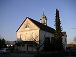
|
|
Pfarrkirche St. Maria
|
B
|
47°11′01″N 7°33′30″E / 47.18349035°N 7.558414087°E / 47.18349035; 7.558414087
|
11130
|
| Biberist
|
|
yes
|
|
Reformierte Kirche
|
B
|
47°10′33″N 7°34′10″E / 47.175788002°N 7.569332492°E / 47.175788002; 7.569332492
|
11131
|
| Biberist
|
|
|
|
Häusergruppe Oberbiberist
|
B
|
47°10′31″N 7°33′07″E / 47.175185617°N 7.552077028°E / 47.175185617; 7.552077028
|
4510
|
| Biberist
|
|
|
|
Steinerhof um 1800
|
B
|
47°11′37″N 7°32′07″E / 47.193730112°N 7.535224852°E / 47.193730112; 7.535224852
|
11129
|
| Biberist
|
|
|
|
Lackenhöfli, Villa mit Brunnen 18. Jh.
|
B
|
47°11′50″N 7°31′57″E / 47.197249221°N 7.532618171°E / 47.197249221; 7.532618171
|
11132
|
| Biberist
|
|
|
|
Schlösschen Schöngrün zweite Hälfte 17. Jahrhundert
|
B
|
47°12′00″N 7°32′38″E / 47.200126859°N 7.54384123°E / 47.200126859; 7.54384123
|
13493
|
| Biberist
|
|
|
|
Bauernhaus
|
B
|
47°10′33″N 7°33′09″E / 47.175796757°N 7.552592785°E / 47.175796757; 7.552592785
|
13494
|
| Biberist
|
|
|
|
Pfarrhaus
|
B
|
47°10′58″N 7°33′33″E / 47.182670912°N 7.55929619°E / 47.182670912; 7.55929619
|
13939
|
| Biberist
|
|
|
|
Spitalhof 1733
|
B
|
47°11′42″N 7°31′48″E / 47.195074687°N 7.52986949°E / 47.195074687; 7.52986949
|
13940
|
| Biberist
|
|
|
|
Kunstsammlung im Schlösschen Vorder-Bleichenberg
|
B
|
47°11′51″N 7°33′39″E / 47.197483767°N 7.56070176°E / 47.197483767; 7.56070176
|
14001
|
| Biezwil
|
|
|
|
Bauernhaus 1827
|
B
|
47°06′57″N 7°25′12″E / 47.11571122°N 7.420080626°E / 47.11571122; 7.420080626
|
13495
|
| Bolken
|
|
yes
|
|
Inkwilersee
|
A
|
47°11′53″N 7°39′43″E / 47.198055555°N 7.661944444°E / 47.198055555; 7.661944444
|
9666
|
| Boningen
|
|
|
|
Bauernhaus (17. Jh.)
|
B
|
47°18′23″N 7°51′24″E / 47.30643°N 7.85671°E / 47.30643; 7.85671
|
4513
|
| Boningen
|
|
|
|
Wirtshaus St. Urs (1644)
|
B
|
47°18′34″N 7°51′24″E / 47.30949°N 7.85668°E / 47.30949; 7.85668
|
4514
|
| Boningen
|
|
|
|
Speicher 1712
|
B
|
|
13941
|
| Boningen
|
|
|
|
Kapelle Maria Hilf 1744
|
B
|
|
13942
|
| Boningen
|
|
|
|
Tanzhüsli 1789
|
B
|
|
13943
|
| Breitenbach
|
|
yes
|
|
Ehemaliges Propsteihaus Rohr 1724
|
B
|
47°24′46″N 7°32′46″E / 47.41268°N 7.54619°E / 47.41268; 7.54619
|
13496
|
| Breitenbach
|
|
|
|
Galerie Laterne
|
B
|
47°24′26″N 7°32′33″E / 47.40725°N 7.54247°E / 47.40725; 7.54247
|
13944
|
| Buchegg
|
|
yes
|
|
Reformierte Kirche (1502)
|
B
|
47°07′57″N 7°30′16″E / 47.132487945°N 7.504312494°E / 47.132487945; 7.504312494
|
4490
|
| Buchegg
|
|
yes
|
|
Burgturm Buechischlössli (13. Jh., 1546, Heimatmuseum)
|
B
|
47°08′29″N 7°30′36″E / 47.14125°N 7.51004°E / 47.14125; 7.51004
|
4581
|
| Buchegg
|
|
yes
|
|
Reformierte Pfarrkirche
|
B
|
47°08′00″N 7°28′30″E / 47.13336°N 7.475°E / 47.13336; 7.475
|
11192
|
| Buchegg
|
|
|
|
Bauernhaus und Ofenhaus Andres
|
B
|
47°07′49″N 7°30′08″E / 47.130222311°N 7.502332719°E / 47.130222311; 7.502332719
|
4489
|
| Buchegg
|
|
|
|
Gasthaus Kreuz (1779)
|
B
|
47°08′47″N 7°28′42″E / 47.14632°N 7.47838°E / 47.14632; 7.47838
|
4752
|
| Buchegg
|
|
|
|
Wohnstock
|
B
|
47°07′52″N 7°30′21″E / 47.131191777°N 7.505853014°E / 47.131191777; 7.505853014
|
11122
|
| Buchegg
|
|
|
|
Ehemaliger Gerichtsstock
|
B
|
47°07′55″N 7°30′18″E / 47.131839897°N 7.505023451°E / 47.131839897; 7.505023451
|
11123
|
| Buchegg
|
|
|
|
Bauernhaus
|
B
|
47°08′45″N 7°27′19″E / 47.145700945°N 7.455403155°E / 47.145700945; 7.455403155
|
11133
|
| Buchegg
|
|
|
|
Mühlestöckli 1809
|
B
|
47°08′00″N 7°25′59″E / 47.13324°N 7.43299°E / 47.13324; 7.43299
|
11148
|
| Buchegg
|
|
|
|
Gasthof Sternen
|
B
|
47°08′31″N 7°28′02″E / 47.14186°N 7.46714°E / 47.14186; 7.46714
|
11157
|
| Buchegg
|
|
|
|
Ehemalige Mühle mit Mühlestöckli
|
B
|
47°09′05″N 7°31′06″E / 47.15147°N 7.51844°E / 47.15147; 7.51844
|
11168
|
| Buchegg
|
|
|
|
Ehemalige Oele
|
B
|
47°08′21″N 7°28′47″E / 47.13907°N 7.47976°E / 47.13907; 7.47976
|
11193
|
| Buchegg
|
|
|
|
Alte Post 1792
|
B
|
47°08′07″N 7°25′54″E / 47.13527°N 7.43173°E / 47.13527; 7.43173
|
13480
|
| Buchegg
|
|
|
|
Wohnhaus 1820
|
B
|
47°08′08″N 7°26′04″E / 47.13546°N 7.43446°E / 47.13546; 7.43446
|
13521
|
| Buchegg
|
|
|
|
Bürgerhaus 1795
|
B
|
47°07′26″N 7°27′58″E / 47.123922204°N 7.466044748°E / 47.123922204; 7.466044748
|
13931
|
| Buchegg
|
|
|
|
Wohnstock und Ofenhaus 1784
|
B
|
47°07′27″N 7°27′59″E / 47.12422797°N 7.466268941°E / 47.12422797; 7.466268941
|
13932
|
| Buchegg
|
|
|
|
Ofenhaus mit Speicheraufbau 1749
|
B
|
47°08′27″N 7°28′04″E / 47.14086°N 7.46776°E / 47.14086; 7.46776
|
13970
|
| Buchegg
|
|
|
|
Bauernhaus 1806
|
B
|
47°08′29″N 7°28′06″E / 47.14144°N 7.46832°E / 47.14144; 7.46832
|
13971
|
| Buchegg
|
|
|
|
Heimatmuseum Bucheggberg
|
B
|
47°08′28″N 7°30′36″E / 47.14122°N 7.51003°E / 47.14122; 7.51003
|
13978
|
| Buchegg
|
|
|
|
Pfarrhaus 81654)
|
B
|
47°07′56″N 7°30′16″E / 47.132271937°N 7.504536301°E / 47.132271937; 7.504536301
|
13997
|
| Buchegg
|
|
|
|
Pfarrscheune (18. Jh.)
|
B
|
47°07′56″N 7°30′15″E / 47.132137162°N 7.504272525°E / 47.132137162; 7.504272525
|
13998
|
| Buchegg
|
|
|
|
Pfrundstöckli (18. Jh.)
|
B
|
47°07′57″N 7°30′17″E / 47.132406824°N 7.504602369°E / 47.132406824; 7.504602369
|
13999
|
| Büren
|
|
yes
|
|
Pfarrkirche St. Martin 1697/1790
|
B
|
47°26′58″N 7°40′07″E / 47.44952°N 7.66854°E / 47.44952; 7.66854
|
13522
|
| Büren
|
|
|
|
Pfarrhaus mit Scheune (1727)
|
B
|
47°26′57″N 7°40′12″E / 47.44917°N 7.6701°E / 47.44917; 7.6701
|
4516
|
| Büren
|
|
|
|
Weiherhaus / Schlössli (16. Jh.)
|
B
|
47°26′56″N 7°40′24″E / 47.44886°N 7.67338°E / 47.44886; 7.67338
|
4518
|
| Büren
|
|
|
|
Ehemalige Beinmühle 17. Jh.
|
B
|
47°26′56″N 7°39′57″E / 47.44899°N 7.66576°E / 47.44899; 7.66576
|
13945
|
| Büren
|
|
|
|
Wohnhaus im Schlössli 1580
|
B
|
47°26′55″N 7°40′25″E / 47.44873°N 7.67361°E / 47.44873; 7.67361
|
13946
|
| Büsserach
|
|
yes
|
|
Burg Neu-Thierstein
|
B
|
47°23′06″N 7°32′18″E / 47.3849°N 7.5383°E / 47.3849; 7.5383
|
4519
|
| Büsserach
|
|
yes
|
|
Turm der Pfarrkirche 1464
|
B
|
47°23′23″N 7°32′24″E / 47.3898°N 7.53994°E / 47.3898; 7.53994
|
13497
|
| Büsserach
|
|
yes
|
|
Gemeindehaus 1863
|
B
|
47°23′34″N 7°32′28″E / 47.39273°N 7.54107°E / 47.39273; 7.54107
|
13498
|
| Büsserach
|
|
yes
|
|
Sammlung im Turm der Pfarrkirche 1464
|
B
|
47°23′23″N 7°32′24″E / 47.38981°N 7.53999°E / 47.38981; 7.53999
|
13947
|
| Büsserach
|
|
yes
|
|
Ehemalige Zehntenscheune spätgotisch
|
B
|
47°23′23″N 7°32′21″E / 47.38979°N 7.53929°E / 47.38979; 7.53929
|
13948
|
| Däniken
|
|
yes
|
|
Nothelferkapelle Däniken
|
B
|
47°20′51″N 7°59′17″E / 47.34738°N 7.98795°E / 47.34738; 7.98795
|
11134
|
| Deitingen
|
|
yes
|
|
Betonschalen Silberkugel, Autobahnraststätte Deitingen Süd
|
B
|
47°13′43″N 7°37′17″E / 47.2287°N 7.62148°E / 47.2287; 7.62148
|
13995
|
| Deitingen
|
|
|
|
Kirchenbezirk mit k. Kirche St. Marien (1476, 1819), Pfarrhaus (1802), Pfarrscheune und St. Antoniuskapelle
|
B
|
|
4521
|
| Deitingen
|
|
|
|
Schlösschen Wilihof (1575, 1680) mit Park, Landwirtschafts- und Nebenbauten
|
B
|
47°13′30″N 7°35′24″E / 47.2251°N 7.59013°E / 47.2251; 7.59013
|
4522
|
| Deitingen
|
|
|
|
Pfarrhaus 1802
|
B
|
47°12′41″N 7°37′11″E / 47.21141°N 7.61981°E / 47.21141; 7.61981
|
13499
|
| Deitingen
|
|
|
|
Pfarrkirche St. Maria 1476/1816-19
|
B
|
47°12′41″N 7°37′09″E / 47.21125°N 7.61922°E / 47.21125; 7.61922
|
13500
|
| Deitingen
|
|
|
|
Wohnhaus 1783
|
B
|
47°12′42″N 7°37′09″E / 47.21155°N 7.61903°E / 47.21155; 7.61903
|
13501
|
| Deitingen
|
|
|
|
Wohnhaus Burg 17. Jahrhundert
|
B
|
47°13′10″N 7°36′56″E / 47.21935°N 7.61555°E / 47.21935; 7.61555
|
13502
|
| Deitingen
|
|
|
|
Altes Schulhaus 1828
|
B
|
47°12′44″N 7°37′10″E / 47.21221°N 7.61945°E / 47.21221; 7.61945
|
13503
|
| Deitingen
|
|
|
|
Kapelle St. Antonius 1514
|
B
|
47°12′40″N 7°37′10″E / 47.21101°N 7.61937°E / 47.21101; 7.61937
|
13949
|
| Derendingen
|
|
yes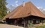
|
|
Aebihaus 18. Jahrhundert
|
B
|
47°11′35″N 7°35′08″E / 47.193°N 7.58557°E / 47.193; 7.58557
|
4523
|
| Derendingen
|
|
|
|
Arbeitssiedlung Elsässli (1884 - 1896)
|
B
|
47°12′13″N 7°35′03″E / 47.20353°N 7.58413°E / 47.20353; 7.58413
|
4524
|
| Derendingen
|
|
|
|
Altes klassizistisches Schulhaus
|
B
|
47°11′38″N 7°35′12″E / 47.19398°N 7.58677°E / 47.19398; 7.58677
|
11136
|
| Derendingen
|
|
|
|
Gomerkingerhaus 1617/1804
|
B
|
47°11′25″N 7°35′12″E / 47.19035°N 7.58679°E / 47.19035; 7.58679
|
11137
|
| Derendingen
|
|
|
|
Reformierte Kirche 1899
|
B
|
47°11′41″N 7°35′12″E / 47.19479°N 7.58654°E / 47.19479; 7.58654
|
13504
|
| Derendingen
|
|
|
|
Allerheiligenkapelle 1724
|
B
|
47°11′18″N 7°35′09″E / 47.18842°N 7.58581°E / 47.18842; 7.58581
|
13505
|
| Derendingen
|
|
|
|
Pfarrkirche Herz Jesus
|
B
|
47°11′39″N 7°35′13″E / 47.19409°N 7.58704°E / 47.19409; 7.58704
|
13506
|
| Derendingen
|
|
|
|
Ehemalige Öle 19. Jahrhundert
|
B
|
47°11′15″N 7°35′22″E / 47.18743°N 7.58939°E / 47.18743; 7.58939
|
13507
|
| Dornach
|
|
yes
|
|
Ruine Dorneck
|
A
|
47°28′48″N 7°37′41″E / 47.47999°N 7.62808°E / 47.47999; 7.62808
|
4526
|
| Dornach
|
|
yes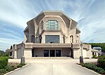
|
|
Goetheanum
|
A
|
47°29′10″N 7°37′13″E / 47.486111°N 7.620278°E / 47.486111; 7.620278
|
4527
|
| Dornach
|
|
yes
|
|
Alte katholische Kirche St. Mauritius (2. Hälfte 15. Jh., 1784)
|
B
|
47°28′43″N 7°36′59″E / 47.478666964°N 7.616400841°E / 47.478666964; 7.616400841
|
4528
|
| Dornach
|
|
yes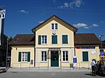
|
|
Bahnhof Dornach-Arlesheim mit Güterexpedition (1875)
|
B
|
47°29′19″N 7°36′40″E / 47.4886°N 7.61103°E / 47.4886; 7.61103
|
4530
|
| Dornach
|
|
yes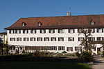
|
|
Kapuzinerkloster (1672) in Dornachbrugg
|
B
|
47°29′18″N 7°36′39″E / 47.48821°N 7.61073°E / 47.48821; 7.61073
|
4532
|
| Dornach
|
|
yes
|
|
Haus de Jaager
|
A
|
47°29′05″N 7°37′13″E / 47.48474°N 7.62015°E / 47.48474; 7.62015
|
10167
|
| Dornach
|
|
yes
|
|
Haus Duldeck
|
A
|
47°29′09″N 7°37′07″E / 47.48578°N 7.61871°E / 47.48578; 7.61871
|
10168
|
| Dornach
|
|
yes
|
|
Landgasthof Engel
|
B
|
47°28′44″N 7°37′00″E / 47.47886°N 7.61673°E / 47.47886; 7.61673
|
11138
|
| Dornach
|
|
yes
|
|
Altes Amtshaus (1650)
|
B
|
47°29′21″N 7°36′28″E / 47.48925°N 7.60775°E / 47.48925; 7.60775
|
13508
|
| Dornach
|
|
yes
|
|
Altes Pfarrhaus Mitte 16. Jahrhundert
|
B
|
47°28′45″N 7°37′00″E / 47.47922°N 7.61676°E / 47.47922; 7.61676
|
13509
|
| Dornach
|
|
yes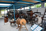
|
|
Heimatmuseum Schwarzbubenland in der alten katholischen Kirche St. Mauritius
|
B
|
47°28′43″N 7°36′59″E / 47.47866°N 7.6164°E / 47.47866; 7.6164
|
13951
|
| Dornach
|
|
|
|
Birsbrücke (1823) und Brunnen (1840)
|
B
|
47°29′18″N 7°36′27″E / 47.48835°N 7.60749°E / 47.48835; 7.60749
|
4529
|
| Dornach
|
|
|
|
Dokumentation am Goetheanum, Bibliothek / Kunstsammlung / Rudolf Steiner-Archiv
|
B
|
47°29′10″N 7°37′14″E / 47.48603°N 7.62045°E / 47.48603; 7.62045
|
8941
|
| Dornach
|
|
|
|
Bauernhaus
|
B
|
47°28′45″N 7°37′02″E / 47.47917°N 7.61717°E / 47.47917; 7.61717
|
11139
|
| Dornach
|
|
|
|
Wohnhaus 1533
|
B
|
47°28′42″N 7°37′00″E / 47.47824°N 7.6167°E / 47.47824; 7.6167
|
13510
|
| Dornach
|
|
|
|
Wohnhaus 18. Jahrhundert
|
B
|
47°29′19″N 7°36′29″E / 47.48858°N 7.60807°E / 47.48858; 7.60807
|
13511
|
| Drei Höfe
|
|
|
|
Wohnstock Hüenerhüsli
|
B
|
47°09′34″N 7°38′28″E / 47.15958°N 7.64121°E / 47.15958; 7.64121
|
11155
|
| Drei Höfe
|
|
|
|
Bauernhaus
|
B
|
47°09′06″N 7°39′06″E / 47.15172°N 7.65156°E / 47.15172; 7.65156
|
13969
|
| Dulliken
|
|
|
|
Wohnhaus Säliloch spätes 18. Jahrhundert
|
B
|
47°20′50″N 7°56′20″E / 47.34719°N 7.93889°E / 47.34719; 7.93889
|
13472
|
| Dulliken
|
|
|
|
Ehemalige Schuhfabrik Hug
|
B
|
47°21′18″N 7°56′44″E / 47.3551°N 7.94551°E / 47.3551; 7.94551
|
13952
|
| Dulliken
|
|
|
|
Speicher 1732
|
B
|
47°20′31″N 7°56′25″E / 47.34208°N 7.94037°E / 47.34208; 7.94037
|
13953
|
| Egerkingen
|
|
yes
|
|
Katholische Kirche St. Martin (um 1400-20. Jh.)
|
B
|
47°19′24″N 7°47′30″E / 47.32332°N 7.79166°E / 47.32332; 7.79166
|
4533
|
| Egerkingen
|
|
|
|
Obere Mühle (1614)
|
B
|
47°19′08″N 7°47′43″E / 47.31901°N 7.79525°E / 47.31901; 7.79525
|
4534
|
| Egerkingen
|
|
|
|
Ramelen, jungsteinzeitliche Höhensiedlung
|
B
|
47°19′28″N 7°46′57″E / 47.32458°N 7.78256°E / 47.32458; 7.78256
|
4535
|
| Egerkingen
|
|
|
|
Wohnhaus Martinstrasse 54
|
B
|
47°19′23″N 7°47′34″E / 47.32301°N 7.79287°E / 47.32301; 7.79287
|
11140
|
| Eppenberg-Wöschnau
|
|
yes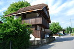
|
|
Eppenberg, steinerner Speicher (16. Jh.)
|
B
|
47°22′33″N 8°01′27″E / 47.37574°N 8.02428°E / 47.37574; 8.02428
|
4537
|
| Eppenberg-Wöschnau
|
|
|
|
Buechholz, eisenzeitliche Höhensiedlung
|
A
|
47°22′50″N 8°01′31″E / 47.38044°N 8.02526°E / 47.38044; 8.02526
|
4536
|
| Erlinsbach
|
|
yes
|
|
Niedererlinsbach, Alte Schmitte 15. Jh.
|
B
|
47°23′49″N 8°00′29″E / 47.39708°N 8.00815°E / 47.39708; 8.00815
|
4617
|
| Erlinsbach
|
|
yes
|
|
Niedererlinsbach, Ehemaliges altes Schulhaus
|
B
|
47°23′47″N 8°00′28″E / 47.39637°N 8.00785°E / 47.39637; 8.00785
|
11206
|
| Erlinsbach
|
|
yes
|
|
Niedererlinsbach, Gasthaus zum Löwen
|
B
|
47°23′49″N 8°00′32″E / 47.39684°N 8.00881°E / 47.39684; 8.00881
|
11207
|
| Erlinsbach
|
|
yes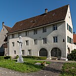
|
|
Ehemalige Schütti
|
B
|
47°23′48″N 8°00′28″E / 47.39679°N 8.00764°E / 47.39679; 8.00764
|
13461
|
| Erlinsbach
|
|
yes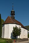
|
|
Kapelle St. Laurentius
|
B
|
47°24′19″N 8°00′27″E / 47.4052°N 8.00743°E / 47.4052; 8.00743
|
13558
|
| Erlinsbach
|
|
yes
|
|
Niedererlinsbach, Gemeindehaus 1897
|
B
|
47°23′48″N 8°00′30″E / 47.39677°N 8.00836°E / 47.39677; 8.00836
|
13954
|
| Erschwil
|
|
yes
|
|
Pfarrkirche St. Peter und Paul
|
B
|
47°22′26″N 7°32′29″E / 47.37388°N 7.54125°E / 47.37388; 7.54125
|
11141
|
| Erschwil
|
|
yes
|
|
Gasthaus zum Kreuz
|
B
|
47°22′18″N 7°32′30″E / 47.37176°N 7.54159°E / 47.37176; 7.54159
|
11142
|
| Feldbrunnen-St. Niklaus
|
|
yes
|
|
Schloss Waldegg
|
A
|
47°13′24″N 7°32′54″E / 47.22338°N 7.54842°E / 47.22338; 7.54842
|
4539
|
| Feldbrunnen-St. Niklaus
|
|
yes
|
|
katholische Kirche St. Niklaus (1683) mit umliegenden Grabdenkmälern
|
B
|
47°13′14″N 7°32′37″E / 47.22052°N 7.54357°E / 47.22052; 7.54357
|
4541
|
| Feldbrunnen-St. Niklaus
|
|
yes
|
|
Villa Koch (1921, Salvisberg)
|
B
|
47°12′59″N 7°33′06″E / 47.21646°N 7.55163°E / 47.21646; 7.55163
|
4543
|
| Feldbrunnen-St. Niklaus
|
|
yes
|
|
Dorfmuseum beim Waldegghof
|
B
|
47°13′13″N 7°33′12″E / 47.22028°N 7.55336°E / 47.22028; 7.55336
|
4545
|
| Feldbrunnen-St. Niklaus
|
|
|
|
Schürmatthof, ehemaliger Schlosshof (1750)
|
B
|
47°13′13″N 7°33′11″E / 47.22025°N 7.55307°E / 47.22025; 7.55307
|
4542
|
| Feldbrunnen-St. Niklaus
|
|
|
|
Villa Serdang (17. Jh., 1900) mit Park
|
B
|
47°13′07″N 7°33′08″E / 47.21856°N 7.55219°E / 47.21856; 7.55219
|
4544
|
| Feldbrunnen-St. Niklaus
|
|
|
|
Wohnhaus
|
B
|
47°13′23″N 7°32′39″E / 47.22305°N 7.5443°E / 47.22305; 7.5443
|
13474
|
| Flumenthal
|
|
|
|
Egghof (18. Jahrhundert, ehemaliges Gasthaus zum Einhorn)
|
B
|
47°14′22″N 7°35′35″E / 47.23937°N 7.59309°E / 47.23937; 7.59309
|
4546
|
| Flumenthal
|
|
|
|
Bauernhaus 1838
|
B
|
47°14′24″N 7°35′53″E / 47.2399°N 7.59812°E / 47.2399; 7.59812
|
13475
|
| Flumenthal
|
|
|
|
Restaurant Nüssli 1727
|
B
|
47°14′20″N 7°35′43″E / 47.23883°N 7.59528°E / 47.23883; 7.59528
|
13476
|
| Flumenthal
|
|
|
|
Pfarrhaus
|
B
|
47°14′08″N 7°35′51″E / 47.23566°N 7.59752°E / 47.23566; 7.59752
|
13477
|
| Fulenbach
|
|
yesgedeckte Holzbrücke über die Aare (1863)
|
|
gedeckte Holzbrücke über die Aare (1863)
|
B
|
47°16′03″N 7°49′54″E / 47.26744°N 7.8318°E / 47.26744; 7.8318
|
4547
|
| Fulenbach
|
|
|
|
Pfarrhaus
|
B
|
47°16′35″N 7°50′13″E / 47.2763°N 7.83695°E / 47.2763; 7.83695
|
11144
|
| Fulenbach
|
|
|
|
Gasthaus zum alten Bad
|
B
|
47°16′22″N 7°49′24″E / 47.27268°N 7.82347°E / 47.27268; 7.82347
|
11145
|
| Fulenbach
|
|
|
|
Bauernhaus
|
B
|
47°16′37″N 7°50′09″E / 47.2769°N 7.83571°E / 47.2769; 7.83571
|
11146
|
| Gänsbrunnen
|
|
yes
|
|
Pfarrkirche St. Joseph 1627
|
B
|
47°15′50″N 7°28′15″E / 47.26388°N 7.47079°E / 47.26388; 7.47079
|
4549
|
| Gänsbrunnen
|
|
yes
|
|
Gasthof St. Joseph
|
B
|
47°15′46″N 7°28′04″E / 47.26289°N 7.4678°E / 47.26289; 7.4678
|
11147
|
| Gänsbrunnen
|
|
yes
|
|
Pfarrhaus 1720
|
B
|
47°15′51″N 7°28′13″E / 47.26406°N 7.47035°E / 47.26406; 7.47035
|
13478
|
| Gempen
|
|
yes
|
|
Wohnhaus 15. Jahrhundert
|
B
|
47°28′33″N 7°39′33″E / 47.47597°N 7.65919°E / 47.47597; 7.65919
|
13479
|
| Gerlafingen
|
|
|
|
Altbauten der Von Rollschen Eisenwerke
|
B
|
47°10′07″N 7°34′00″E / 47.16869°N 7.56657°E / 47.16869; 7.56657
|
4550
|
| Grenchen
|
|
yes
|
|
BLS-Viadukt und Bahnanlagen Grenchen-Nord (1915)
|
B
|
47°11′35″N 7°23′24″E / 47.19295°N 7.39007°E / 47.19295; 7.39007
|
4553
|
| Grenchen
|
|
yes
|
|
Hôtel de Ville Gemeindehaus 1907
|
B
|
47°11′27″N 7°23′47″E / 47.19094°N 7.3965°E / 47.19094; 7.3965
|
4554
|
| Grenchen
|
|
yes
|
|
Schulhaus I (1844/46)
|
B
|
47°11′31″N 7°23′39″E / 47.19203°N 7.3943°E / 47.19203; 7.3943
|
4555
|
| Grenchen
|
|
yes
|
|
Kapelle Allerheiligen (1682)
|
B
|
47°11′43″N 7°22′13″E / 47.19537°N 7.37026°E / 47.19537; 7.37026
|
4556
|
| Grenchen
|
|
yes
|
|
Kapelle im Staad (18. und 20. Jh.)
|
B
|
47°09′47″N 7°24′25″E / 47.16318°N 7.40706°E / 47.16318; 7.40706
|
4557
|
| Grenchen
|
|
yes
|
|
Kunsthaus Grenchen
|
B
|
47°11′21″N 7°23′53″E / 47.18912°N 7.39812°E / 47.18912; 7.39812
|
10171
|
| Grenchen
|
|
yes
|
|
Villa Girard
|
B
|
47°11′21″N 7°23′53″E / 47.18912°N 7.39806°E / 47.18912; 7.39806
|
11076
|
| Grenchen
|
|
yes
|
|
Hotel Löwen
|
B
|
47°11′33″N 7°23′46″E / 47.19247°N 7.39607°E / 47.19247; 7.39607
|
11078
|
| Grenchen
|
|
yes
|
|
Alte Mühle 1611/1834
|
B
|
47°11′52″N 7°23′39″E / 47.19771°N 7.39405°E / 47.19771; 7.39405
|
11079
|
| Grenchen
|
|
yes
|
|
Pfarrkirche St. Eusebius 1805-1812
|
B
|
47°11′34″N 7°23′40″E / 47.19285°N 7.39449°E / 47.19285; 7.39449
|
13531
|
| Grenchen
|
|
yes
|
|
Rainschulhaus 1821-1823 / Kulturhistorisches Museum
|
B
|
47°11′33″N 7°23′42″E / 47.19259°N 7.39488°E / 47.19259; 7.39488
|
13532
|
| Grenchen
|
|
yes
|
|
Schulhaus III (1910/1912)
|
B
|
47°11′33″N 7°23′32″E / 47.19254°N 7.39211°E / 47.19254; 7.39211
|
13533
|
| Grenchen
|
|
yes
|
|
Ehemaliges Pfarrhaus/Lindenschulhaus um 1870
|
B
|
47°11′33″N 7°23′40″E / 47.192430765°N 7.394559906°E / 47.192430765; 7.394559906
|
13535
|
| Grenchen
|
|
yes
|
|
Parktheater
|
B
|
47°11′28″N 7°23′27″E / 47.191°N 7.39075°E / 47.191; 7.39075
|
13536
|
| Grenchen
|
|
yes
|
|
Schulhaus II (1883)
|
B
|
47°11′30″N 7°23′36″E / 47.19162°N 7.39344°E / 47.19162; 7.39344
|
13955
|
| Grenchen
|
|
yes
|
|
Alte Turnhalle (1905)
|
B
|
47°11′32″N 7°23′34″E / 47.19218°N 7.3928°E / 47.19218; 7.3928
|
13957
|
| Grenchen
|
|
|
|
Bachtelenbad (1818)
|
B
|
47°11′19″N 7°22′59″E / 47.18867°N 7.38302°E / 47.18867; 7.38302
|
4552
|
| Grenchen
|
|
|
|
Stadtarchiv Grenchen
|
B
|
47°11′32″N 7°23′40″E / 47.19218°N 7.39436°E / 47.19218; 7.39436
|
10589
|
| Grenchen
|
|
|
|
Kultur-Historisches Museum Grenchen
|
B
|
47°11′34″N 7°23′42″E / 47.192655748°N 7.394863215°E / 47.192655748; 7.394863215
|
10997
|
| Grenchen
|
|
|
|
Arbeiterhaus Frohheim
|
B
|
47°11′48″N 7°23′24″E / 47.1967°N 7.39013°E / 47.1967; 7.39013
|
11077
|
| Grenchen
|
|
|
|
Bauernhaus
|
B
|
47°09′48″N 7°24′20″E / 47.16342°N 7.40547°E / 47.16342; 7.40547
|
11149
|
| Grenchen
|
|
|
|
Ehemaliges Kaplanenhaus
|
B
|
47°11′44″N 7°22′15″E / 47.1955°N 7.37074°E / 47.1955; 7.37074
|
13534
|
| Grenchen
|
|
|
|
Römerbrücke
|
B
|
47°10′53″N 7°25′27″E / 47.18144°N 7.42405°E / 47.18144; 7.42405
|
13537
|
| Gretzenbach
|
|
yes
|
|
Pfarrkirche St. Peter und Paul 1664/1884
|
B
|
47°21′42″N 7°59′45″E / 47.36173°N 7.99579°E / 47.36173; 7.99579
|
11151
|
| Gretzenbach
|
|
|
|
Gutshof Zirzelhof 17. Jh.
|
B
|
47°21′36″N 8°00′16″E / 47.36003°N 8.0044°E / 47.36003; 8.0044
|
11150
|
| Gretzenbach
|
|
|
|
Pfahlbauten im Bally-Park
|
B
|
47°21′52″N 7°59′43″E / 47.36439°N 7.99519°E / 47.36439; 7.99519
|
14000
|
| Grindel
|
|
|
|
Pfarrkirche St. Stephan
|
B
|
47°22′53″N 7°30′05″E / 47.38134°N 7.50136°E / 47.38134; 7.50136
|
13559
|
| Günsberg
|
|
|
|
Pfarrhof 1697
|
B
|
47°15′26″N 7°34′35″E / 47.25722°N 7.57634°E / 47.25722; 7.57634
|
13958
|
| Günsberg
|
|
|
|
Restaurant Glutzenberg
|
B
|
47°15′47″N 7°34′18″E / 47.263°N 7.57172°E / 47.263; 7.57172
|
13959
|
| Gunzgen
|
|
yes
|
|
Pfarrkirche St. Katharina 1643/1860
|
B
|
47°18′54″N 7°49′39″E / 47.31504°N 7.82737°E / 47.31504; 7.82737
|
13560
|
| Hägendorf
|
|
|
|
Wohnhaus 1586
|
B
|
47°20′00″N 7°50′39″E / 47.33335°N 7.84411°E / 47.33335; 7.84411
|
4559
|
| Hägendorf
|
|
|
|
Berghof 17. Jh.
|
B
|
47°21′44″N 7°49′40″E / 47.36233°N 7.82765°E / 47.36233; 7.82765
|
13960
|
| Hägendorf
|
|
|
|
Fasiswaldhof 1781
|
B
|
47°21′30″N 7°49′17″E / 47.35824°N 7.82126°E / 47.35824; 7.82126
|
13961
|
| Halten
|
|
yes
|
|
Wohnturm
|
B
|
47°10′05″N 7°36′14″E / 47.16819°N 7.60389°E / 47.16819; 7.60389
|
4560
|
| Halten
|
|
yes
|
|
Museum Wasseramt
|
B
|
47°10′06″N 7°36′14″E / 47.16821°N 7.60384°E / 47.16821; 7.60384
|
13962
|
| Härkingen
|
|
yes
|
|
Gasthaus zum Lamm
|
B
|
47°18′29″N 7°48′50″E / 47.30809°N 7.8139°E / 47.30809; 7.8139
|
11152
|
| Härkingen
|
|
yes
|
|
Ehemalige Pfarrkirche St. Johann der Täufer
|
B
|
47°18′31″N 7°48′57″E / 47.30871°N 7.81573°E / 47.30871; 7.81573
|
13966
|
| Härkingen
|
|
|
|
Bauernhaus
|
B
|
47°18′28″N 7°48′53″E / 47.30784°N 7.81472°E / 47.30784; 7.81472
|
11153
|
| Härkingen
|
|
|
|
Wohnhaus 1832
|
B
|
47°18′30″N 7°48′57″E / 47.30842°N 7.81588°E / 47.30842; 7.81588
|
13963
|
| Härkingen
|
|
|
|
Bauernhaus 1728
|
B
|
47°18′29″N 7°48′54″E / 47.30795°N 7.81513°E / 47.30795; 7.81513
|
13964
|
| Härkingen
|
|
|
|
Pfarrhaus
|
B
|
47°18′31″N 7°48′56″E / 47.30858°N 7.81552°E / 47.30858; 7.81552
|
13965
|
| Hauenstein-Ifenthal
|
|
yes
|
|
Pfarrkirche St. Katharina
|
B
|
47°22′25″N 7°51′20″E / 47.37362°N 7.85569°E / 47.37362; 7.85569
|
11154
|
| Hauenstein-Ifenthal
|
|
|
|
Pfarrhaus 1824
|
B
|
47°22′24″N 7°51′19″E / 47.3734°N 7.85517°E / 47.3734; 7.85517
|
13967
|
| Hauenstein-Ifenthal
|
|
|
|
Restaurant zur Sonne mit Scheune
|
B
|
47°22′37″N 7°52′23″E / 47.3769°N 7.87301°E / 47.3769; 7.87301
|
13968
|
| Herbetswil
|
|
yes
|
|
Pfarrkirche St. Johann Baptist
|
B
|
47°17′49″N 7°35′35″E / 47.29691°N 7.59311°E / 47.29691; 7.59311
|
11156
|
| Himmelried
|
|
yes
|
|
Kastelhöhle, paläolithische Wohnhöhle
|
A
|
47°25′40″N 7°34′09″E / 47.42773°N 7.56919°E / 47.42773; 7.56919
|
4563
|
| Himmelried
|
|
yes
|
|
Pfarrkirche St. Franz Xaver 1807-09
|
B
|
47°25′20″N 7°35′54″E / 47.42222°N 7.59844°E / 47.42222; 7.59844
|
13972
|
| Himmelried
|
|
yes
|
|
Gemeindehaus 1811
|
B
|
47°25′20″N 7°35′53″E / 47.42236°N 7.59816°E / 47.42236; 7.59816
|
13973
|
| Hochwald
|
|
yes
|
|
Kirche St. Gallus
|
B
|
47°27′22″N 7°38′28″E / 47.4561°N 7.64102°E / 47.4561; 7.64102
|
13538
|
| Hofstetten-Flüh
|
|
yes
|
|
Ruine Sternenberg
|
B
|
47°28′43″N 7°30′18″E / 47.47858°N 7.50495°E / 47.47858; 7.50495
|
4565
|
| Hofstetten-Flüh
|
|
yes
|
|
St. Johanneskapelle (Wandmalereien um 1430)
|
B
|
47°28′30″N 7°30′52″E / 47.47491°N 7.51437°E / 47.47491; 7.51437
|
4567
|
| Hofstetten-Flüh
|
|
yes
|
|
Ehemaliges Meierhaus
|
B
|
47°28′33″N 7°30′55″E / 47.4758°N 7.51537°E / 47.4758; 7.51537
|
11158
|
| Hofstetten-Flüh
|
|
yes
|
|
Flühmühle
|
B
|
47°28′54″N 7°30′04″E / 47.48159°N 7.50119°E / 47.48159; 7.50119
|
11159
|
| Hofstetten-Flüh
|
|
yes
|
|
Restaurant zur Rose 1688
|
B
|
47°29′19″N 7°29′53″E / 47.48854°N 7.49792°E / 47.48854; 7.49792
|
13539
|
| Hofstetten-Flüh
|
|
yes
|
|
Roter Ochsen 1692
|
B
|
47°29′13″N 7°29′52″E / 47.48705°N 7.49772°E / 47.48705; 7.49772
|
13540
|
| Hofstetten-Flüh
|
|
yes
|
|
Pfarrkirche St. Nikolaus 1609
|
B
|
47°28′38″N 7°30′44″E / 47.47728°N 7.51221°E / 47.47728; 7.51221
|
13578
|
| Hofstetten-Flüh
|
|
|
|
Hofstetter Köpfli, Fluchtburg mit Wall
|
B
|
47°28′58″N 7°30′23″E / 47.48282°N 7.50629°E / 47.48282; 7.50629
|
4568
|
| Holderbank
|
|
yes
|
|
Ruine Alt-Bechburg
|
A
|
47°19′57″N 7°46′19″E / 47.33245°N 7.77199°E / 47.33245; 7.77199
|
4569
|
| Holderbank
|
|
yes
|
|
katholische Kirche St. Fridolin (1734, 1912)
|
B
|
47°20′01″N 7°45′12″E / 47.33351°N 7.75329°E / 47.33351; 7.75329
|
4570
|
| Holderbank
|
|
|
|
Sennhof Alt Bechburg
|
B
|
47°19′56″N 7°46′21″E / 47.3323°N 7.77261°E / 47.3323; 7.77261
|
11160
|
| Holderbank
|
|
|
|
Ehemaliges Untervogthaus spätgotisch
|
B
|
47°19′59″N 7°45′12″E / 47.33312°N 7.75328°E / 47.33312; 7.75328
|
13541
|
| Holderbank
|
|
|
|
Ehemaliges Pfarrhaus frühes 19. Jh.
|
B
|
47°20′03″N 7°45′24″E / 47.33407°N 7.75678°E / 47.33407; 7.75678
|
13542
|
| Holderbank
|
|
|
|
Ehemaliges Zollhaus 18. Jh.
|
B
|
47°20′30″N 7°46′05″E / 47.34177°N 7.76797°E / 47.34177; 7.76797
|
13974
|
| Hüniken
|
|
|
|
Kapelle St. Michael
|
B
|
47°11′04″N 7°38′14″E / 47.18456°N 7.63735°E / 47.18456; 7.63735
|
11161
|
| Kammersrohr
|
|
yes
|
|
Herrenhaus Mattenhof
|
B
|
47°15′21″N 7°35′26″E / 47.25592°N 7.5906°E / 47.25592; 7.5906
|
11162
|
| Kappel
|
|
|
|
Pfarrhof (1687)
|
B
|
47°19′29″N 7°50′53″E / 47.3246°N 7.848°E / 47.3246; 7.848
|
4573
|
| Kappel
|
|
|
|
Landgasthof Kreuz
|
B
|
47°19′24″N 7°50′46″E / 47.32331°N 7.84621°E / 47.32331; 7.84621
|
13543
|
| Kappel
|
|
|
|
Speicher
|
B
|
47°19′40″N 7°50′58″E / 47.32789°N 7.84942°E / 47.32789; 7.84942
|
13975
|
| Kappel
|
|
|
|
Speicher
|
B
|
47°19′41″N 7°50′59″E / 47.32812°N 7.84975°E / 47.32812; 7.84975
|
13976
|
| Kappel
|
|
|
|
Ehemaliges Wohn- und Gewerbehaus 1700
|
B
|
47°19′37″N 7°50′59″E / 47.32705°N 7.84979°E / 47.32705; 7.84979
|
13977
|
| Kestenholz
|
|
yes
|
|
katholische Kirche St. Urs und Viktor (1904, Turm und Ausstattung 1642)
|
B
|
47°16′59″N 7°45′15″E / 47.28302°N 7.75405°E / 47.28302; 7.75405
|
4575
|
| Kestenholz
|
|
|
|
Kapelle St. Peter und Paul (14. Jh., Wandmalereien)
|
B
|
47°17′09″N 7°44′54″E / 47.28591°N 7.74843°E / 47.28591; 7.74843
|
4576
|
| Kestenholz
|
|
|
|
Wohnhaus
|
B
|
47°17′03″N 7°45′15″E / 47.28403°N 7.75403°E / 47.28403; 7.75403
|
11163
|
| Kestenholz
|
|
|
|
Bauernhaus mit Brunnen
|
B
|
47°16′57″N 7°45′08″E / 47.28239°N 7.75215°E / 47.28239; 7.75215
|
11164
|
| Kienberg
|
|
yes
|
|
Pfarrkirche Mariä Himmelfahrt
|
B
|
47°26′20″N 7°58′04″E / 47.43885°N 7.96774°E / 47.43885; 7.96774
|
4577
|
| Kleinlützel
|
|
yes
|
|
Kapelle St. Josef (Ende 16. Jh.) und Oekonomiegebäude
|
B
|
47°25′56″N 7°22′53″E / 47.43214°N 7.38151°E / 47.43214; 7.38151
|
4578
|
| Kleinlützel
|
|
yes
|
|
Pfarrkirche St. Mauritius
|
B
|
47°25′27″N 7°25′05″E / 47.4242°N 7.41799°E / 47.4242; 7.41799
|
11165
|
| Kriegstetten
|
|
yes
|
|
Pfarrkirche St. Mauritius
|
B
|
47°10′34″N 7°35′53″E / 47.17611°N 7.59809°E / 47.17611; 7.59809
|
11166
|
| Kriegstetten
|
|
|
|
Gasthof zum Kreuz
|
B
|
47°10′25″N 7°35′51″E / 47.1736°N 7.59757°E / 47.1736; 7.59757
|
4580
|
| Kriegstetten
|
|
|
|
Pfarrhaus (Kriegstetten)
|
B
|
47°10′28″N 7°35′54″E / 47.17449°N 7.59835°E / 47.17449; 7.59835
|
11167
|
| Langendorf
|
|
yes
|
|
Landsitz Staalenhof (17. Jh.)
|
B
|
47°13′05″N 7°30′21″E / 47.21801°N 7.50597°E / 47.21801; 7.50597
|
4582
|
| Langendorf
|
|
yes
|
|
Kirchliches Zentrum
|
B
|
47°13′17″N 7°31′04″E / 47.22128°N 7.51764°E / 47.22128; 7.51764
|
13544
|
| Langendorf
|
|
|
|
Steinsäge
|
B
|
47°13′27″N 7°31′29″E / 47.22422°N 7.52484°E / 47.22422; 7.52484
|
11169
|
| Laupersdorf
|
|
yes
|
|
St. Jakobs-Kapelle
|
B
|
47°19′14″N 7°40′28″E / 47.32069°N 7.67432°E / 47.32069; 7.67432
|
11173
|
| Laupersdorf
|
|
yes
|
|
Waschhaus
|
B
|
47°19′14″N 7°40′27″E / 47.32063°N 7.67414°E / 47.32063; 7.67414
|
13979
|
| Laupersdorf
|
|
|
|
Pfarrhaus / Kaplanei
|
B
|
47°18′58″N 7°39′02″E / 47.31612°N 7.6505°E / 47.31612; 7.6505
|
11170
|
| Laupersdorf
|
|
|
|
Haus Brisenmatt und Nachbargebäude
|
B
|
47°18′51″N 7°39′04″E / 47.31418°N 7.651°E / 47.31418; 7.651
|
11171
|
| Laupersdorf
|
|
|
|
Gasthof zum Storchen
|
B
|
47°18′44″N 7°39′08″E / 47.31211°N 7.65222°E / 47.31211; 7.65222
|
11172
|
| Lohn-Ammannsegg
|
|
yes
|
|
Landsitz Buchhof (1650, 1831)
|
B
|
47°11′01″N 7°31′31″E / 47.18364°N 7.52537°E / 47.18364; 7.52537
|
4491
|
| Lohn-Ammannsegg
|
|
yes
|
|
Alte Schmitte
|
B
|
47°09′53″N 7°31′34″E / 47.16479°N 7.52624°E / 47.16479; 7.52624
|
11174
|
| Lohn-Ammannsegg
|
|
yes
|
|
Gasthaus Sternen
|
B
|
47°10′09″N 7°31′29″E / 47.16918°N 7.52463°E / 47.16918; 7.52463
|
11175
|
| Lohn-Ammannsegg
|
|
yes
|
|
Wohnstock mit Annexbau
|
B
|
47°10′12″N 7°31′32″E / 47.16999°N 7.52555°E / 47.16999; 7.52555
|
11176
|
| Lohn-Ammannsegg
|
|
yes
|
|
Kapelle der Unschuldigen Kinder
|
B
|
47°10′11″N 7°31′24″E / 47.16969°N 7.52345°E / 47.16969; 7.52345
|
11177
|
| Lommiswil
|
|
|
|
Alte Kirche St. Germann
|
B
|
47°13′26″N 7°28′20″E / 47.22379°N 7.4722°E / 47.22379; 7.4722
|
4585
|
| Lostorf
|
|
yes
|
|
Ehemaliges Kornhaus (Ende 17. Jh.)
|
B
|
47°23′10″N 7°56′59″E / 47.38623°N 7.94963°E / 47.38623; 7.94963
|
4587
|
| Lostorf
|
|
yes
|
|
Haus Nr. 49
|
B
|
47°23′18″N 7°56′32″E / 47.38832°N 7.94232°E / 47.38832; 7.94232
|
4588
User:Yiyi/Test2
Template:Cultural heritage CH footer 2018
|


.jpg)
_267.JPG)
_299.JPG)


_(53).JPG)


_(3).JPG)


