Category:Maps of the world before Columbus
Jump to navigation
Jump to search
list of early depictions of the world | |||||
| Upload media | |||||
| Instance of | |||||
|---|---|---|---|---|---|
| Subclass of | |||||
| |||||
Subcategories
This category has the following 26 subcategories, out of 26 total.
Media in category "Maps of the world before Columbus"
The following 40 files are in this category, out of 40 total.
-

-
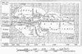
 17 of 'Geographie Générale ... Avec index, etc' (11100032736).jpg 802 × 443; 91 KB
-
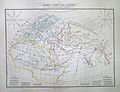
 1837 Malte-Brun Map of Europe in the Middle Ages - Geographicus - MiddleAges-mb-1837.jpg 2,223 × 1,656; 650 KB
-
-
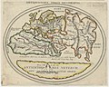 Antiquissima orbis delineatio - btv1b53179325z (1 of 2).jpg 2,488 × 1,984; 929 KB
-
 Babylonian Map of the World, 700-500 BC.jpg 2,857 × 3,777; 7.6 MB
-
 Book of Roger MS. Greaves 42 1b cropped.jpg 686 × 603; 377 KB
-
 Book of Roger MS. Greaves 42 1b.jpg 1,000 × 714; 605 KB
-
 Butler Obris Veteribus Notus.jpg 3,002 × 2,016; 1.88 MB
-
 Butler Orbis Herodoti.jpg 2,543 × 1,592; 1 MB
-
 C+B-Geography-Map1-StrabosMap.PNG 1,566 × 770; 695 KB
-

-
 D401- Monde connu d’Eratosthènes.-L2-Ch9.png 1,442 × 950; 222 KB
-
 Das Weltkärtchen von Strassburg, 9. Jahrhundert.jpg 836 × 930; 273 KB
-
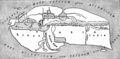
 EB 1911 Map Fig 6.png 2,350 × 1,596; 2.25 MB
-
 European knowledge 1400.jpg 448 × 253; 33 KB
-
 Fr Sélestat Bibliothèque Humaniste In Somnium Scipionis.jpg 3,648 × 2,736; 4.32 MB
-
 Hekataios.jpg 736 × 580; 85 KB
-
 Idrisi MS BNF Ar 2221 f 3v-4r.JPEG 871 × 899; 683 KB
-
 Islamic map of the world Wellcome L0035009.jpg 3,576 × 4,072; 2.54 MB
-
 Karte Isidor.jpg 4,120 × 4,328; 6.12 MB
-
 Karte Orosius.jpg 2,400 × 2,616; 2.98 MB
-
 Karte Pomponius Mela (cropped).jpg 10,717 × 12,112; 36.82 MB
-
 Karte Pomponius Mela rotated.jpg 12,177 × 10,799; 30.46 MB
-
 Karte Pomponius Mela.jpg 12,449 × 17,055; 52.84 MB
-
 Karte Ravennat.jpg 2,448 × 3,264; 3.9 MB
-
 Liber floridus Weltkarte.jpg 1,790 × 1,513; 500 KB
-
 Map of the world.jpg 2,592 × 3,888; 2.42 MB
-
 Mappaemundi vertical.gif 200 × 951; 26 KB
-
 Mapping of the world, 1922.jpg 5,651 × 4,026; 4.61 MB
-
 Mela codanus sinus.jpg 830 × 649; 497 KB
-
 Monde-anciens.JPG 1,317 × 827; 333 KB
-
 Nr. 1. Sechs Karten zur Geschichte der antiken Erdkunde.png 4,185 × 3,386; 40.57 MB
-
 Playfair, Principal. Map of the World According to Strabo. 1814 A.jpg 7,523 × 4,724; 4.33 MB
-
 Playfair, Principal. Map of the World According to Strabo. 1814 B.jpg 7,071 × 4,328; 4.1 MB
-
 Playfair, Principal. Map of the World According to Strabo. 1814.jpg 8,730 × 6,463; 6.99 MB
-
 Son Buzul Maksimumu.png 1,062 × 565; 51 KB
-
 Tabula Rogeriana 1929 copy by Konrad Miller.jpg 12,999 × 5,958; 17.94 MB
-
 TabulaRogeriana.jpg 4,128 × 1,872; 3.37 MB
-

_vol._1%27_(11058648883).jpg)
.jpg)


.jpg)


.jpg)


